

Adina Sommer
Antique and Contemporary Art
Winzerer Str. 154
80797 München
telephone
+49 89 304714
business hours:
by appointment
Email
![]()


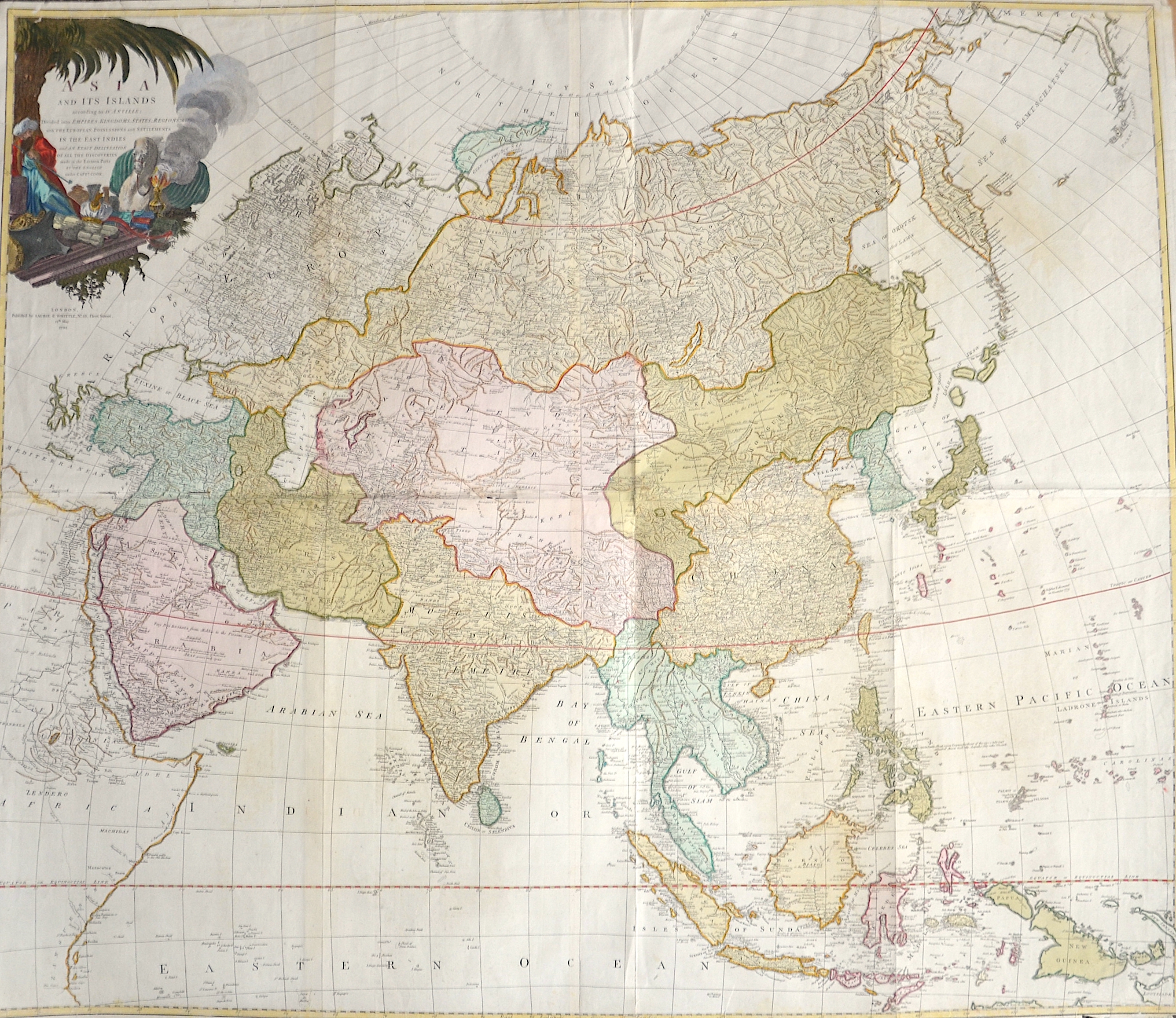
Karte von Asien……

| Article ID | ASX0503 |
Title | Karte von Asien…… |
Description | Map shows total Asia with inset map of the peninsula Tschuktschen |
| Year | dated 1795 |
Artist | Reilly (1766-1820) |
Franz Johann Joseph von Reilly (1766 - 1820) Vienna. Franz Johann Joseph von Reilly was an Austrian publisher, cartographer and writer. He was born the son of the court master Johann Reilly. He initially worked in the civil service, but then devoted himself exclusively to geography. From 1789 to 1806, he produced the atlas Schauplatz der fünf Theile der Welt, which only covers Europe on its 830 sheets. After the Schul Atlas (1791-92) and the Allgemeine Erdbeschreibung (3 volumes, 1792-93), he published the first (complete) Austrian world atlas entitled Grosser deutscher Atlas from 1794 to 1796. In 1796, he produced the series Geschichtliche und bildliche Vorstellung der Regimenter des Erzhauses Oesterreich (Historical and Pictorial Presentation of the Regiments of the Archduke of Austria), and in 1799 the Allgemeine Post Atlas von der ganzen Welt (General Postal Atlas of the Whole World) - the first atlas of its kind in the world. | |
Historical Description | Asia is Earth's largest and most populous continent, located primarily in the Eastern and Northern Hemispheres. The history of Asia can be seen as the distinct histories of several peripheral coastal regions: East Asia, South Asia, Southeast Asia and the Middle East, linked by the interior mass of the Central Asian steppes. The coastal periphery was home to some of the world's earliest known civilizations, each of them developing around fertile river valleys. The civilizations in Mesopotamia, the Indus Valley and the Yellow River shared many similarities. These civilizations may well have exchanged technologies and ideas such as mathematics and the wheel. Other innovations, such as writing, seem to have been developed individually in each area. Cities, states and empires developed in these lowlands. The central steppe region had long been inhabited by horse-mounted nomads who could reach all areas of Asia from the steppes. The earliest postulated expansion out of the steppe is that of the Indo-Europeans, who spread their languages into the Middle East, South Asia, and the borders of China, where the Tocharians resided. The northernmost part of Asia, including much of Siberia, was largely inaccessible to the steppe nomads, owing to the dense forests, climate and tundra. These areas remained very sparsely populated. The center and the peripheries were mostly kept separated by mountains and deserts. The Caucasus and Himalaya mountains and the Karakum and Gobi deserts formed barriers that the steppe horsemen could cross only with difficulty. While the urban city dwellers were more advanced technologically and socially, in many cases they could do little in a military aspect to defend against the mounted hordes of the steppe. However, the lowlands did not have enough open grasslands to support a large horsebound force; for this and other reasons, the nomads who conquered states in China, India, and the Middle East often found themselves adapting to the local, more affluent societies. |
| Place of Publication | Vienna |
| Dimensions (cm) | 47 x 62,5 |
| Condition | Some restoration at lower centerfold |
| Coloring | colored |
| Technique | Copper print |