

Adina Sommer
Antique and Contemporary Art
Winzerer Str. 154
80797 München
telephone
+49 89 304714
business hours:
by appointment
Email
![]()


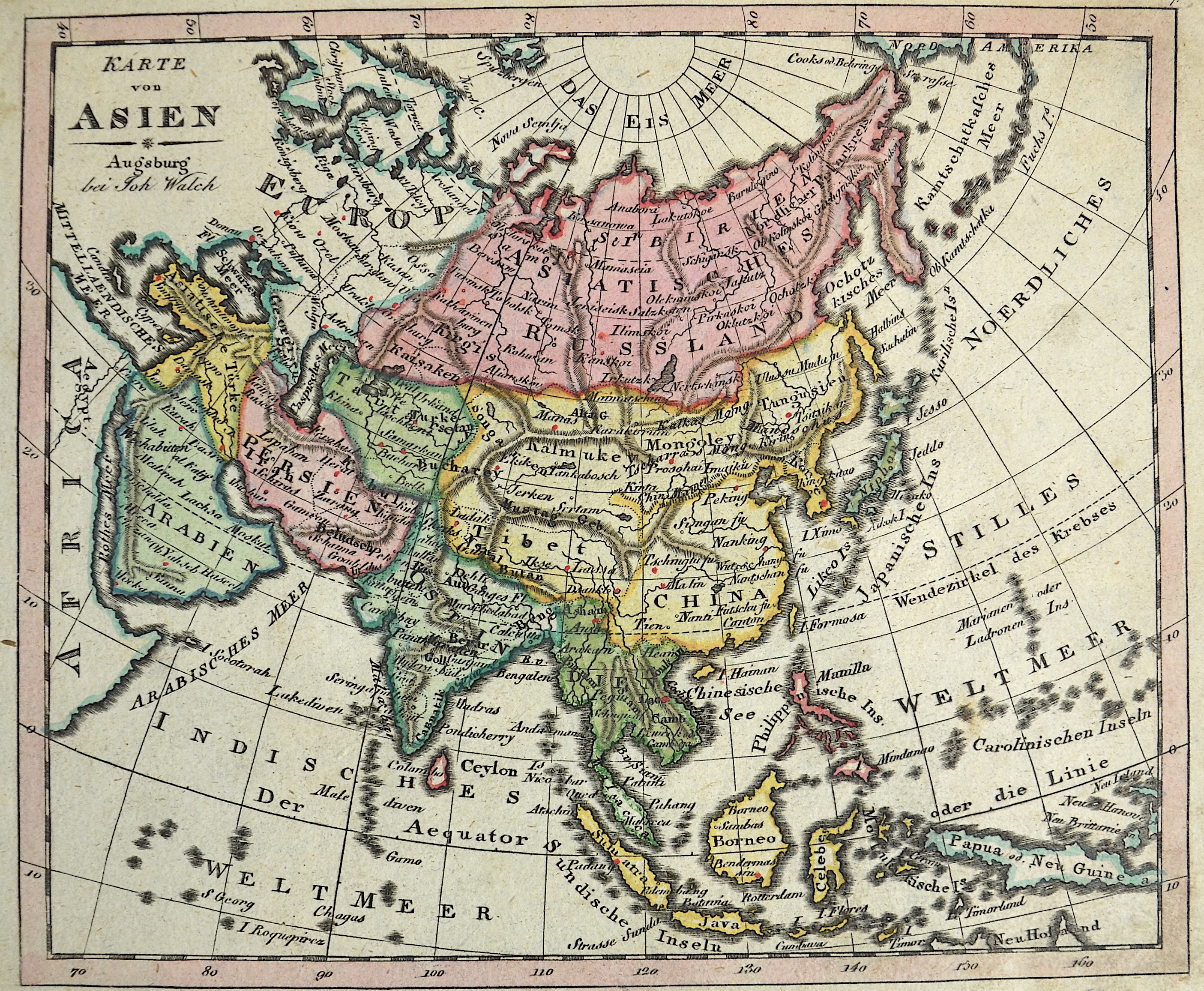
Karte von Asien

| Article ID | ASX1109 |
Title | Karte von Asien |
Description | Mpa shows total Asia. |
| Year | ca. 1828 |
Artist | Walch (1757-1815) |
Johann Walch ( 1757 - 1815 Augsburg )in Kempten-Allgäu was a german painter, drawer, printer and publisher. He was the son of Sebastian Walch and married in 1786 the daughter of the printer and publisher Johann Martin Will and worked with his father in law. In 1789 he was able to pruchase the herritage material of the copper printer and publisher Matthäus Seutter und Tobias Conrad Lotter with 208 copper plates and 25000 maps material. With this material he expanded the company into the famous map publishing company called „Joh. Walch’sche Landkarten Handlung“. Later then, it was called "Druckerei Joh. Walch". | |
Historical Description | Asia is Earth's largest and most populous continent, located primarily in the Eastern and Northern Hemispheres. The history of Asia can be seen as the distinct histories of several peripheral coastal regions: East Asia, South Asia, Southeast Asia and the Middle East, linked by the interior mass of the Central Asian steppes. The coastal periphery was home to some of the world's earliest known civilizations, each of them developing around fertile river valleys. The civilizations in Mesopotamia, the Indus Valley and the Yellow River shared many similarities. These civilizations may well have exchanged technologies and ideas such as mathematics and the wheel. Other innovations, such as writing, seem to have been developed individually in each area. Cities, states and empires developed in these lowlands. The central steppe region had long been inhabited by horse-mounted nomads who could reach all areas of Asia from the steppes. The earliest postulated expansion out of the steppe is that of the Indo-Europeans, who spread their languages into the Middle East, South Asia, and the borders of China, where the Tocharians resided. The northernmost part of Asia, including much of Siberia, was largely inaccessible to the steppe nomads, owing to the dense forests, climate and tundra. These areas remained very sparsely populated. The center and the peripheries were mostly kept separated by mountains and deserts. The Caucasus and Himalaya mountains and the Karakum and Gobi deserts formed barriers that the steppe horsemen could cross only with difficulty. While the urban city dwellers were more advanced technologically and socially, in many cases they could do little in a military aspect to defend against the mounted hordes of the steppe. However, the lowlands did not have enough open grasslands to support a large horsebound force; for this and other reasons, the nomads who conquered states in China, India, and the Middle East often found themselves adapting to the local, more affluent societies. |
| Place of Publication | Augsburg |
| Dimensions (cm) | 18,5 x 22 |
| Condition | Perfect condition |
| Coloring | original colored |
| Technique | Copper print |