

Adina Sommer
Antique and Contemporary Art
Winzerer Str. 154
80797 München
telephone
+49 89 304714
business hours:
by appointment
Email
![]()


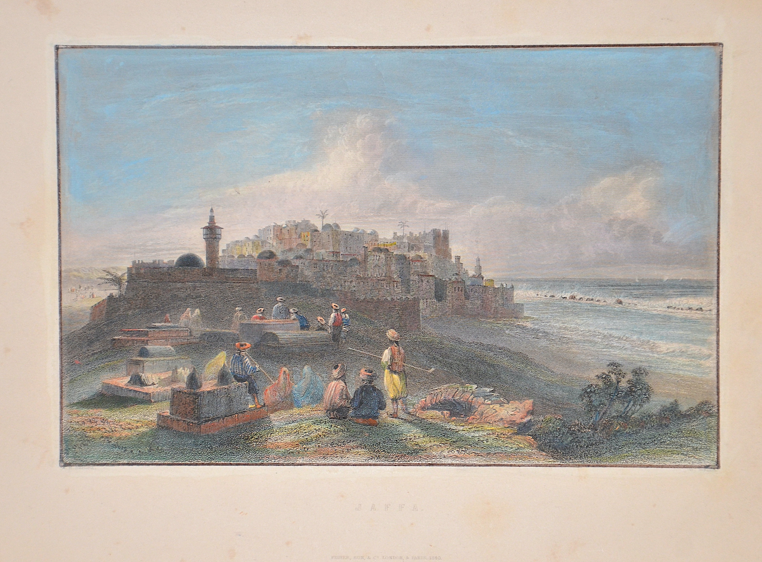
Jaffa.

| Article ID | ASP1449 |
Title | Jaffa. |
Description | View of the port city of Jaffa (today Tel Aviv-Jaffa), looking south with figure staffage in the foreground. After William Henry Bartlett, published by Fisher, Son & Co. |
| Year | c. 1840 |
Artist | Wallis |
Historical Description | Tel Aviv was founded by the Jewish community on the outskirts of the ancient port city of Jaffa in 1909. Immigration by mostly Jewish refugees meant that the growth of Tel Aviv soon outpaced Jaffa's, which had a majority Arab population at the time. Tel Aviv and Jaffa were merged into a single municipality in 1950, two years after the establishment of the State of Israel. In the 16th century, Jaffa was conquered by the Ottomans and was administered as a village in the Sanjak of Gaza. Napoleon besieged the city in 1799 and killed scores of inhabitants; a plague epidemic followed, decimating the remaining population. The surrendering garrison of several thousand Muslims was massacred. Builder in Tel Aviv, 1920s Jaffa began to grow as an urban center in the early 18th century, when the Ottoman government in Istanbul intervened to guard the port and reduce attacks by Bedouins and pirates. However, the real expansion came during the 19th century, when the population grew from 2,500 in 1806 to 17,000 in 1886. |
| Place of Publication | London / Paris |
| Dimensions (cm) | 15,5 x 19,5 cm |
| Condition | Margin outside slightly spotted |
| Coloring | original colored |
| Technique | Steel engraving |