

Adina Sommer
Antique and Contemporary Art
Winzerer Str. 154
80797 München
telephone
+49 89 304714
business hours:
by appointment
Email
![]()


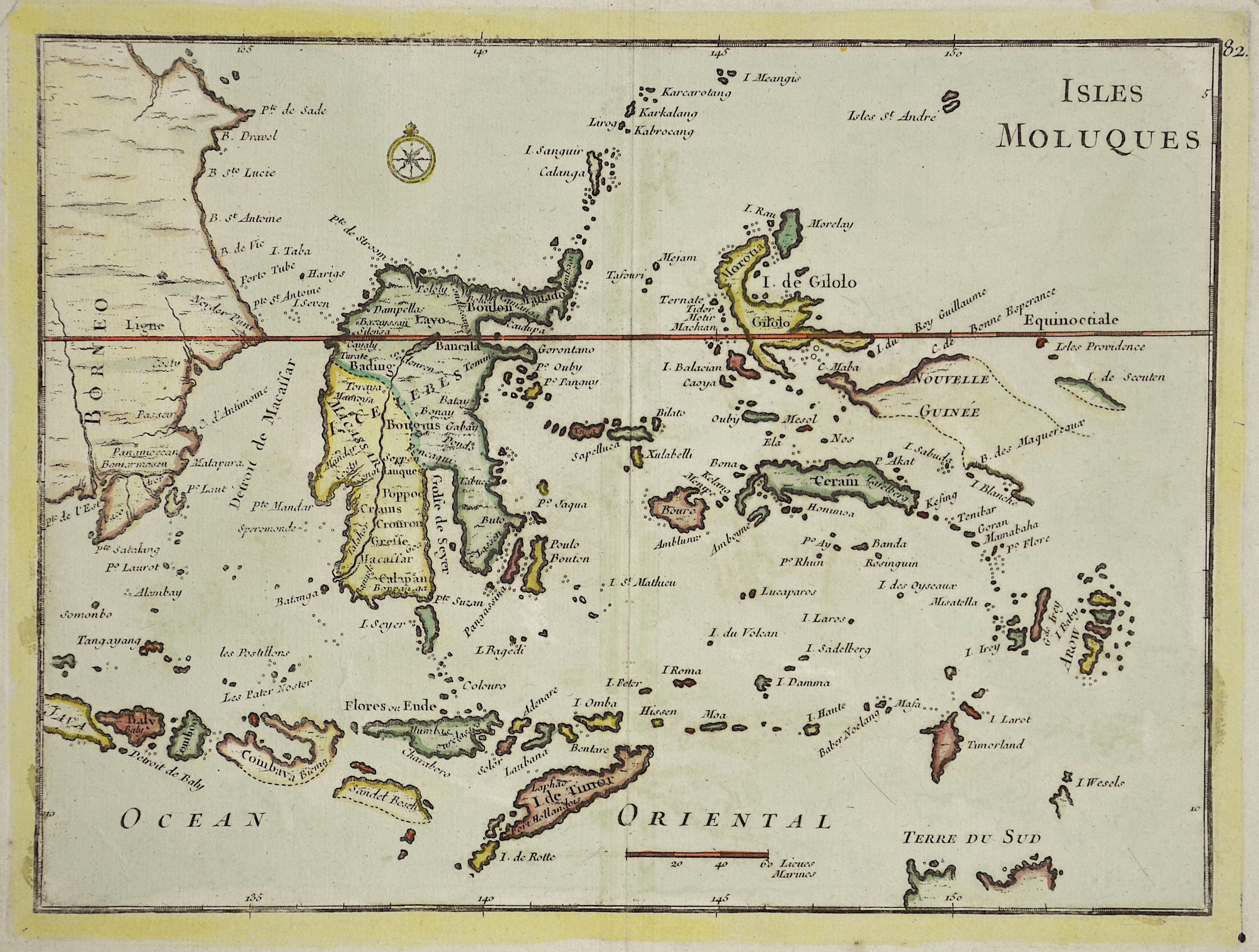
Isles Molluques

| Article ID | ASS0657 |
Title | Isles Molluques |
Description | Map shows the ilsands of Molucces, partly Borneo, Timor and West- Nusa- Tenggara. |
| Year | ca. 1767 |
Artist | Crepy |
Jean Babtiste Crepy was a french engraver and painter. | |
Historical Description | The Maluku Islands are an archipelago within Banda Sea, Indonesia. Tectonically they are located on the Halmahera Plate within the Molucca Sea Collision Zone. Geographically they are located east of Sulawesi, west of New Guinea, and north and east of Timor. The islands were known as the Spice Islands due to the nutmeg, mace and cloves that were originally exclusively found there, the presence of which sparked colonial interest from Europe in the 16th century. The Maluku Islands formed a single province from Indonesian independence until 1999, when it was split into two provinces. A new province, North Maluku, incorporates the area between Morotai and Sula, with the arc of islands from Buru and Seram to Wetar remaining within the existing Maluku Province. |
| Dimensions (cm) | 22 x 28,5 |
| Condition | Very good |
| Coloring | original colored |
| Technique | Copper print |