

Adina Sommer
Antique and Contemporary Art
Winzerer Str. 154
80797 München
telephone
+49 89 304714
business hours:
by appointment
Email
![]()


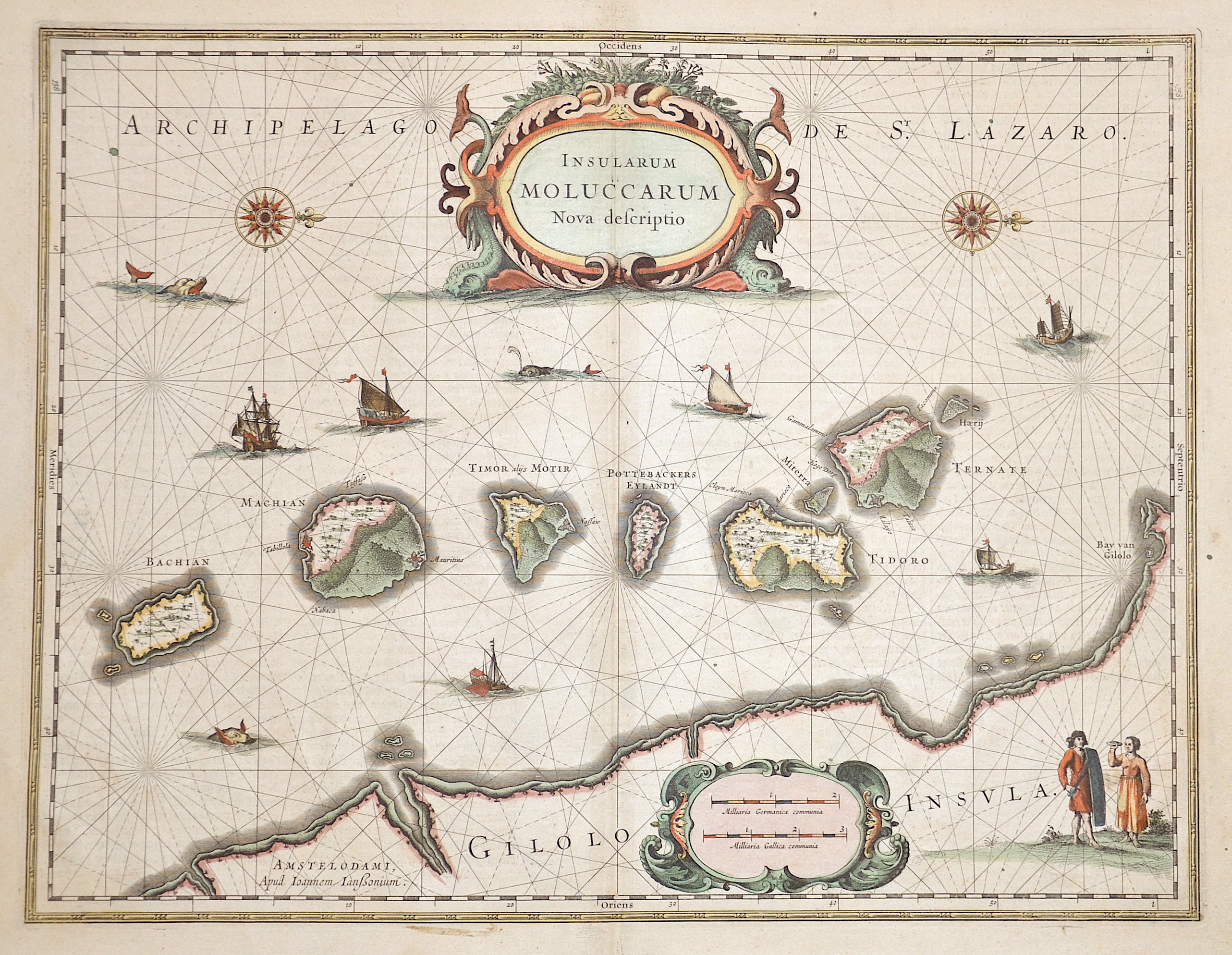
Insularum Moluccarum Nova descriptio.

| Article ID | ASS1176 |
Title | Insularum Moluccarum Nova descriptio. |
Description | Map shows the islands of the Molucces, Ternale, Tidore, Timor, Machian, Bachian, the coast of Dschailolo and beautiful cartushes. |
| Year | ca. 1630 |
Artist | Janssonius (1588-1664) |
Johannes Janssonius (Jansson)( 1588- 1664) Amsterdam, was born in Arnhem, the son of Jan Janszoon the Elder, a publisher and bookseller. In 1612 he married Elisabeth de Hondt, the daughter of Jodocus Hondius. He produced his first maps in 1616 of France and Italy. In 1623 Janssonius owned a bookstore in Frankfurt am Main, later also in Danzig, Stockholm, Copenhagen, Berlin, Königsberg, Geneva and Lyon. In the 1630s he formed a partnership with his brother in law Henricus Hondius, and together they published atlases as Mercator/Hondius/Janssonius. Under the leadership of Janssonius the Hondius Atlas was steadily enlarged. Renamed Atlas Novus, it had three volumes in 1638, one fully dedicated to Italy. 1646 a fourth volume came out with ""English County Maps"", a year after a similar issue by Willem Blaeu. Janssonius' maps are similar to those of Blaeu, and he is often accused of copying from his rival, but many of his maps predate those of Blaeu and/or covered different regions. By 1660, at which point the atlas bore the appropriate name ""Atlas Major"", there were 11 volumes, containing the work of about a hundred credited authors and engravers. It included a description of ""most of the cities of the world"" (Townatlas), of the waterworld (Atlas Maritimus in 33 maps), and of the Ancient World (60 maps). The eleventh volume was the Atlas of the Heavens by Andreas Cellarius. Editions were printed in Dutch, Latin, French, and a few times in German. | |
Historical Description | The Maluku Islands are an archipelago within Banda Sea, Indonesia. Tectonically they are located on the Halmahera Plate within the Molucca Sea Collision Zone. Geographically they are located east of Sulawesi, west of New Guinea, and north and east of Timor. The islands were known as the Spice Islands due to the nutmeg, mace and cloves that were originally exclusively found there, the presence of which sparked colonial interest from Europe in the 16th century. The Maluku Islands formed a single province from Indonesian independence until 1999, when it was split into two provinces. A new province, North Maluku, incorporates the area between Morotai and Sula, with the arc of islands from Buru and Seram to Wetar remaining within the existing Maluku Province. |
| Place of Publication | Amsterdam |
| Dimensions (cm) | 38,5 x 50 |
| Condition | Some minor restoration at upper centerfold |
| Coloring | original colored |
| Technique | Copper print |