

Adina Sommer
Antique and Contemporary Art
Winzerer Str. 154
80797 München
telephone
+49 89 304714
business hours:
by appointment
Email
![]()


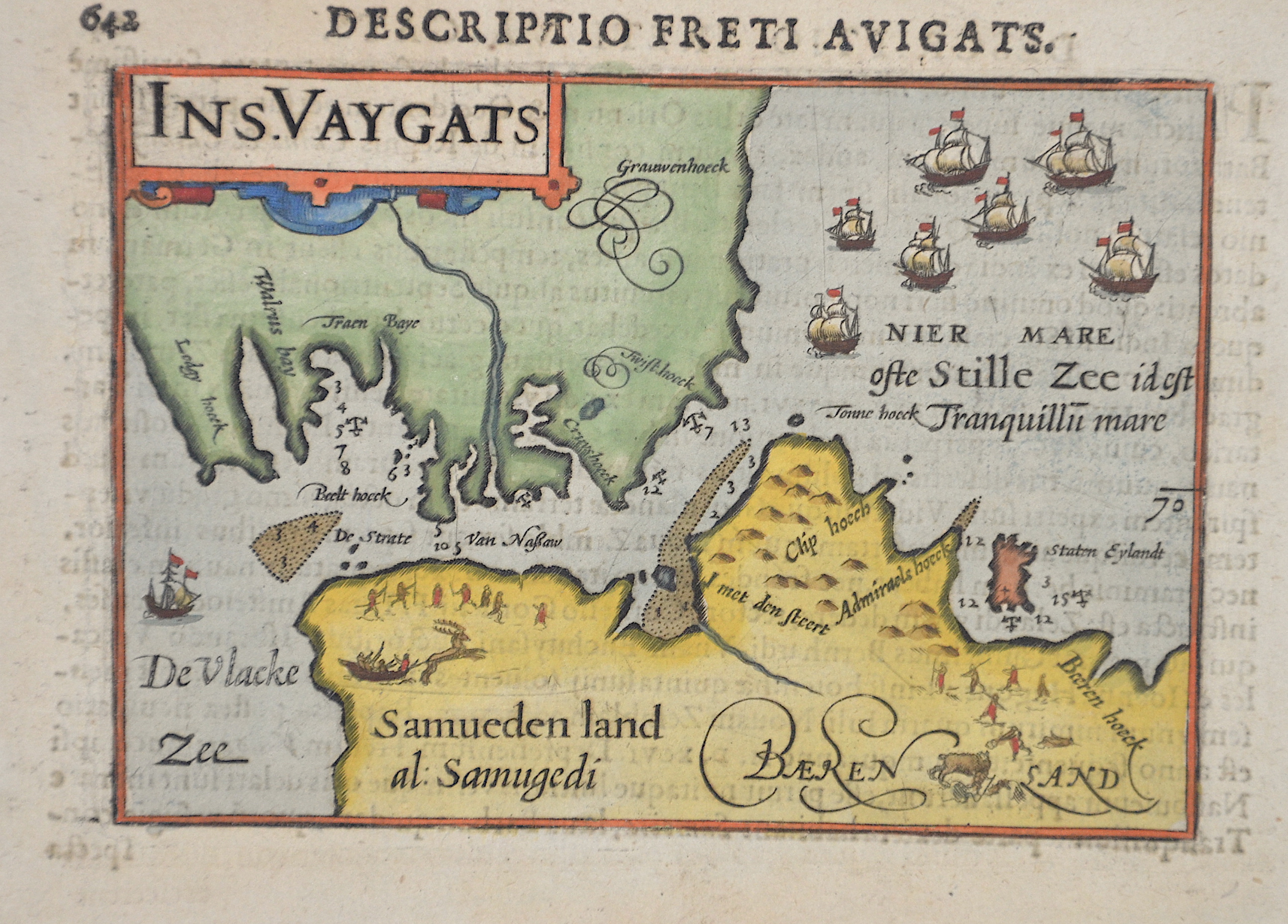
Ins. Vaygats

| Article ID | EUO4222 |
Title | Ins. Vaygats |
Description | Map shows the south part of Vaygach Island in the Arctic Sea, the Yugorsky Strait and partly Russia. |
| Year | ca. 1610 |
Artist | Bertius (1565-1629) |
Petrus Bertius (1565 -1629) was a Flemish theologian, historian, geographer and cartographer, He grew up in Beveren (Flanders). In 1593 he was appointed mathematics professor and librarian of the University of Leyden. His main cartographic work includes a miniature world atlas of 1600, a pocket atlas of the German Empire of 1616 with 26 engraved maps and 101 city views, a version of the Geographia of Ptolemy with 28 maps by Mercator and 14 maps from the Parergon of Ortelius of 1618, but he is known today as a cartographer with his edition of the Geographia of Ptolemy (based on Mercator's edition of 1578) and for his atlas. | |
Historical Description | The island name, Waigatsch, is probably that of the explorer of the same name who visited the island in the 16th century. The island, which belongs to the Nenets Autonomous Okrug, lies east of the Barents Sea and south of the Kara Sea (parts of the Arctic Ocean, respectively). The island is a sacred place for the Nenets, who breed reindeer here, they came here every year to make ritual sacrifices. The vegetation on Waigatsch is typical for tundra. The local wildlife consists of polar bears, seals, walruses and a large population of swimming birds. |
| Place of Publication | Amsterdam |
| Dimensions (cm) | 9,2 x 12,5 cm |
| Condition | Perfect condition |
| Coloring | colored |
| Technique | Copper print |