

Adina Sommer
Antique and Contemporary Art
Winzerer Str. 154
80797 München
telephone
+49 89 304714
business hours:
by appointment
Email
![]()


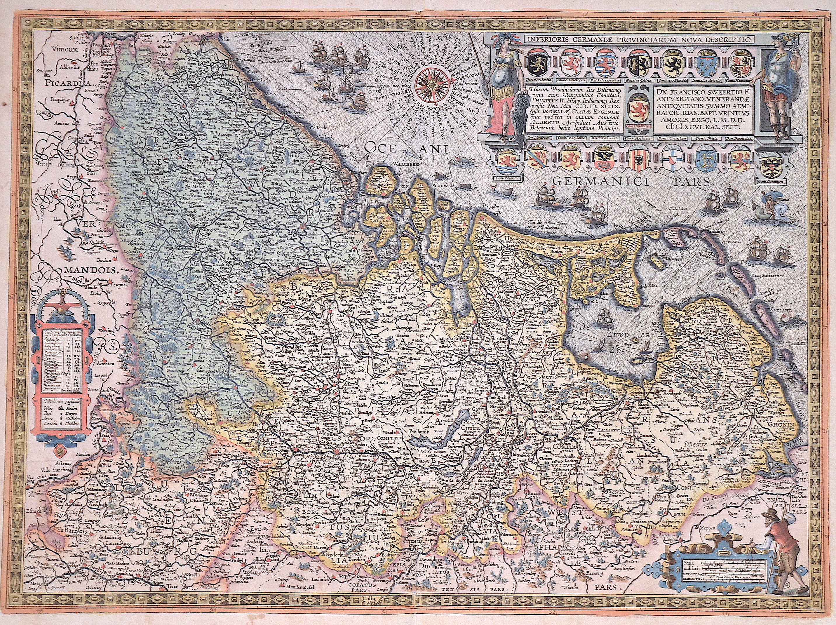
Inferioris Germaniae Provinciarum Nova Descriptio

| Article ID | EUB1499 |
Title | Inferioris Germaniae Provinciarum Nova Descriptio |
Description | Decorative map shows the whole of Holland, East Frisia, Belgium, a scroll cartouche with index, a mileage scale cartouche, compass rose and many sailing ship staffages, sea monsters and the god of the sea. There is also a magnificent title cartouche with 17 coats of arms, e.g. of Holland, Zeeland, Brabant, Luxembourg, Flanders, Frisland, etc. |
| Year | c. 1608 |
Artist | Vrients/Ortelius (1552-1612) |
After 1600, Jan Baptist Vrients acquired the inventory and the plates of Ortelius' Theatrum. In 1603, he published his first atlas of the Netherlands, which was compiled from the sheets of the Theatrum. In 1608, he added 8 new maps to the atlas, including the Inferioris Germaniae Provinciarum. When Vrients died in 1612, the entire stock of maps and engravings was sold to the Moretus brothers from the House of Plantin, who published three further editions (Latin, Italian, Spanish) of the Theatrum. | |
Historical Description | The area, which later includes the Benelux area, is called de Lage Landen in Dutch, Low Countries in English, consisting of Belgium, the Netherlands (Nederland) and Luxembourg. In the 19th century, three countries were united under the crown of the Dutch king from 1815 to 1830, until Belgium became independent. The forerunners of the Benelux Treaty were the economic union concluded between Luxembourg and Belgium on July 25, 1921. |
| Place of Publication | Antwerp |
| Dimensions (cm) | 41 x 56 cm |
| Condition | Tear perfectly restored |
| Coloring | original colored |
| Technique | Copper print |