

Adina Sommer
Antique and Contemporary Art
Winzerer Str. 154
80797 München
telephone
+49 89 304714
business hours:
by appointment
Email
![]()


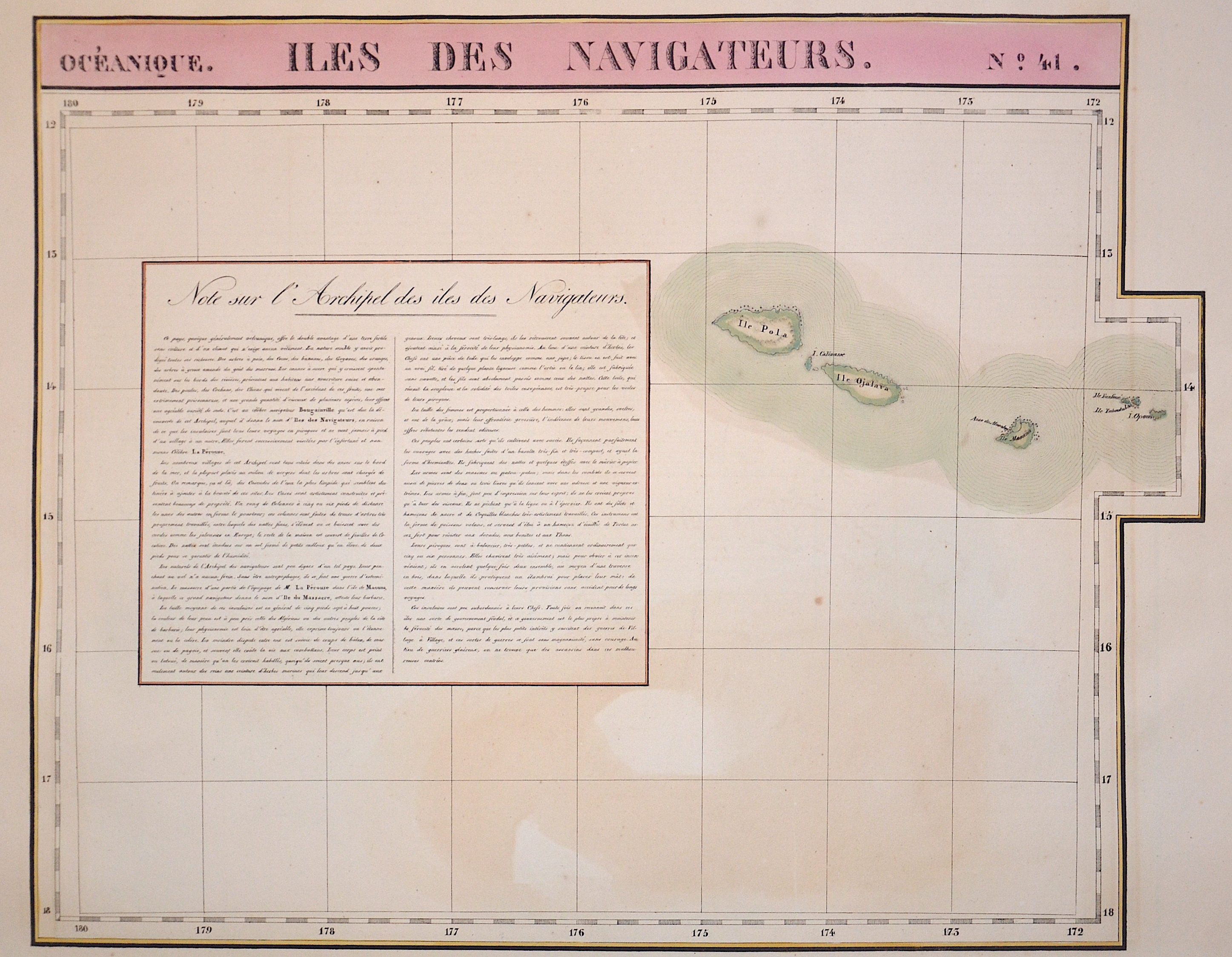
Iles des Navigateurs No. 41

| Article ID | OZ0339 |
Title | Iles des Navigateurs No. 41 |
Description | Map shows the island Ojalava of Samoa in the south Pacific. The Independent State of Samoa, known as Western Samoa, is a Unitary Parliamentary Republic with eleven administrative divisions. The two main islands are Savai'i and Upolu with four smaller islands surrounding the landmasses. The capital city is Apia. The Lapita people discovered and settled the Samoan islands around 3,500 years ago. They developed a unique language and cultural identity. |
| Year | ca. 1825 |
Artist | Vandermaelen |
| Place of Publication | Bruxelles |
| Dimensions (cm) | 48 x 60 |
| Condition | Very good |
| Coloring | original colored |
| Technique | Lithography |