

Adina Sommer
Antique and Contemporary Art
Winzerer Str. 154
80797 München
telephone
+49 89 304714
business hours:
by appointment
Email
![]()


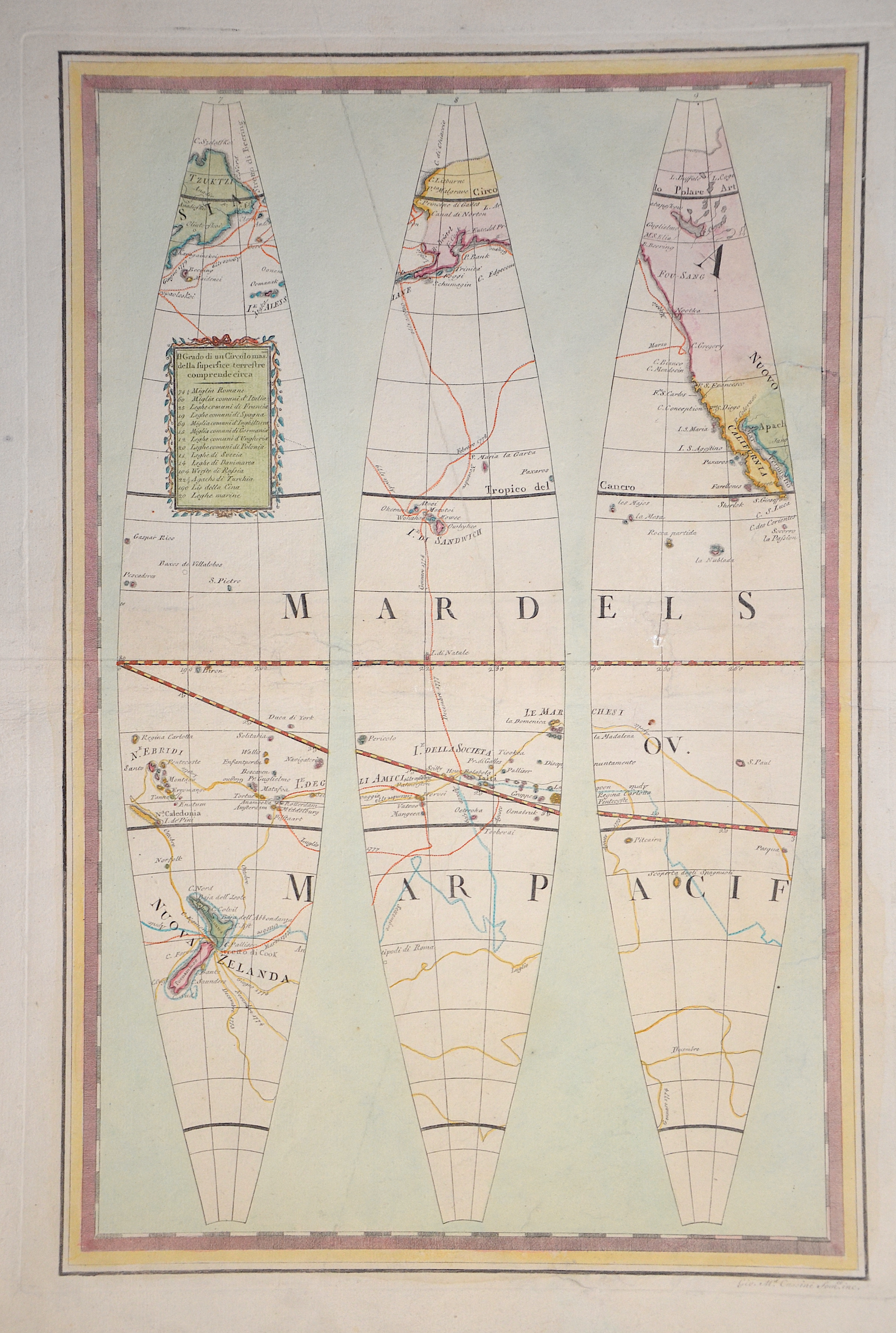
Il Grado di un Circolo mas. Della supersice terrestre comprende circa / Globo Terrestre II

| Article ID | OZ0492 |
Title | Il Grado di un Circolo mas. Della supersice terrestre comprende circa / Globo Terrestre II |
Description | Map with three globe segments of New Zealand and the Bering Strait, the South Sandwich Islands and Tahiti, and partly North America with California. |
| Year | ca. 1790 |
Artist | Cassini (1745-1824) |
Giovanni Maria Cassini (1745 - ca. 1824) Rom, was a noted geographer, engraver, and publisher in Rome. He was one of the last of the fine Italian globe makers active at the end of the 18th century. Cassini made Terrestrial and Celestial Globes in 1790 and 1792. He also published the twelve terrestrial and twelve celestial globe gores that formed these globes in his atlas "Nuovo Atlante Geografico Universale" along with rules for the construction of globes and globe gores. | |
Historical Description | New Zealand was discovered by Polynesians around the end of the 13th century, or at the latest in the first half of the 14th century, and was settled in several waves of immigration. The descendants of the first immigrants founded the Māori culture. The first Māori to reach the land found no mammals. To feed themselves, they first hunted the moa, a flightless bird remotely similar to the African ostrich. The first European to set eyes on New Zealand was the Dutch navigator Abel Tasman. His mission was to find the "Great Southern Land" because valuable raw materials were suspected there. On his voyage, in 1642, he discovered a "great high land" on the South Island, today's West Coast region. He was not sure and suspected that he had discovered another piece of Staten Landt coast. When he went to Golden Bay in what is now the Tasman region to explore the land up close, he had his first bloody encounter with the "aborigines" in which four Dutch sailors were killed. The "discoverer of New Zealand" never set foot on New Zealand soil. A year later, when an expedition under Hendrik Brouwer determined that the coastal strip found by Tasman did not belong to Staten Landt, the country was named Nova Zeelandia (Latin) or Nieuw Zeeland (Dutch), in reference to Australia, which had been called Nova Hollandia or Nieuw Holland. Like Tasman, the British captain James Cook was to find a suspected southern continent. In 1769, Cook's ship Endeavour, coming from Tahiti, encountered New Zealand at the southwestern point of the bay called Poverty Bay. After first hostile encounters, but then also successful approaches with Māori, Cook first circumnavigated the North Island and, after a longer stay in the Marlborough Sounds, the South Island and was thus able to prove that New Zealand was islands and not part of a continent. Cook and the scientists accompanying him began to map the country thoroughly, they explored flora and fauna extensively and gathered information about the Māori. Only a few weeks after Cook, Jean François Marie de Surville also reached the islands. In the following years, mainly whalers, sealers and later missionaries migrated to New Zealand. These maintained pronounced contacts with the Māori. The two parties engaged in lively trade with each other, and some Europeans also lived together with the Māori. |
| Place of Publication | Rome |
| Dimensions (cm) | 49,5 x 32,5 cm |
| Condition | Tear perfectly restored |
| Coloring | original colored |
| Technique | Copper print |