

Adina Sommer
Antique and Contemporary Art
Winzerer Str. 154
80797 München
telephone
+49 89 304714
business hours:
by appointment
Email
![]()


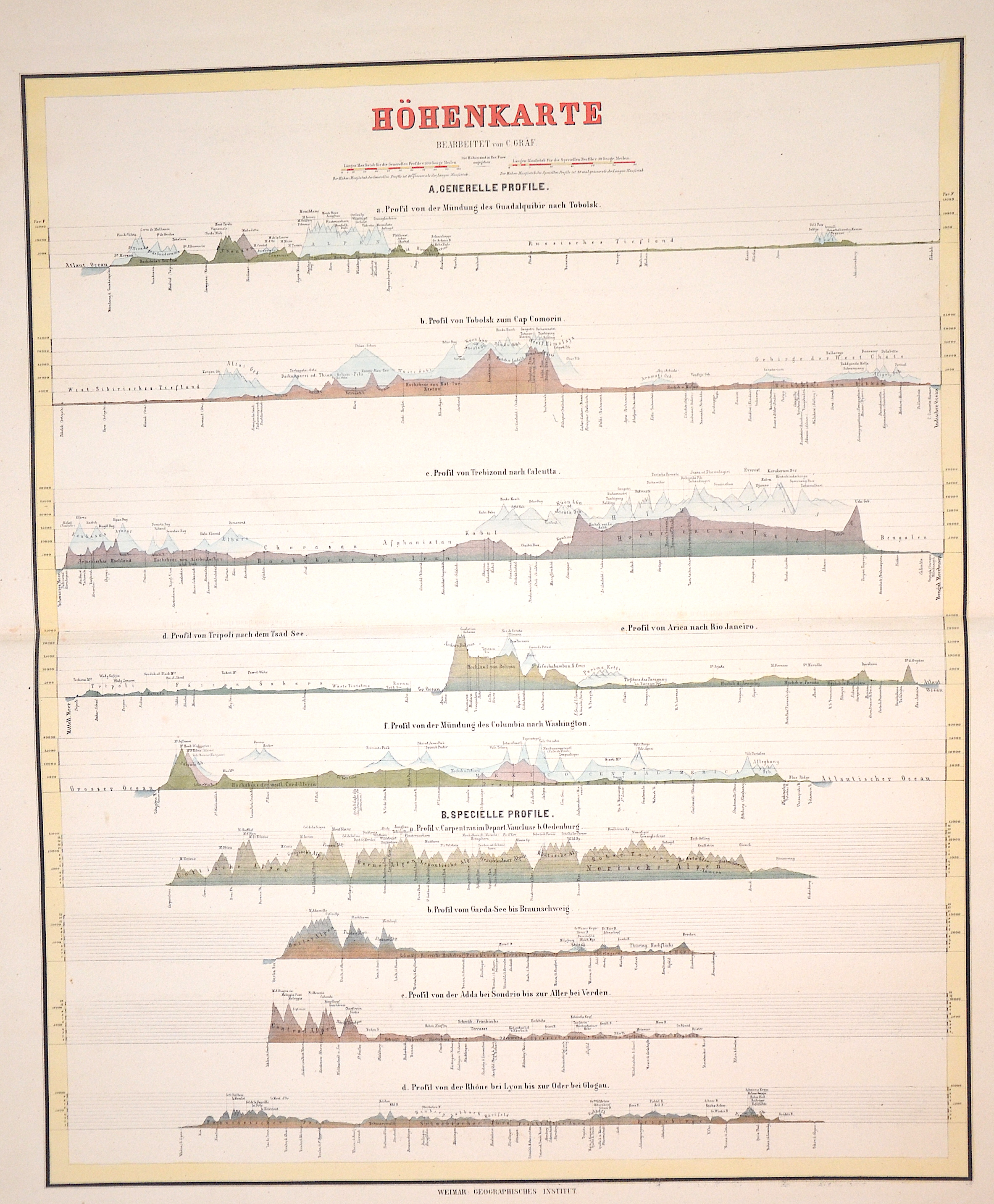
Höhenkarte

| Article ID | T0114 |
Title | Höhenkarte |
Description | Representation of the hights of different places of the world: Tobolsk, Cap Comotin, Trebiszond bis Calcutta, Tripoli bis Tsad See, Arica bis Rio de Janeiro, Columbis bis Washington, Vaucluse bis Oedenburg,Gardasee bis Braunschweig, Sondrio bis Aller bei Verden, Lyon bis Glogau. |
| Year | ca. 1840 |
Artist | Geographisches Institut (1804-1867) |
| Place of Publication | Weimar |
| Dimensions (cm) | 55,5 x 46 |
| Condition | Perfect condition |
| Coloring | colored |
| Technique | Lithography |