

Adina Sommer
Antique and Contemporary Art
Winzerer Str. 154
80797 München
telephone
+49 89 304714
business hours:
by appointment
Email
![]()


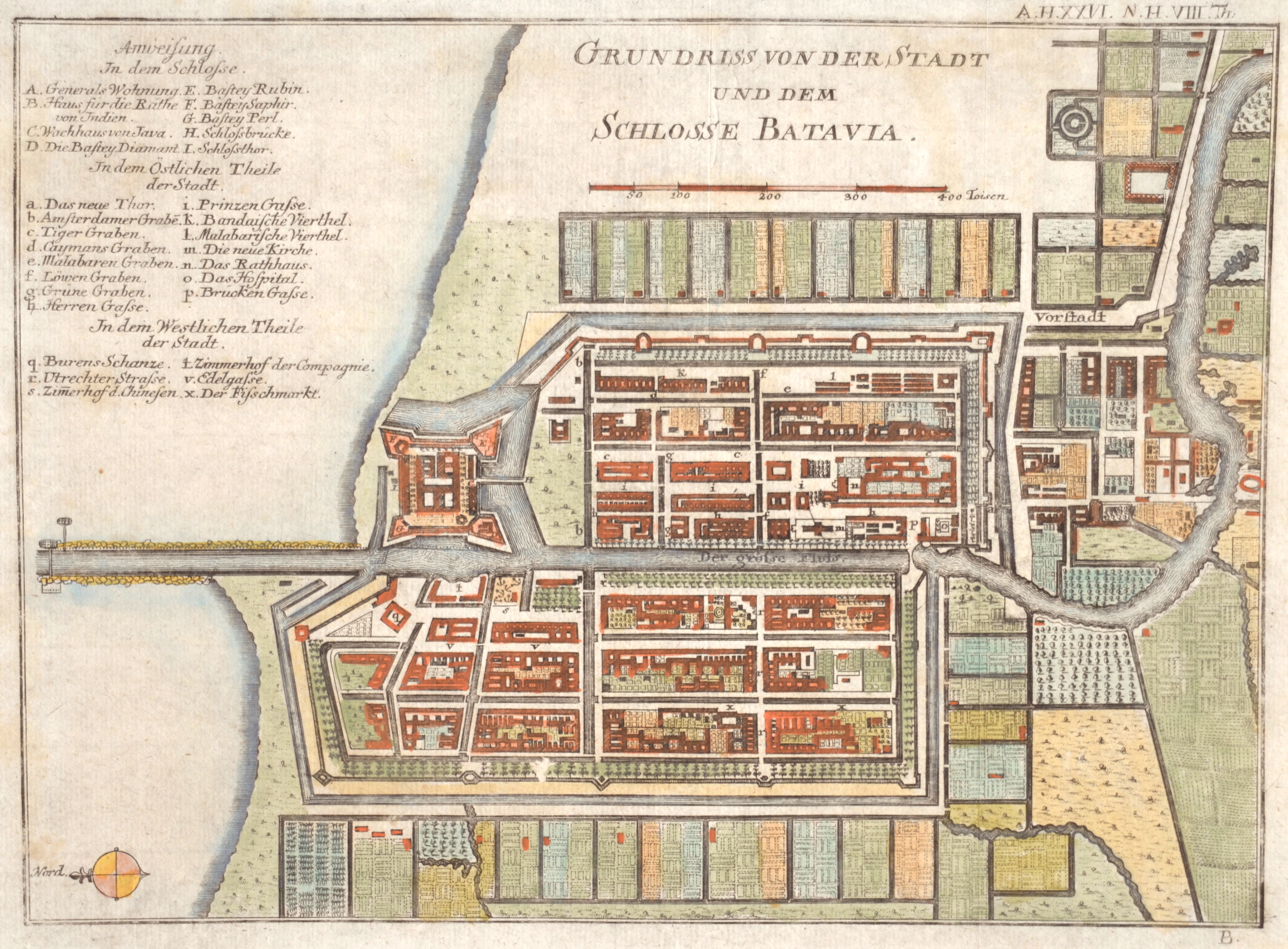
Grundriss von der Stadt und dem Schlosse Batavia

| Article ID | ASS0773 |
Title | Grundriss von der Stadt und dem Schlosse Batavia |
Description | Map shows the city plan of Batavia (now Jakarta) on the Indonesian island of Java with a city index. |
| Year | ca. 1790 |
Artist | Baumgarten/Semler |
Historical Description | The island's exceptional fertility and rainfall allowed the development of wet-field rice cultivation, which required sophisticated levels of cooperation between villages. Out of these village alliances, small kingdoms developed. The chain of volcanic mountains and associated highlands running the length of Java kept its interior regions and peoples separate and relatively isolated. Java's contact with the European colonial powers began in 1522 with a treaty between the Sunda kingdom and the Portuguese in Malacca. After its failure, the Portuguese presence was confined to Malacca, and to the eastern islands. In 1596, a four-ship expedition led by Cornelis de Houtman was the first Dutch contact with Indonesia. In June 1619 the Dutch moved to Jakarta, which influenced them under the name Batavia to the center of the colonial empire in Asia. Realization of colonial rule also spread to Java. He was particularly significant because he was heard by many as a counterweight to the culture of European perception. On the other hand, the Dutch hardly attempted Christian missionary work. The Dutch use Chinese as traders and tax collectors, they concern each other incredibly in the social relationship. At the beginning of the 19th century, the Eligible State owned control of the colony. Since the administration was proclaimed, Java has been the center of the Republic of Indonesia with the state capital Jakarta. |
| Place of Publication | Halle |
| Dimensions (cm) | 21,5 x 29,5 cm |
| Condition | Very good |
| Coloring | original colored |
| Technique | Copper print |