

Adina Sommer
Antique and Contemporary Art
Winzerer Str. 154
80797 München
telephone
+49 89 304714
business hours:
by appointment
Email
![]()


Germany

| Article ID | EUD562 |
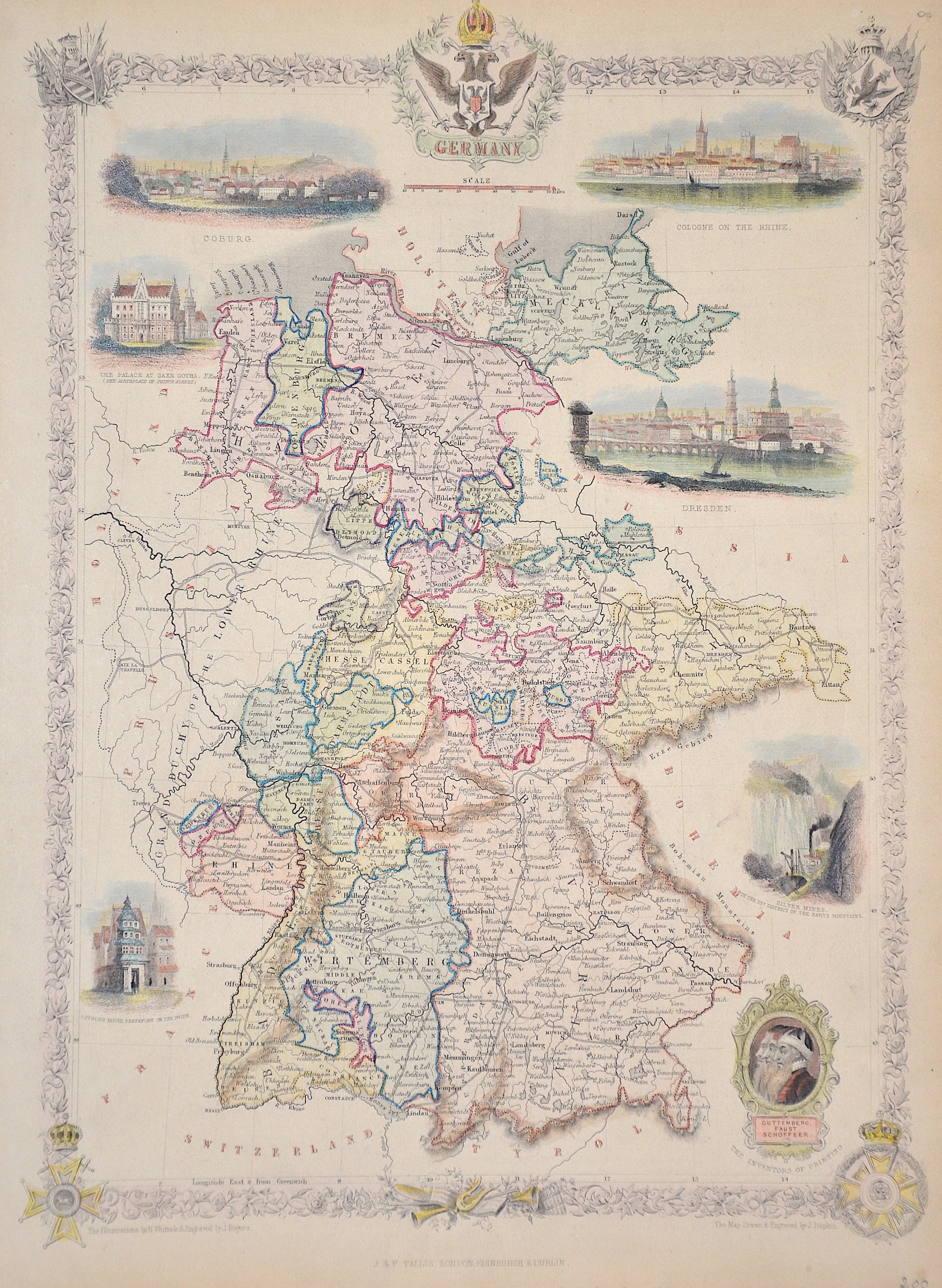
Title | Germany |
Description | Map shows the whole of Germany with floral border and 5 coats of arms. Furthermore, six views, such as Coburg, Cologne, Dresden and the silver mine in the Hartz. |
| Year | ca. 1850 |
Artist | Tallis (1817-1876) |
John Tallis was an English cartographic publisher. His company, John Tallis and Company, published views, maps and atlases in London from roughly 1838 to 1851. | |
Historical Description | The concept of Germany as a distinct region in central Europe can be traced to Roman commander Julius Caesar, who referred to the unconquered area east of the Rhine as Germania, thus distinguishing it from Gaul (France), which he had conquered. In the High Middle Ages, the regional dukes, princes and bishops gained power at the expense of the emperors. Martin Luther led the Protestant Reformationagainst the Catholic Church after 1517, as the northern states became Protestant, while the southern states remained Catholic. The two parts of the Holy Roman Empire clashed in the Thirty Years' War (1618–1648). 1648 marked the effective end of the Holy Roman Empire and the beginning of the modern nation-state system, with Germany divided into numerous independent states, such as Prussia, Bavaria and Saxony. |
| Place of Publication | London |
| Dimensions (cm) | 35 x 24 cm |
| Condition | Upper margin perfectly enlarged |
| Coloring | original colored |
| Technique | Steel engraving |