


Adina Sommer
Antique and Contemporary Art
Winzerer Str. 154
80797 München
telephone
+49 89 304714
business hours:
by appointment



Email



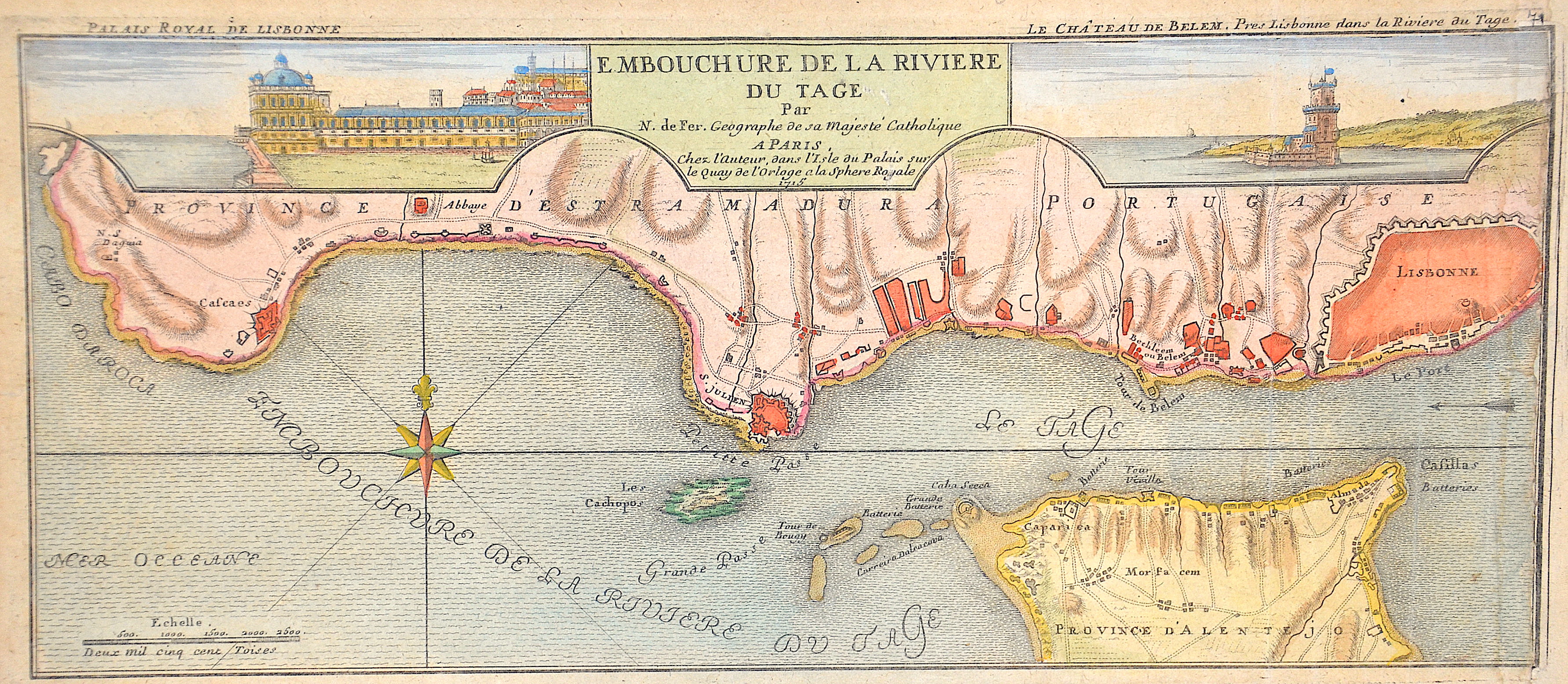
E. Mbouchure de la Riviere du Tage

| Article ID | EUE5005 |
Title | E. Mbouchure de la Riviere du Tage |
Description | Map shows the mouth of the Tagus from the sea to Lisbon with a detailed representation of the coastline, the settlements and the fortifications, a compass rose and a mileage indicator. Furthermore two partial maps on the left the "Palais Royal de Lisbonne" and on the right "Le Chateau de Belem". |
| Year | c. 1715 |
Artist | Fer, de Nicolas (1646-1720) |
Nicolas de Fer ( 1646 - 1720 in Paris) was a French cartographer and geographer. He also was an engraver and publisher. De Fer was the youngest of three sons of Antoine de Fer, who was also a cartographer. When he was 12, he became the apprentice of Parisian engraver Louis Spirinx, and made his first map, of the Canal du Midi, at the age of 23. After the death of his father in June 1673, de Fer was so successful at improving the firm that, in 1690, he became the official geographer to Louis, Dauphin of France. With support from the Spanish and French Royal Families, de Fer also became official geographer for Philip V and Louis XIV, the kings of Spain and France, respectively. Because of this, his maps became Bourbon propaganda, endorsing French King Louis XIV. His business flourished, producing town plans, atlases, wall maps, and more than 600 sheet maps.He made maps of places in Europe and North America, including New Spain, places fortified by Vauban, the Low Countries, and the War of the Spanish Succession. In 1698, de Fer published a map of North America, which included a depiction of beavers building dams near Niagara Falls. Seventeen years later, Herman Moll published an identical map as his own, known as the -Beaver map-. De Fer became the official geographer for His Catholic Majesty in 1720.Two of his sons-in-law, Guillaume Danet and Jaques-François Bénard, continued the company after de Fer's death on 25 October of that year until around 1760. | |
Historical Description | Saint Lisbon is one of the oldest cities in Europe, with a history of settlement by Phoenicians, Romans, and Moors. In 1147, King Afonso I captured the city during the Christian Reconquista. During the fifteenth and sixteenth centuries, Lisbon became Portugal's principal port and a leading center of European maritime trade in the Age of Discovery. The devastating earthquake of 1755 destroyed much of the city, which was subsequently rebuilt under the direction of the Marquis of Pombal according to modern urban planning principles. Today, Lisbon is the capital of Portugal and the country's political, economic, and cultural center. |
| Place of Publication | Paris |
| Dimensions (cm) | 17,5 x 40,5 cm |
| Condition | Right Margin enlarged |
| Coloring | colored |
| Technique | Copper print |