

Adina Sommer
Antique and Contemporary Art
Winzerer Str. 154
80797 München
telephone
+49 89 304714
business hours:
by appointment
Email
![]()


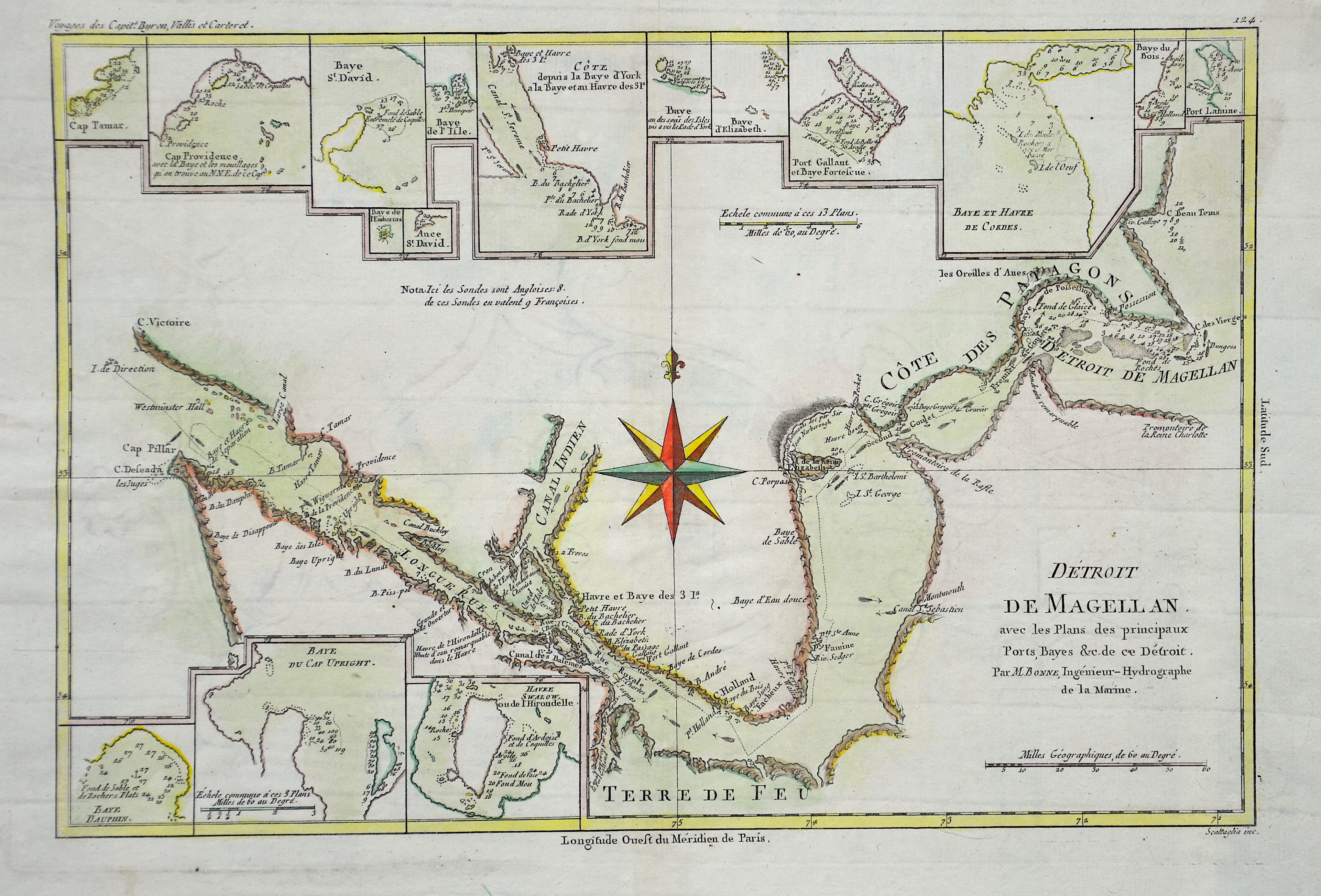
Detroit de Magellan avec les Plans des Principaux Ports, Bays & de ce Detroits

| Article ID | AMS0615 |
Title | Detroit de Magellan avec les Plans des Principaux Ports, Bays & de ce Detroits |
Description | Map shows the Street of Magellan with 16 small inset maps showing different harbours and bays. |
| Year | ca. 1740 |
Artist | Bonne (1727-1795) |
Rigobert Bonne (1727–1795) was one of the most important cartographers of the late 18th century. In 1773 Bonne succeeded Jacques Nicolas Bellin as Royal Cartographer to France in the office of the Hydrographer at the Depôt de la Marine. Working in his official capacity, Bonne compiled some of the most detailed and accurate maps of the period. Bonne’s work represents an important step in the evolution of the cartographic ideology away from the decorative work of the 17th and early 18th century towards a more detail oriented and practical aesthetic. With regard to the rendering of terrain Bonne maps bear many stylistic similarities to those of his predecessor, Bellin. However, Bonne maps generally abandon such common 18th century decorative features such as hand coloring, elaborate decorative cartouches, and compass roses. While mostly focusing on coastal regions, the work of Bonne is highly regarded for its detail, historical importance, and overall aesthetic appeal. | |
Historical Description | Ferdinand Magellan (1480 –1521) was a Portuguese explorer who organised the Spanish expedition to the East Indies from 1519 to 1522, resulting in the first circumnavigation of the Earth, completed by Juan Sebastián Elcano. Born into a Portuguese noble family in around 1480, Magellan became a skilled sailor and naval officer and was eventually selected by King Charles I of Spain to search for a westward route to the Maluku Islands (the "Spice Islands"). Commanding a fleet of five vessels, he headed south through the Atlantic Ocean to Patagonia, passing through the Strait of Magellan into a body of water he named the "peaceful sea" (the modern Pacific Ocean). Despite a series of storms and mutinies, the expedition reached the Spice Islands in 1521 and returned home via the Indian Ocean to complete the first circuit of the globe. Magellan did not complete the entire voyage, as he was killed during the Battle of Mactan in the Philippines in 1521.Tierra del Fuego is an archipelago off the southernmost tip of the South American mainland, across the Strait of Magellan. The archipelago consists of the main island, Isla Grande de Tierra del Fuego. Europeans first explored the islands during Ferdinand Magellan's expedition of 1520; Tierra del Fuego and similar namings stem from sightings of the many bonfires that the natives built. |
| Place of Publication | Paris |
| Dimensions (cm) | 23 x 34 |
| Condition | Very good |
| Coloring | original colored |
| Technique | Copper print |