

Adina Sommer
Antique and Contemporary Art
Winzerer Str. 154
80797 München
telephone
+49 89 304714
business hours:
by appointment
Email
![]()


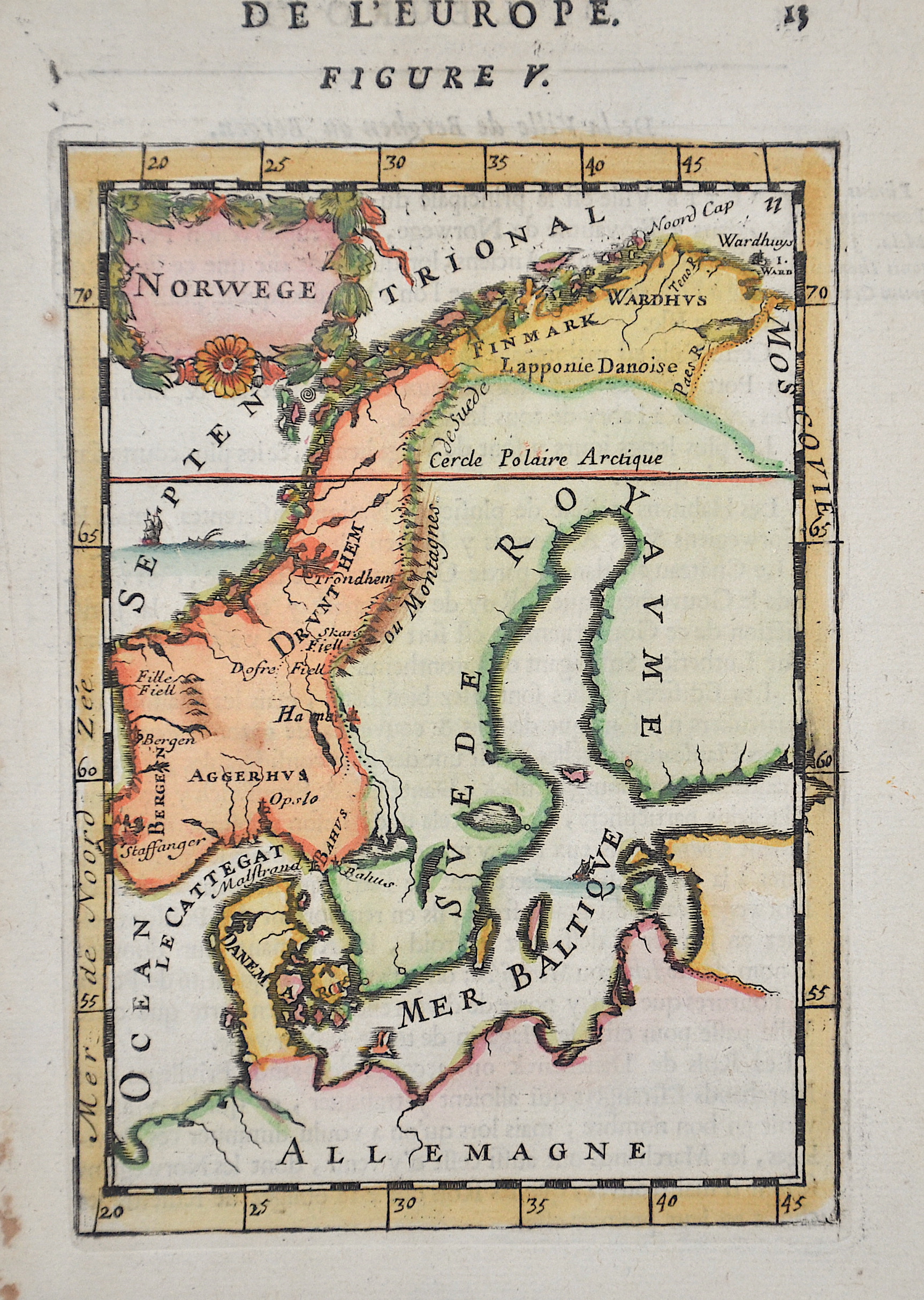
De L’Europe. Figure V. / Norwege

| Article ID | EUS3844 |
Title | De L’Europe. Figure V. / Norwege |
Description | Map shows the Scandinavian Peninsula with Norway, Sweden, Denmark and the northwestern area of Finland. |
| Year | ca. 1683 |
Artist | Mallet (1630-1706) |
Alain Manesson Mallet (1630- 1706 ) was a French cartographer and engineer. He started his career as a soldier in the army of Louis XIV, became a Sergeant-Major in the artillery and an Inspector of Fortifications. He also served under the King of Portugal, before returning to France, and his appointment to the court of Louis XIV. His military engineering and mathematical background led to his position teaching mathematics at court. His major publications were Description de L'Univers (1683) in 5 volumes, and Les Travaux de Mars ou l'Art de la Guerre (1684) in 3 volumes. His Description de L'Universe contains a wide variety of information, including star maps, maps of the ancient and modern world, and a synopsis of the customs, religion and government of the many nations included in his text. It has been suggested that his background as a teacher led to his being concerned with entertaining his readers. This concern manifested itself in the charming harbor scenes and rural landscapes that he included beneath his description of astronomical concepts and diagrams. Mallet himself drew most of the figures that were engraved for this book. | |
Historical Description | Scandinavia characterized by common ethnocultural North Germanic heritage and mutually intelligible North Germanic languages The term Scandinavia in local usage covers the three kingdoms of Denmark, Norway, and Sweden, but in English usage, it also sometimes refers to the Scandinavian Peninsula or to the broader region which includes Finland and Iceland This broader region is usually known locally as the Nordic countries. The remote Norwegian islands of Svalbard and Jan Mayen are usually not seen as a part of Scandinavia, nor is Greenland, a constituent country within the Kingdom of Denmark. The Faroe Islands may be included. For more than 500 years there was a common ground in the field of foreign policy, from the attack by the Danish king Chlochilaicus on Gaul (517) to the unfortunate move by Harald Hardrades against England in 1066, the Vikings carried out their raids and raids on all European coastal areas, but also deep into Russia stretch. For a long time, another commonality was the rejection of Christianity in times when it had been common in Western Europe for centuries. In addition, the great importance of the Jarle, who were initially only leaders of raids, but as such became very rich and powerful, is characteristic of this period. For this reason, fiefdom in Scandinavia developed much more slowly than in core Europe, and serfdom did not become fully established. In addition to these general similarities, there were also times when several of the Scandinavian countries were united under one rule, such as Denmark, Norway and (more relaxed) Sweden as well as England under Knut the Great from 1028 to 1035, as well as England. Denmark and Norway were soon under the common rule of Magnus the Good from 1042 to 1046. But the main time of the common political development lies in the Kalmar Union, which the countries of Denmark, Norway and Sweden were linked from 1397 to 1523. During this period, Norway lost significant political independence, so that after Sweden left the Kalmar Union with the Danish-Norwegian personal union, there was practically Danish dominance until 1814, which was replaced in 1814 by the Swedish-Norwegian union, which continued until 1905. |
| Place of Publication | Paris |
| Dimensions (cm) | 16,5 x 10 |
| Condition | Perfect condition |
| Coloring | original colored |
| Technique | Copper print |