

Adina Sommer
Antique and Contemporary Art
Winzerer Str. 154
80797 München
telephone
+49 89 304714
business hours:
by appointment
Email
![]()


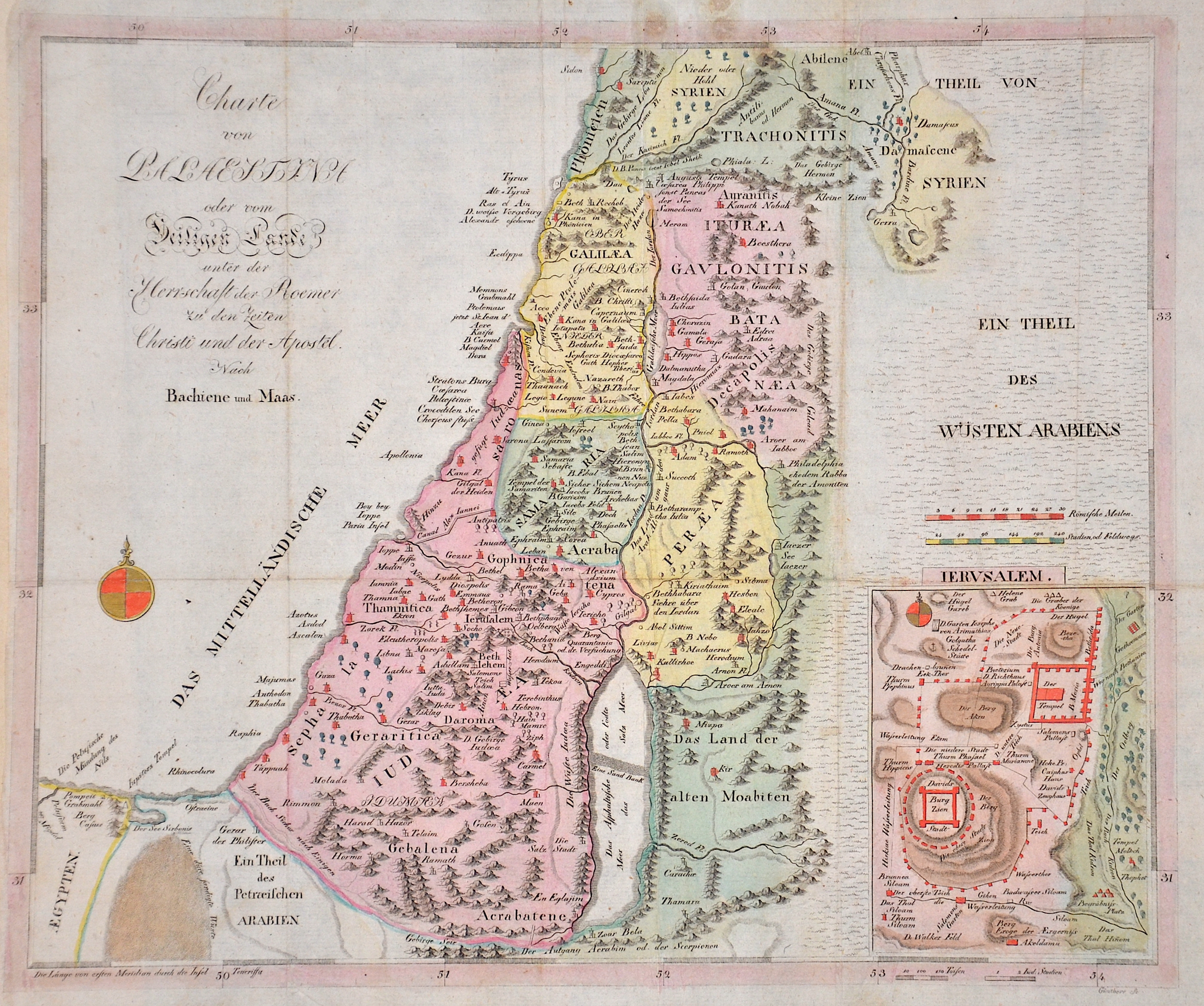
Charte von Palaestina oder vom Heiligen Lande unter der Herrschaft der Roemer zu den Zeiten Christi und der Apostel. Nach Bachiene und Maas.

| Article ID | ASI1273 |
Title | Charte von Palaestina oder vom Heiligen Lande unter der Herrschaft der Roemer zu den Zeiten Christi und der Apostel. Nach Bachiene und Maas. |
Description | Map shows the Holy Land (Palestine) with partial maps of a plan of Jerusalem. |
| Year | ca. 1750 |
Artist | Günthers |
Historical Description | The first archaeologically proven traces of an early or proto-Israelite settlement in the Mashrek region go back to the period between the 12th and 11th centuries BC. BC back. According to biblical tradition, Jerusalem was founded around 1000 BC. Conquered by David from the Jebusites and chosen as the capital of his great empire. The country subsequently became part of the Persian Empire, then the Empire of Alexander the Great, and finally the Empire of the Seleucids. The Maccabees revolt in 165 BC BC brought Israel once more state independence for about 100 years. 63 BC The time of Roman supremacy began. The Romans divided the area into two provinces: Syria in the north, Judea in the south. In the course of the Islamic expansion, the area came under Arab rule in 636. Since then, Palestine has been predominantly inhabited by Arabs. The crusaders ruled from 1099 to 1291 what they called the "Latin Kingdom of Jerusalem". This was followed by the Mamluks from 1291 to 1517 and then the Ottoman rule from 1517 to 1918. None of these authorities had planned their own administration for Palestine or viewed the area as an independent geographical unit. The region was also part of Syria for the Ottomans, probably going back to the Roman name Syria. |
| Place of Publication | Germany |
| Dimensions (cm) | 27,5 x 33 cm |
| Condition | Somer stains upper margin |
| Coloring | original colored |
| Technique | Copper print |