

Adina Sommer
Antique and Contemporary Art
Winzerer Str. 154
80797 München
telephone
+49 89 304714
business hours:
by appointment
Email
![]()


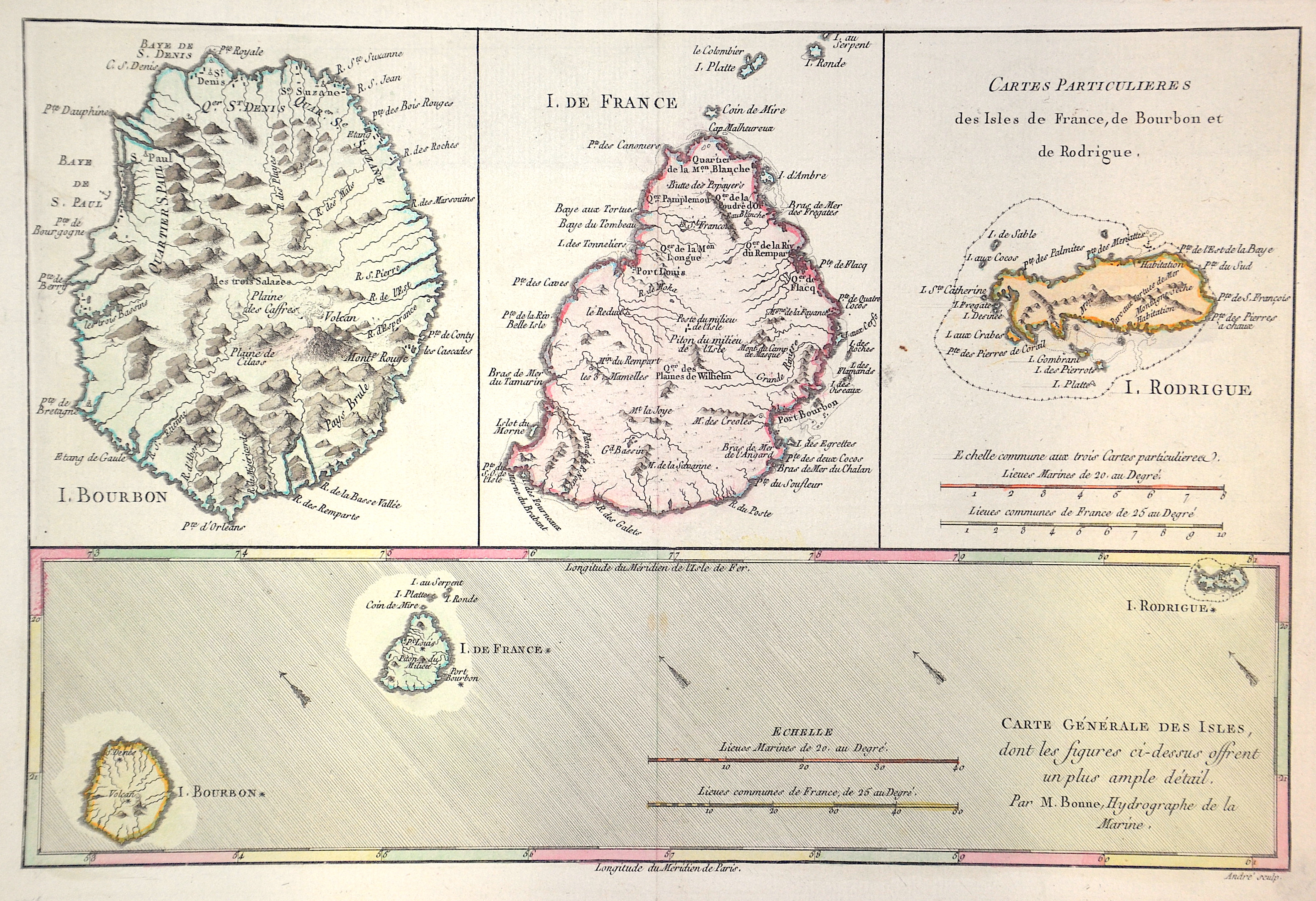
Cartes Generale et Particulieres des Isles de France, de Bourbon et de Rodrigue.

| Article ID | AF0544 |
Title | Cartes Generale et Particulieres des Isles de France, de Bourbon et de Rodrigue. |
Description | Map shows the island of Mauritius and the island of La Réunion. Furthermore, three additional partial maps of the island of La Réunion, Mauritius and the island of Rodrigues in the Indian Ocean. |
| Year | ca. 1779 |
Artist | Bonne (1727-1795) |
Rigobert Bonne (1727–1795) was one of the most important cartographers of the late 18th century. In 1773 Bonne succeeded Jacques Nicolas Bellin as Royal Cartographer to France in the office of the Hydrographer at the Depôt de la Marine. Working in his official capacity, Bonne compiled some of the most detailed and accurate maps of the period. Bonne’s work represents an important step in the evolution of the cartographic ideology away from the decorative work of the 17th and early 18th century towards a more detail oriented and practical aesthetic. With regard to the rendering of terrain Bonne maps bear many stylistic similarities to those of his predecessor, Bellin. However, Bonne maps generally abandon such common 18th century decorative features such as hand coloring, elaborate decorative cartouches, and compass roses. While mostly focusing on coastal regions, the work of Bonne is highly regarded for its detail, historical importance, and overall aesthetic appeal. | |
Historical Description | The island was discovered by Europeans in 1505 (other sources mention 1507 or even 1510) by the Portuguese Pedro Mascarenhas. He is still remembered by the name of the archipelago of the Mascarenes (consisting of Mauritius, Rodrigues and Réunion). However, the Portuguese used the island only as a base and not as a colony. Admiral Wybrand van Warwijck took possession of the island for Holland in 1598 and named it after Prince Moritz of Orange. In 1715 the island was conquered by the French, who renamed it "Île de France". From 1767 the island was a French crown colony. In 1810, after a successful campaign - the so-called Mauritius Campaign - against France, the British under Commodore Josias Rowley occupied the island and renamed it Mauritius again. From 1958, Great Britain prepared Mauritius for its independence together with Rodrigues, became independent in 1968 and joined the Commonwealth. |
| Place of Publication | Paris |
| Dimensions (cm) | 21,5 x 32 cm |
| Condition | Perfect condition |
| Coloring | original colored |
| Technique | Copper print |