

Adina Sommer
Antique and Contemporary Art
Winzerer Str. 154
80797 München
telephone
+49 89 304714
business hours:
by appointment
Email
![]()


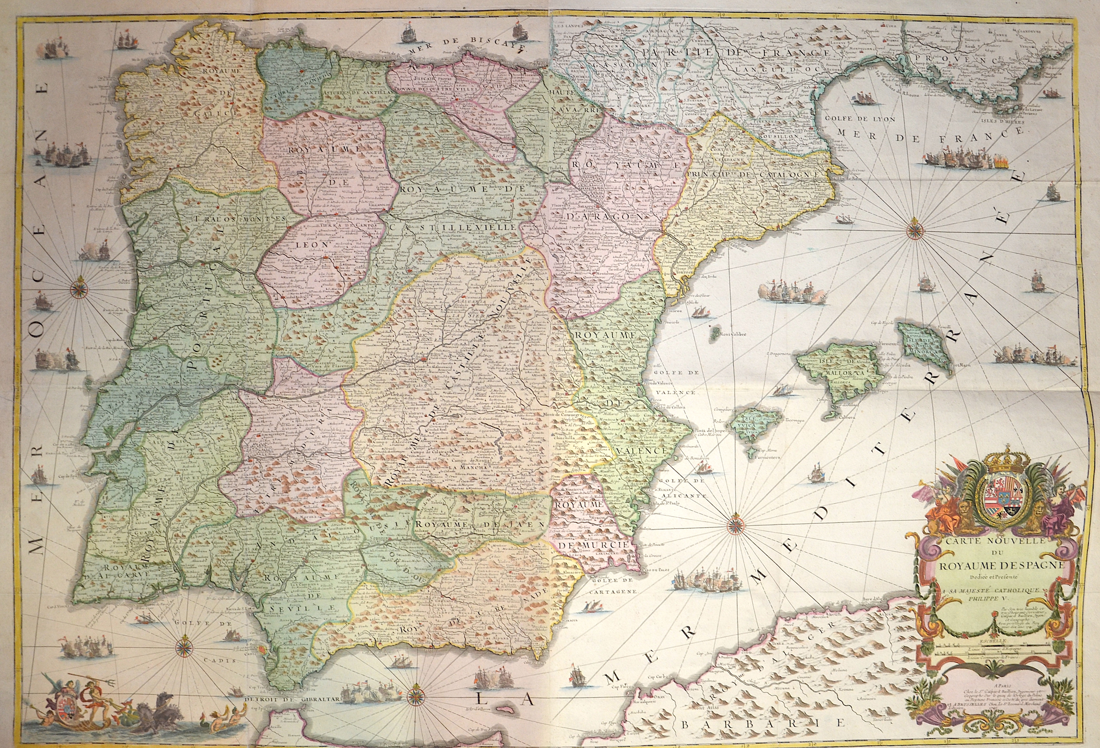
Carte Nouvelle du Royaume d Espagne

| Article ID | EUE4436 |
Title | Carte Nouvelle du Royaume d Espagne |
Description | Splendid map shows Spain with Portugal, five wind roses and many ship staffages. Furthermore, lower right title cartouche with mileage indicator and the coat of arms of King Philip V of Spain. Bottom left cartouche with the sea god Poseidon and the coat of arms of the King of Spain. |
| Year | c. 1740 |
Artist | Baillieu (1680 c.-1744) |
Gaspard Baillieul (active roughly 1700s–1744) was a French geographer, engraver, publisher, printer, and engineer based in Paris. He styled himself Engineer and Geographer to the King from at least 1735, operating near the Place du Change in Paris. His work primarily consisted of producing copper engraved maps, often richly decorated with cartouches and heraldry; he also published them under his own name . His engraving workshop became a family business; his children François, Marie, and Nicolas continued the enterprise, with Nicolas later active in Lyon. | |
Historical Description | In prehistoric and prehistoric times, Iberians, Celts and Basques settled on the Iberian peninsula named after the former. In the 11th century BC The Phoenicians settled on the south coast; the most famous of their colonies was Cadiz. The name Spain is derived from the Roman name Hispania (from Phoenician ishapan "land of the rock hyrax". In the early 8th century, the Moors destroyed the Visigoth Empire and conquered the entire Iberian Peninsula. Their centuries of rule shaped the country. The Arabic heritage was reflected in both the architecture and the language. However, the Moors were unable to establish themselves permanently in the northern outskirts of the peninsula. From there the "Reconquest" (Reconquista) started. In this process, which spanned several centuries (722–1492) and was not continuous, the Muslim empires were gradually pushed back by the Christian empires until the fall of Granada in 1492, the last Moorish state structure on the peninsula also disappeared. In the 15th century, the kingdoms of Castile and Aragon were united. Aragon was an important maritime power in the Mediterranean at that time. The Spanish colonial empire extended around 1600 across large parts of South and Central America, the southern part of today's USA and the Philippines. As the English and French also intensified their colonial efforts, Spain gradually lost its supremacy. The liberation wars of the American states, particularly the Mexican and South American wars of independence in the early 19th century, brought independence to most of the colonies. In 1898, the last major properties were lost to the United States during the Spanish-American War, which meant the end of the colonial empire. The African colonies that followed later (Spanish-Morocco, Spanish-Sahara and Equatorial Guinea) finally became independent in the 20th century. |
| Place of Publication | Paris |
| Dimensions (cm) | 78,5 x 114,5 cm |
| Condition | Lower and right margin, tear perfectly restored |
| Coloring | original colored |
| Technique | Copper print |