

Adina Sommer
Antique and Contemporary Art
Winzerer Str. 154
80797 München
telephone
+49 89 304714
business hours:
by appointment
Email
![]()


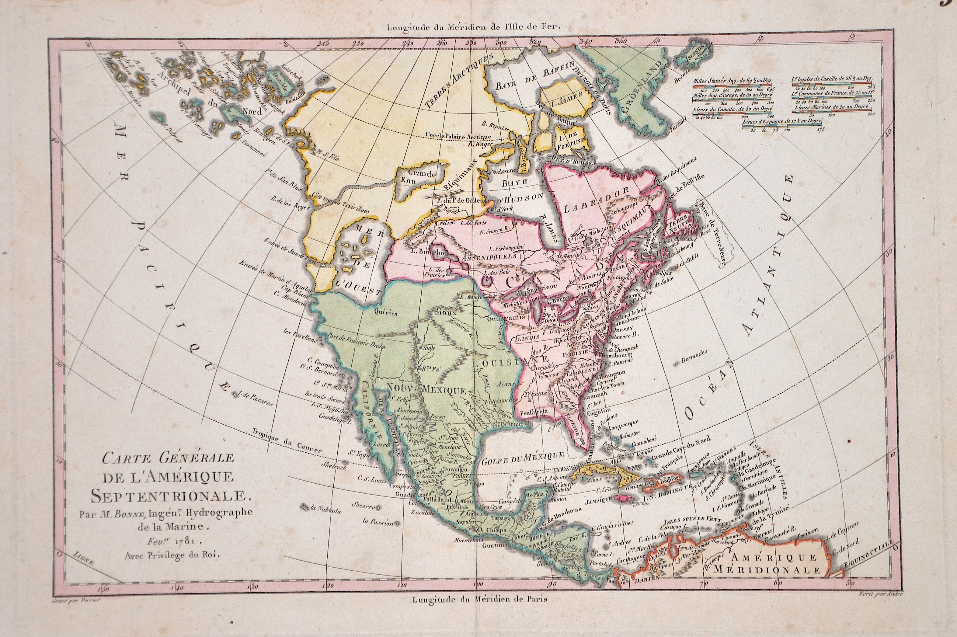
Carte generale de l´Amerique Septentrionale

| Article ID | AMU0586 |
Title | Carte generale de l´Amerique Septentrionale |
Description | Map shows total north America, USA, middle America, West Indies and Canada. |
| Year | dated 1781 |
Artist | Bonne (1727-1795) |
Rigobert Bonne (1727–1795) was one of the most important cartographers of the late 18th century. In 1773 Bonne succeeded Jacques Nicolas Bellin as Royal Cartographer to France in the office of the Hydrographer at the Depôt de la Marine. Working in his official capacity, Bonne compiled some of the most detailed and accurate maps of the period. Bonne’s work represents an important step in the evolution of the cartographic ideology away from the decorative work of the 17th and early 18th century towards a more detail oriented and practical aesthetic. With regard to the rendering of terrain Bonne maps bear many stylistic similarities to those of his predecessor, Bellin. However, Bonne maps generally abandon such common 18th century decorative features such as hand coloring, elaborate decorative cartouches, and compass roses. While mostly focusing on coastal regions, the work of Bonne is highly regarded for its detail, historical importance, and overall aesthetic appeal. | |
Historical Description | The discovery of America means the first sighting of the American continent by seafarers. Before Columbus' arrival in 1492, North America may have had more inhabitants than Europe at that time. In 1497 the Genoese John Cabot (actually: Giovanni Caboto) became the first European since the Vikings to set foot on North American soil. However, permanent branches were not established for the time being. St. Augustine in Florida, founded in 1565 by the Spanish, is considered the first city on mainland North America, and is also the oldest city in the USA. Four states stood out in the European conquest of North America, each of which made it easier to take possession: England was under pressure to emigrate, also based on religion, and was thus able to represent the largest group in terms of numbers. France had special skills in dealing with the indigenous peoples, which later led to the only mixed ethnic group, the Métis, and the Netherlands had the financial means to establish colonies in North America. Spain had enormous military potential due to the combat experience. In 1604 the King of England Jacob I divided his North American colonies as follows: The area from the 1st to the 41st degree of latitude is said to be populated by the Virginia Company of London, the area from the 41st to the 45th degree the Plymouth Company. 1607 is considered the year of foundation of the first permanent colony of English settlers on the east coast of America. There was a collision between three cultures: Native Americans, white settlers and slaves from Africa. This year the first settlers from England landed in Jamestown, followed in 1620 by the (better known) pilgrims with the Mayflower in what is now the US state of Massachusetts. These could find shelter directly in the abandoned Indian settlements. The coastal Indians were now ready to cooperate and had Plymouth established the English gateway to North America. |
| Place of Publication | Paris |
| Dimensions (cm) | 22 x 32 cm |
| Condition | Very good |
| Coloring | colored |
| Technique | Copper print |