

Adina Sommer
Antique and Contemporary Art
Winzerer Str. 154
80797 München
telephone
+49 89 304714
business hours:
by appointment
Email
![]()


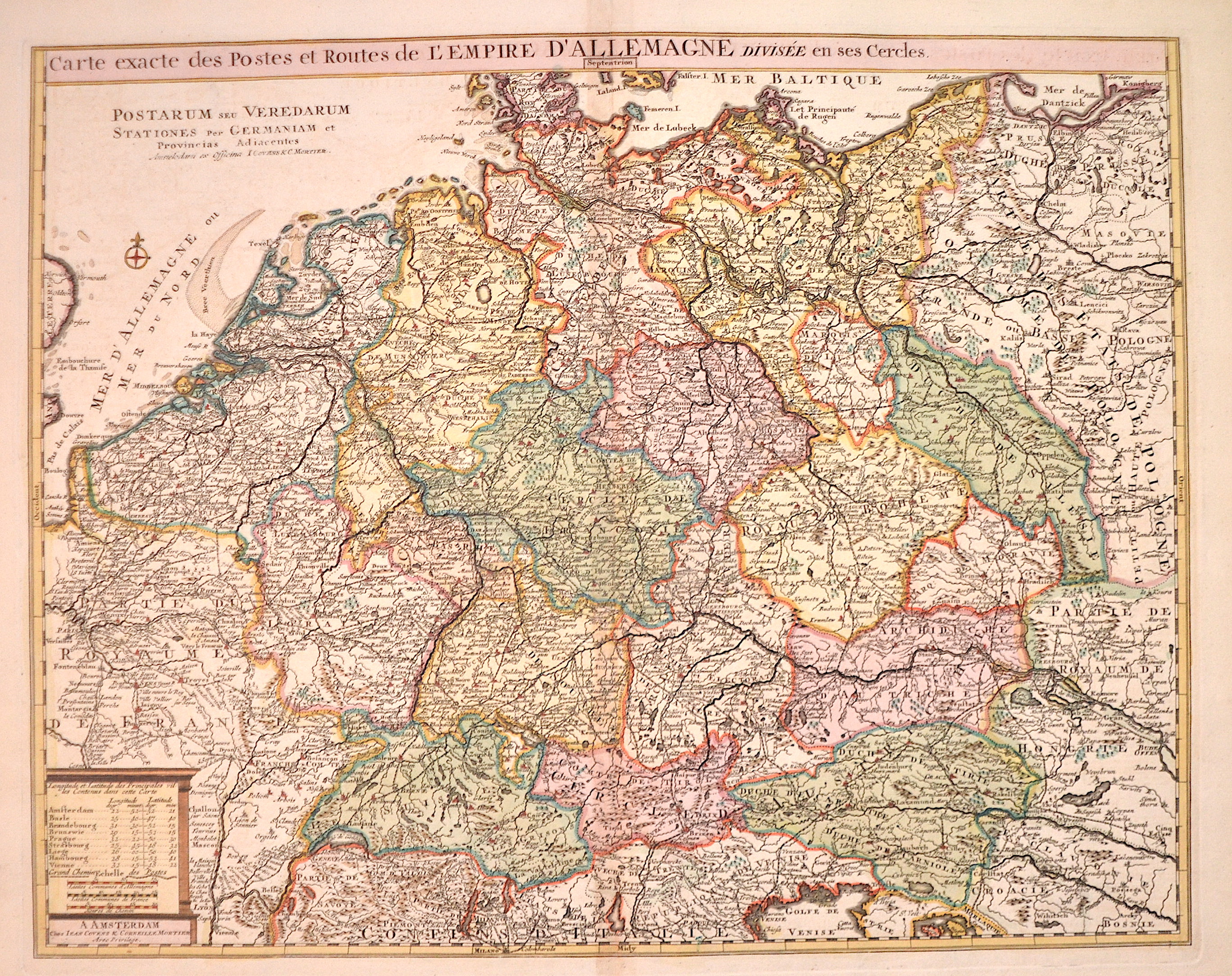
Carte exacte des Postes et Routes de L´Empire de Allemagne divesee en ses Cercles

| Article ID | EUD1121 |
Title | Carte exacte des Postes et Routes de L´Empire de Allemagne divesee en ses Cercles |
Description | Map shows the whole of Germany, the Netherlands, Switzerland, Pomerania, Silesia, the Czech Republic and Austria with its postal routes. |
| Year | ca. 1730 |
Artist | Covens/ Mortier (1685-1740) |
Jean Covens und Corneille Mortier where brothers in law, who continued the bussines, founded of Pierre Mortier in 1685 in Amsterdam. They called it Covens & Mortier. They extended their buissines in buying the company of De Witt. | |
Historical Description | The concept of Germany as a distinct region in central Europe can be traced to Roman commander Julius Caesar, who referred to the unconquered area east of the Rhine as Germania, thus distinguishing it from Gaul (France), which he had conquered. In the High Middle Ages, the regional dukes, princes and bishops gained power at the expense of the emperors. Martin Luther led the Protestant Reformationagainst the Catholic Church after 1517, as the northern states became Protestant, while the southern states remained Catholic. The two parts of the Holy Roman Empire clashed in the Thirty Years' War (1618–1648). 1648 marked the effective end of the Holy Roman Empire and the beginning of the modern nation-state system, with Germany divided into numerous independent states, such as Prussia, Bavaria and Saxony. |
| Place of Publication | Amsterdam |
| Dimensions (cm) | 46 x 58 cm |
| Condition | Very good |
| Coloring | original colored |
| Technique | Copper print |