

Adina Sommer
Antique and Contemporary Art
Winzerer Str. 154
80797 München
telephone
+49 89 304714
business hours:
by appointment
Email
![]()


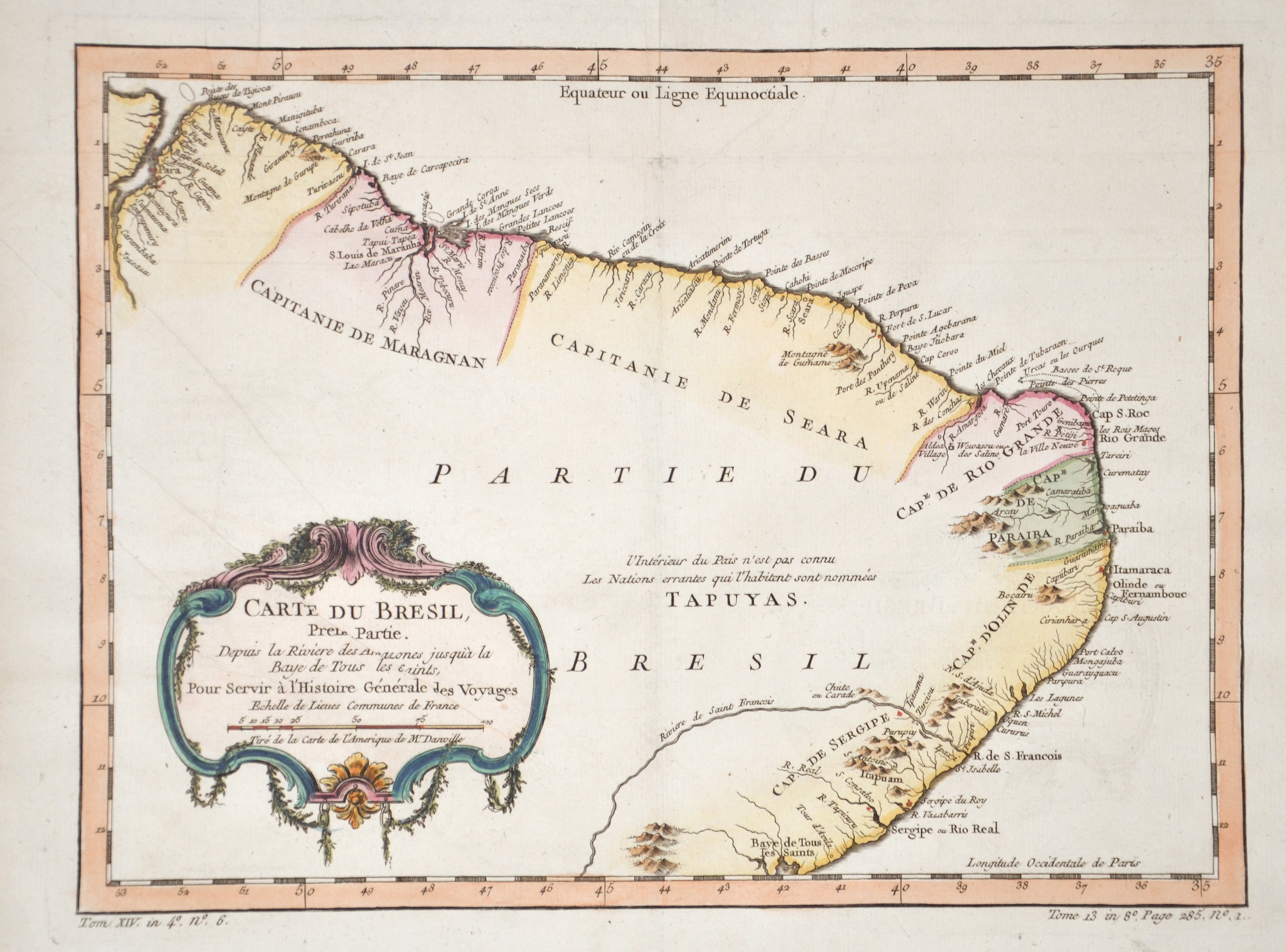
Carte du Bresil, prem Partie.

| Article ID | AMS1146 |
Title | Carte du Bresil, prem Partie. |
Description | Map showsthe coasts of Brasil with a decoartive title cartouche. |
| Year | ca. 1758 |
Artist | Bellin (1703-1772) |
Jacques-Nicolas Bellin (1703 Paris -1772 Versailles) was a French cartographer, engineer-geographer, marine hydrographer. As a contributor to the Encyclopédie, he wrote more than a thousand articles on maritime topics. As a cartographer, Bellin distinguished himself primarily in the field of sea cartography. From 1721 he worked for the Dépot des Cartes et Plans de la Marine, from 1741 until his death as an engineer-hydrograph of the Navy. In 1753 his atlas Neptune français, which covered all the coasts of France, was published, and in 1756 the hydrography françoise covering all seas of the earth. In 1764 the five-volume Petit Atlas maritime was published, which Bellin prepared on the orders of the Minister of the Navy, Choiseul. In addition, he wrote a number of geographical works and with Nouvelle méthode pour apprendre la geographie (1769) a geographic textbook for teaching. His maps illustrated, among other things, Bougainville's work Voyage autour du monde, published in 1771. As a co-author of the Encyclopédie edited by Diderot and d'Alembert, Bellin wrote more than a thousand articles in the field of shipping and navy. | |
Historical Description | The oldest traces of human life were found in the Caverna da Pedra Pintada in the state of Piauí. The early inhabitants fundamentally changed the ecosystem of the Amazon basin by planting certain types of plants and improving the soil. Their settlements - for example on the huge river island of Marajó - were far larger than long thought. In the province of Mato Grosso there were numerous planned locations where fish farming and agriculture were practiced until around 1500. The cities, which were up to 60 hectares in size, were connected by a road network - although in most areas the canoe was the means of transportation - there were dams and artificial ponds. As in many places in America, the people of the Xingu are believed to have been victims of the epidemic, especially smallpox. The indigenous peoples in Brazil lived partly from hunting, fishing and gathering, as well as from the fragile ecosystem of adapted soil management. A large part of the local population died in the course of European colonization, mostly from imported diseases, but also as a result of forced labor or enslavement. The majority of the Indians living outside the rainforest, especially in the cities, were assimilated insofar as they survived violence and epidemics and mingled with European immigrants. Already in 1494 Portugal and Spain decided to divide South America in the Tordesillas Treaty. Because the line had been agreed in ignorance of the coastline of the New World, the (at that time still generally unknown) eastern tip of South America also belonged to Portugal. The prerequisite for a legitimate possession was the consequent catholization of the locals. The period from 1500 to 1530 was marked by bartering with the locals. In 1549, today's Salvador da Bahia (São Salvador da Bahía de Todos os Santos) was named the capital. From 1530, native Indians were brought to the coast from inland who had to do the work on the sugar cane plantations in the northeast. Many of them died because of hard work, persecution, and indigenous susceptibility to European diseases. The colonialists then tried to replace the lost labor with slaves from Africa. |
| Place of Publication | Paris |
| Dimensions (cm) | 24 x 32,5 |
| Condition | Perfect condition |
| Coloring | colored |
| Technique | Copper print |