

Adina Sommer
Antique and Contemporary Art
Winzerer Str. 154
80797 München
telephone
+49 89 304714
business hours:
by appointment
Email
![]()


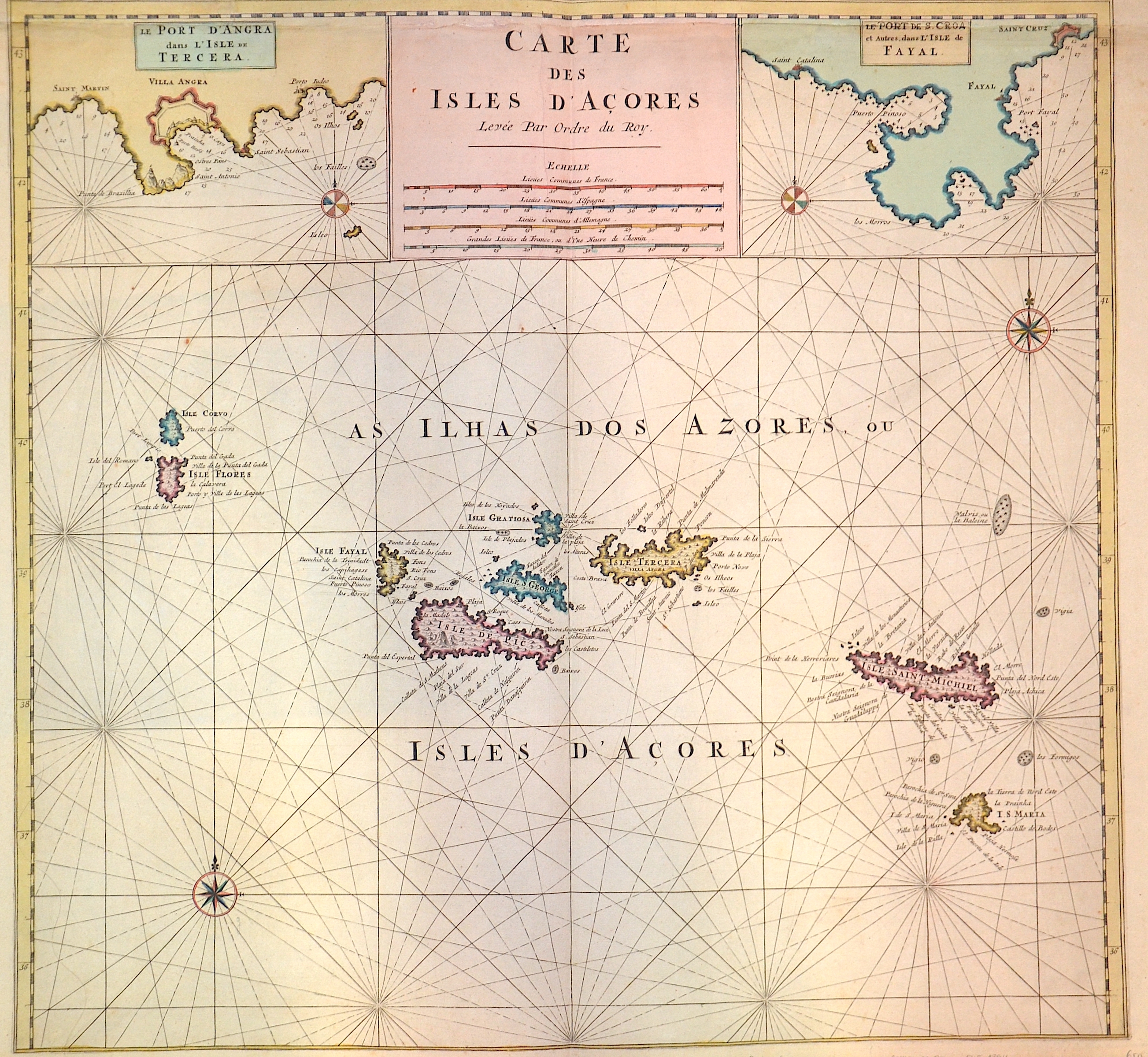
Carte des Isles d´Acores

| Article ID | EUE1294 |
Title | Carte des Isles d´Acores |
Description | Map shows the Azores and on seperate map Port d´Angra dans l´Isle de Tercera, Les Porte de S. Croa....Isle de Fayal. |
| Year | ca. 1750 |
Artist | Anonymus |
Historical Description | The islands are first recorded on the Portolan nautical charts of the 14th century, such as the Medici Atlas (1351) and the Atlas Catalan (1375). The Azores were officially visited and taken possession of for Portugal in 1427 by Diogo de Silves on behalf of Henry the Navigator. The Portuguese name Ilhas dos Açores ("Hawk Islands") originated, according to the official Azorean account, because of the numerous buzzards living there, which the Portuguese conquerors initially mistook for hawks. The name remained even after the error was discovered. Portuguese settlement began in the mid-15th century, first on Santa Maria Island from 1431. The Azores soon became an important base on the way to the possessions in Central and South America. Thus, Christopher Columbus visited the islands in 1493 on his way back from his first voyage of discovery. |
| Dimensions (cm) | 50,5 x 53,5 cm |
| Condition | Upper margin perfectly replaced |
| Coloring | original colored |
| Technique | Copper print |