

Adina Sommer
Antique and Contemporary Art
Winzerer Str. 154
80797 München
telephone
+49 89 304714
business hours:
by appointment
Email
![]()


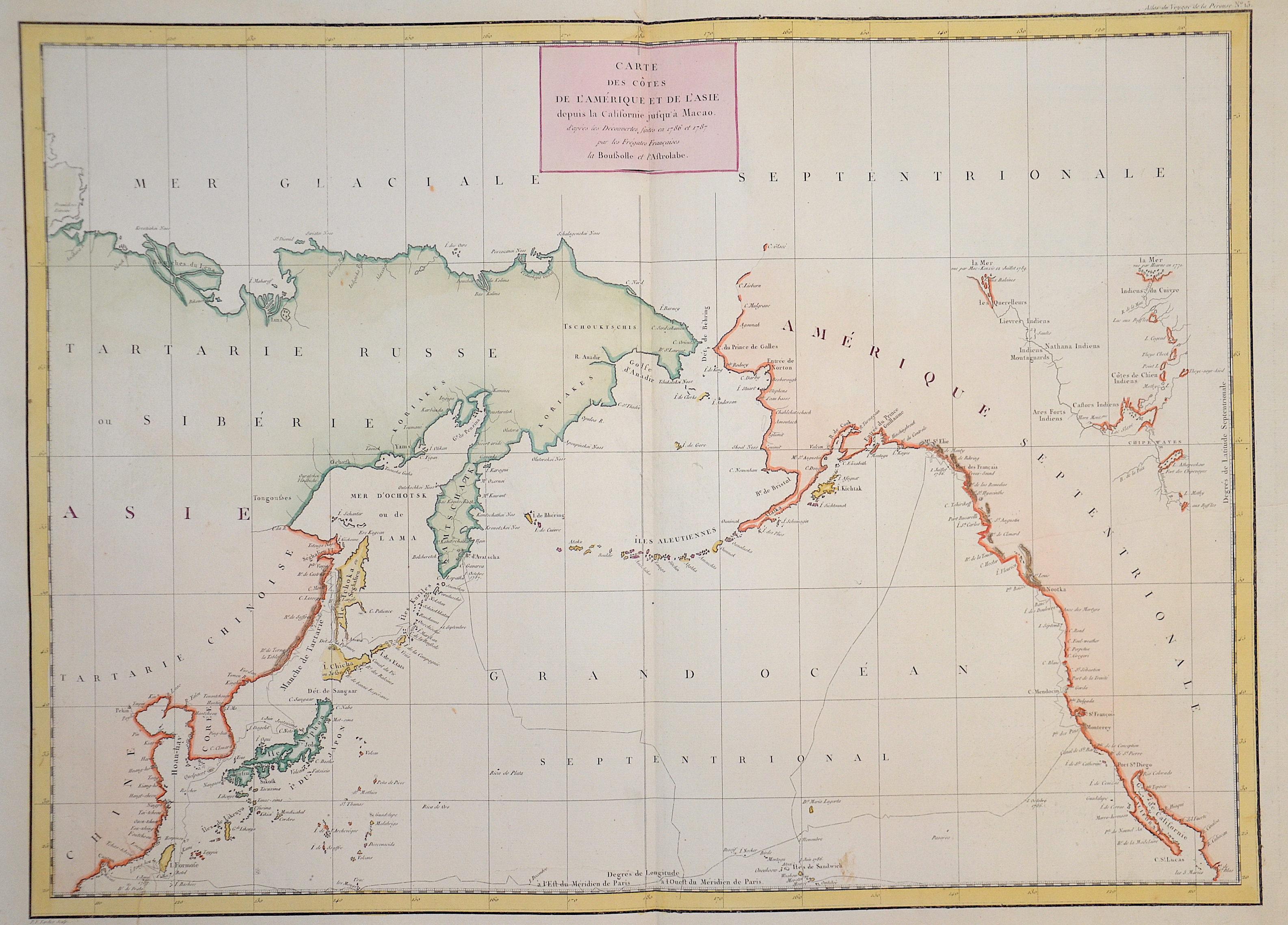
Carte des Cotes de L´Amerique et de L´Asie

| Article ID | SE0276 |
Title | Carte des Cotes de L´Amerique et de L´Asie |
Description | Map shows the Bering Sea with Sibirea and Alaska |
| Year | dated 1787 |
Artist | Pérouse, la (1741-1788) |
Jean-François de Galaup de La Pérouse (1741 1788) was a French Naval officer and explorer whose expedition vanished in Oceania. La Pérouse crossed the Pacific Ocean in 100 days, arriving at Macau, where he sold the furs acquired in Alaska, dividing the profits among his men. Lapérouse sailed all the way south to the Spanish Las Californias in 1786. He stopped at the Presidio of San Francisco long enough to create an outline map of the Bay Area, Plan du Port du St. Francois, which was reproduced as Map 33 in L. Aubert's 1797 Atlas du Voyage de la Perouse. Laterhe arrived in Monterey Bay and at the Presidio of Monterey. In 1787 after a visit to Manila, he set out for the northeast Asian coasts. He saw the island of Quelpart, present-day Cheju in South Korea, which had been visited by Europeans only once before when a group of Dutchmen shipwrecked there in 1635. He visited the Asian mainland coasts of Korea. | |
Historical Description | The Bering Strait is a strait of the Pacific, which separates Russia and Alaska slightly south of the Arctic Circle. The earliest reference of the strait were from maps from the Polo family; based on the adventures of Marco Polo. From at least 1562, European geographers thought that there was a Strait of Anián between Asia and North America. In 1648, Semyon Dezhnyov probably passed through the strait, but his report did not reach Europe. Danish-born Russian navigator Vitus Bering entered it in 1728. In 1732, Mikhail Gvozdev crossed it for the first time, from Asia to America. |
| Place of Publication | Paris |
| Dimensions (cm) | 50 x 68,5 |
| Condition | Very good |
| Coloring | original colored |
| Technique | Copper print |