

Adina Sommer
Antique and Contemporary Art
Winzerer Str. 154
80797 München
telephone
+49 89 304714
business hours:
by appointment
Email
![]()


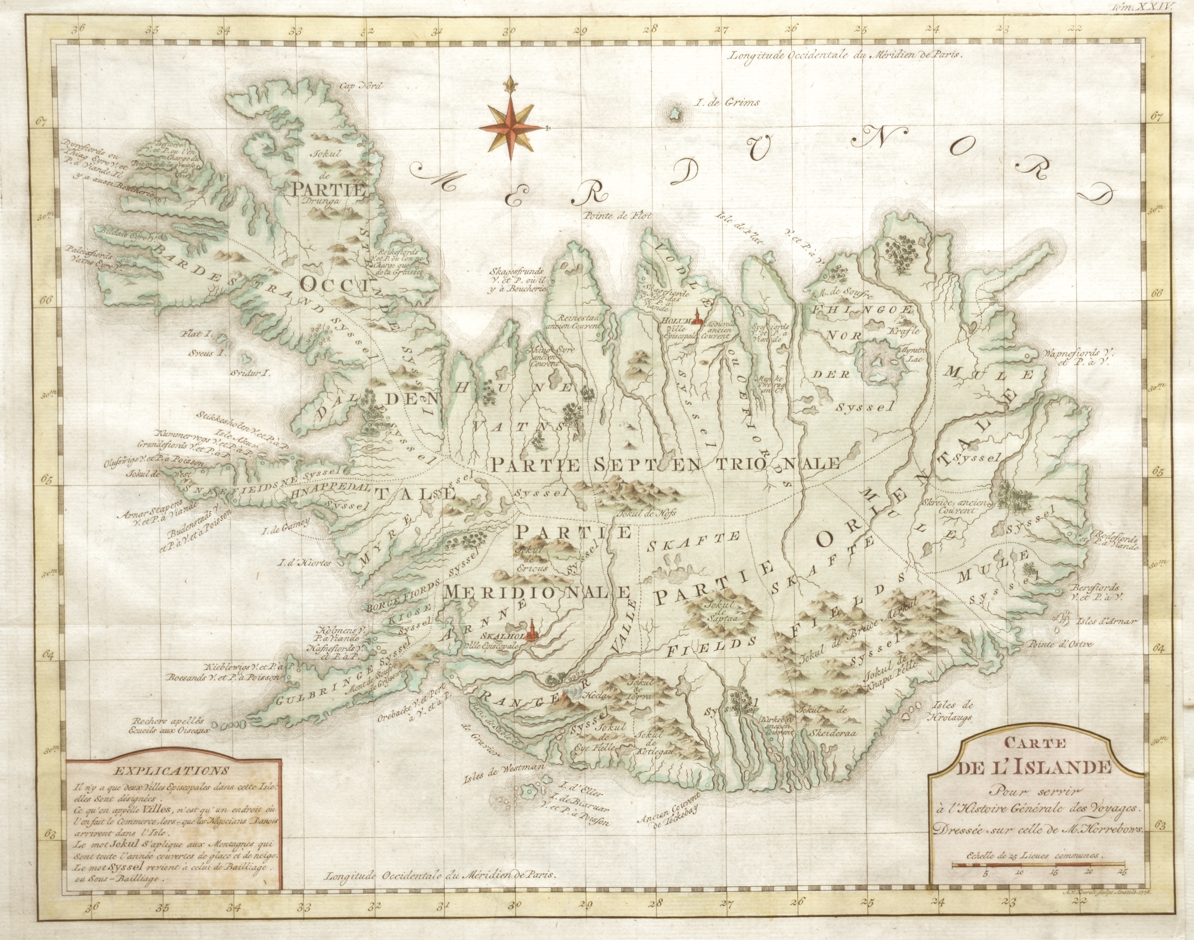
Carte de l’Islande Pour servir à l’Histoire Générale des Voyages.

| Article ID | EUS4101 |
Title | Carte de l’Islande Pour servir à l’Histoire Générale des Voyages. |
Description | Map shows total Iceland. |
| Year | ca. 1778 |
Artist | Krevelt |
Historical Description | Iceland is a Nordic island country in the North Atlantic. Iceland is volcanically and geologically active. According to the ancient manuscript Landnámabók, the settlement of Iceland began in 874 AD when the Norwegian chieftain Ingólfr Arnarson became the first permanent settler on the island. In the following centuries, Norwegians, and to a lesser extent other Scandinavians, emigrated to Iceland, bringing with them thralls (i.e., slaves or serfs) of Gaelic origin. The island was governed as an independent commonwealth under the Althing, one of the world's oldest functioning legislative assemblies. Following a period of civil strife, Iceland acceded to Norwegian rule in the 13th century. The establishment of the Kalmar Union in 1397 united the kingdoms of Norway, Denmark, and Sweden. Iceland thus followed Norway's integration to that union and came under Danish rule, after Sweden's secession from that union in 1523. In the wake of the French Revolution and the Napoleonic Wars, Iceland's struggle for independence took form and culminated in independence in 1918 and the founding of a republic in 1944. Until the 20th century, Iceland relied largely on subsistence fishing and agriculture, and was among the poorest countries in Europe. |
| Place of Publication | Amsterdam |
| Dimensions (cm) | 29,5 x 37,5 |
| Condition | Some folds |
| Coloring | colored |
| Technique | Copper print |