

Adina Sommer
Antique and Contemporary Art
Winzerer Str. 154
80797 München
telephone
+49 89 304714
business hours:
by appointment
Email
![]()


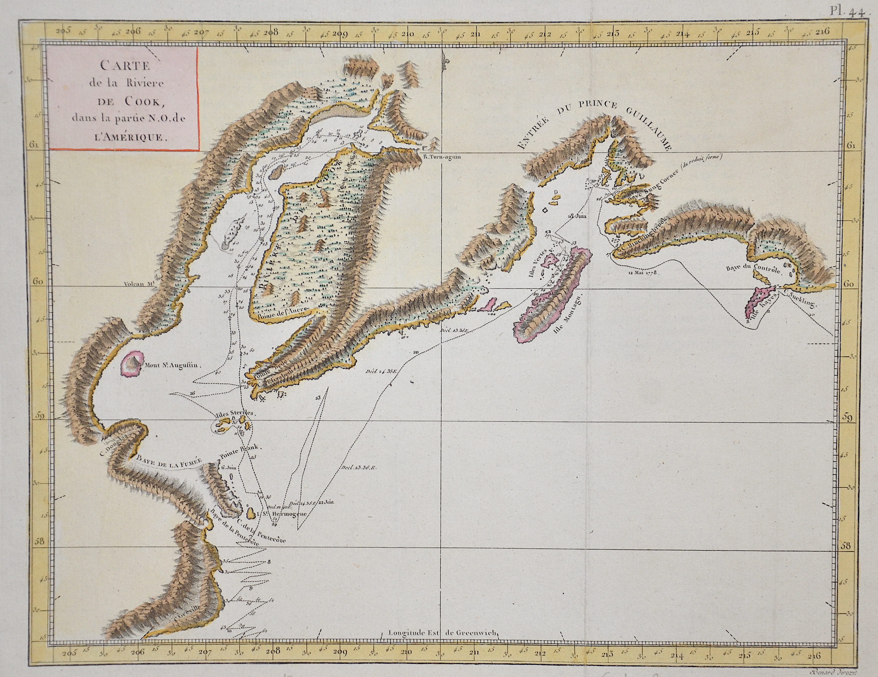
Carte de la Riviere de Cook, dans la partie N. O. de L’Amérique.

| Article ID | SE0317 |
Title | Carte de la Riviere de Cook, dans la partie N. O. de L’Amérique. |
Description | Detailed map of Captain James Cook's route from Cape Suckling and Control Bay through Prince William Sound and past Mount St Augustine, Cape Douglass and Cape Grenville. Furthermore, it shows Cook Inlet in the Gulf of Alaska, separating the Kenai Peninsula from mainland Alaska. |
| Year | ca. 1778 |
Artist | Bonne (1727-1795) |
Rigobert Bonne (1727–1795) was one of the most important cartographers of the late 18th century. In 1773 Bonne succeeded Jacques Nicolas Bellin as Royal Cartographer to France in the office of the Hydrographer at the Depôt de la Marine. Working in his official capacity, Bonne compiled some of the most detailed and accurate maps of the period. Bonne’s work represents an important step in the evolution of the cartographic ideology away from the decorative work of the 17th and early 18th century towards a more detail oriented and practical aesthetic. With regard to the rendering of terrain Bonne maps bear many stylistic similarities to those of his predecessor, Bellin. However, Bonne maps generally abandon such common 18th century decorative features such as hand coloring, elaborate decorative cartouches, and compass roses. While mostly focusing on coastal regions, the work of Bonne is highly regarded for its detail, historical importance, and overall aesthetic appeal. | |
Historical Description | The bay was first explored and settled by the Dena'ina people. In the 18th century, Russian fur hunters were among the first European visitors. Among the other Europeans to visit Cook Inlet was the expedition of James Cook, who sailed here in 1778 in search of the Northwest Passage. Cook obtained maps of Alaska, the Aleutian Islands and Kamchatka during a visit to Unalaska by the Russian fur trader Gerasim Izmailov and combined these maps with those of his expedition to create the first Mercator projection of the North Pacific. The bay was named after Cook in 1794 by George Vancouver, who had served under Cook in 1778. Cook Bay on the Gulf of Alaska, which separates the Kenai Peninsula and Alaska. |
| Place of Publication | Paris |
| Dimensions (cm) | 23,5 x 30 cm |
| Condition | Perfect condition |
| Coloring | original colored |
| Technique | Copper print |