

Adina Sommer
Antique and Contemporary Art
Winzerer Str. 154
80797 München
telephone
+49 89 304714
business hours:
by appointment
Email
![]()


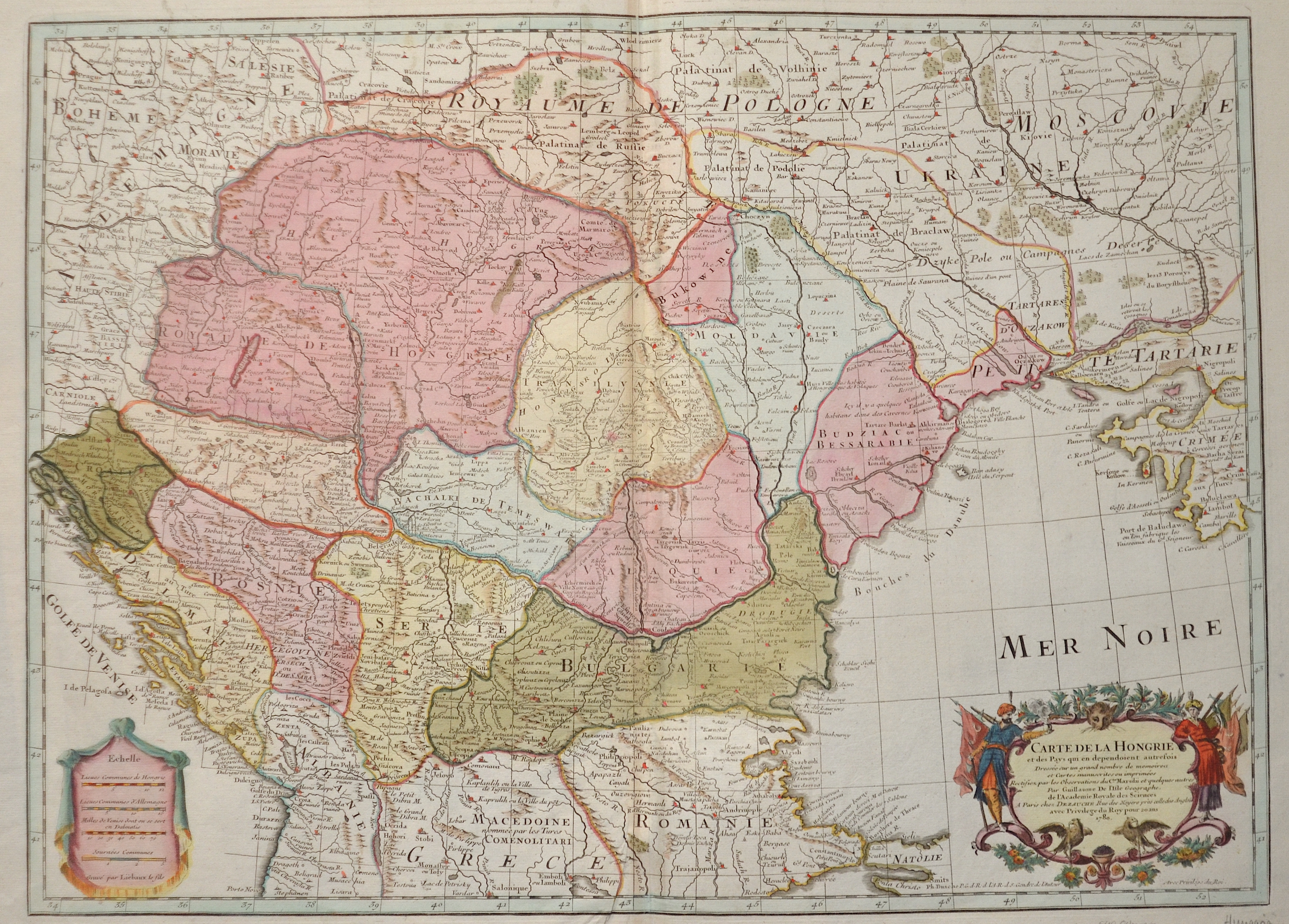
Carte de la Hongrie et des Pays qui en dependoient autrefois..

| Article ID | EUO4235 |
Title | Carte de la Hongrie et des Pays qui en dependoient autrefois.. |
Description | Map shows Hungary, Tanzilvania, southern Poland (historical land in Galicia), Bosnia, Dalmatia, Serbia, Bulgaria, Wallachia, Moldavia, a title cartouche and a mileage scale cartouche. |
| Year | ca. 1780 |
Artist | L´Isle, de (1675-1726) |
Guillaume De L’Isle (1675–1726) was a renowned French cartographer famous for his accurate maps of Europe, the Americas, and Africa. He joined the French Académie Royale des Sciences, signing his maps as “Géographe de l’Académie,” and later became Premier Géographe du Roi in 1718, teaching geography to the Dauphin. De L’Isle mostly worked from his office, relying on a strong network of traveler reports and scientific updates, ensuring his maps were precise and honest. He openly noted uncertain information, such as a disputed river in Louisiana. In 1700, he won a legal case against Jean-Baptiste Nolin for plagiarism. Unlike the Sanson workshop, which often published outdated maps, De L’Isle focused on up-to-date, scientifically grounded cartography. | |
Historical Description | In the historical sense, Eastern Europe refers to Ukraine, the European part of Russia, Belarus and the Republic of Moldova. Occasionally, the Caucasian countries of Georgia, Armenia and, conditionally, Azerbaijan are also seen as part of Eastern Europe. By Christian Giordano and other scholars, one of the six historical regions of Europe is called "Eastern Europe." The Eastern European countries are historically and culturally largely influenced by the Orthodox Church (Islamic Azerbaijan excepted) and were - in contrast to the Ottoman-dominated Balkans - under the rule of the Russian Empire. Like the Balkan countries, the countries of Eastern Europe were for a long time backward agricultural states (cf.: Intermediate Europe) and had no or only a limited share in the social developments of the Renaissance, Reformation and Enlightenment of the Western world. |
| Place of Publication | Paris |
| Dimensions (cm) | 47 x 64,5 cm |
| Condition | Perfect condition |
| Coloring | original colored |
| Technique | Copper print |