

Adina Sommer
Antique and Contemporary Art
Winzerer Str. 154
80797 München
telephone
+49 89 304714
business hours:
by appointment
Email
![]()


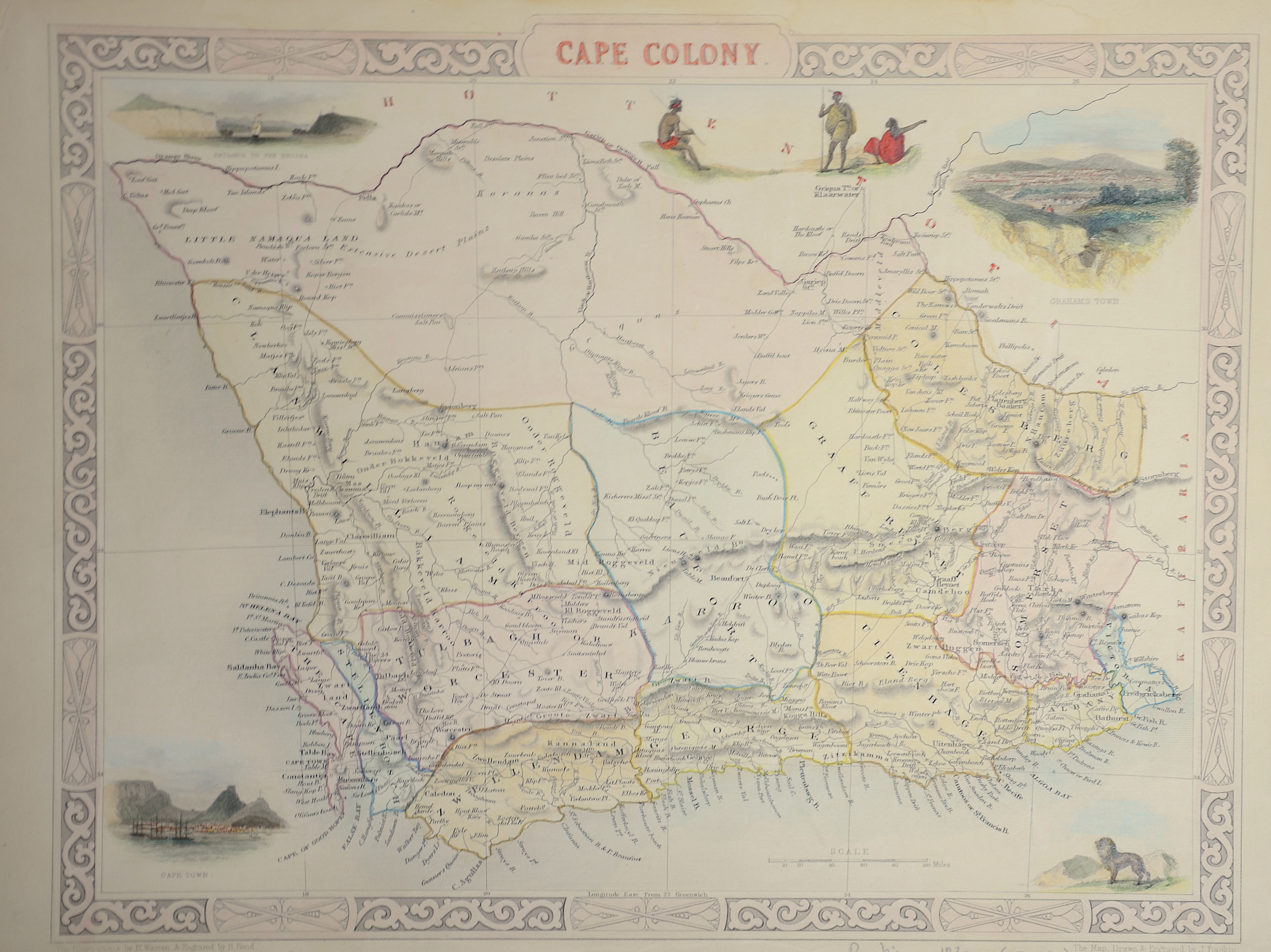
Cape Colony

| Article ID | AF0290 |
Title | Cape Colony |
Description | Map shows the countries of south Africa with 6 representations of countries and population, also a view of Capetown. |
| Year | ca. 1840 |
Artist | Tallis (1817-1876) |
John Tallis was an English cartographic publisher. His company, John Tallis and Company, published views, maps and atlases in London from roughly 1838 to 1851. | |
Historical Description | Some of the world's oldest paleoanthropological fossils have been unearthed in South Africa. After these pre-humans, various species of the Homo genus such as Homo habilis, Homo naledi, Homo erectus and finally modern man, Homo sapiens, lived here. The beginning of modern historiography in South Africa is set on April 6, 1652, when the Dutchman Jan van Riebeeck built a supply station on the Cape of Good Hope on behalf of the Dutch East India Company (Dutch Vereenigde Oostindische Compagnie, VOC). Due to its strategically favorable location, it was supposed to be a rest stop for merchant ships traveling between Europe and Southeast Asia. During the 17th and 18th centuries, the settlement, which slowly but steadily expanded, was owned by the Netherlands. The settlers initially spread to the western Cape region, which at that time was a retreat for the Khoisan. Several hundred French Huguenots, after being persecuted in France from 1686, came into the country via the Netherlands from 1688 and brought the viticulture culture with them. The French-speaking names of wineries and fruit-growing farms in the western Cape can be traced back to them. After reaching the Bantu settlement border eastwards in 1770, they waged a series of wars - the border wars - against the Xhosa people. The Cape Dutch brought numerous slaves into the country from Indonesia, Madagascar and India. |
| Place of Publication | London |
| Dimensions (cm) | 24,5 x 32 cm |
| Condition | Very good |
| Coloring | original colored |
| Technique | Lithography |