

Adina Sommer
Antique and Contemporary Art
Winzerer Str. 154
80797 München
telephone
+49 89 304714
business hours:
by appointment
Email
![]()


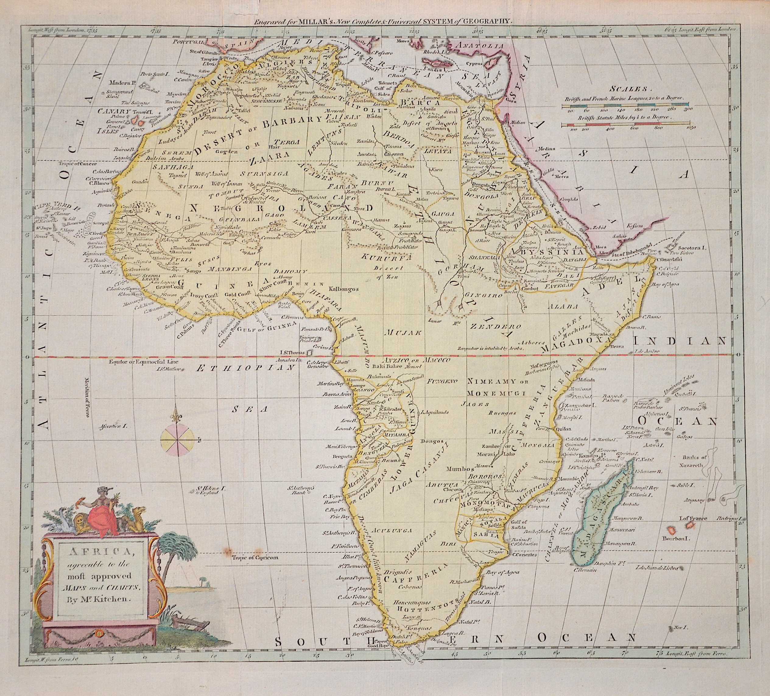
Africa, agreeable to the most approved Maps and Charts, By Mr. Kitchen.

| Article ID | AF0335 |
Title | Africa, agreeable to the most approved Maps and Charts, By Mr. Kitchen. |
Description | Map depicts Africa with Madagascar, a winrose in the cartouche. |
| Year | ca. 1760 |
Artist | Kitchin (Kitchen) (1718-1784) |
Thomas Kitchin (or Thomas Kitchen (1718–1784) was an English engraver and cartographer, who became hydrographer to the king. He was also an author, who wrote about the history of the West Indies. He produced John Elphinstone's map of Scotland (1746), Geographia Scotiae (1749), and The Small English Atlas (1749) with Thomas Jefferys. The Large English Atlas (with Bowen 1749–60) was a serious attempt to cover England at large scale. In 1755 Kitchin engraved the Mitchell Map map of North AmericaHe worked for London Magazine. He produced 170 maps for London Magazine (1747–83). Kitchin was the head hydrographer for the King of England. Kitchin frequently stole the works of other cartographers, which is one reason why he created so much work as a cartographer. His book, The Present State of the West-Indies: Containing an Accurate Description of What Parts Are Possessed by the Several Powers in Europe was published in 1778 by R. Baldwin in London. | |
Historical Description | According to the "Out-of-Africa theory", Africa is considered the "cradle of mankind", where homo development led to the development of the anatomically modern human Homo sapiens. One of the earliest advanced civilizations in mankind was formed in ancient Egypt. Over the millennia, various "great empires" such as the Empire of Abyssinia emerged on the continent. There were other kingdoms in West Africa, such as the Ashanti and Haussa, but they emerged much later. There were also some important cultures in East and South Africa, as in the area of today's Sudan, then called Nubia or Kush. Nubian pharaohs ruled all of Egypt for a dynasty. For example, the inhabitants of Greater Zimbabwe were important cultures in southern Africa. This stone castle was architecturally a masterpiece at that time and important for trade between the peoples of the south and east. The Swahili were known in East Africa. North Africa was connected to Europe and the Near East by the Mediterranean rather than separated. Carthage, a foundation of the Phoenicians in what is now Tunisia, was around the middle of the 1st millennium BC. The dominant power in the western Mediterranean until it was replaced by Rome in the Punic Wars. This prevailed from 30 BC. BC (conquest of Egypt) over all of North Africa. Even the ancient Egyptians (Queen Hatshepsut) made trips to Punt, probably in what is now Somalia. The kingdom of the Queen of Sheba, which probably had its center in southern Arabia, is said to have spanned parts of the Horn from Africa to the north of Ethiopia. |
| Place of Publication | London |
| Dimensions (cm) | 33,5 x 38 |
| Condition | Some folds |
| Coloring | colored |
| Technique | Copper print |