

Adina Sommer
Antique and Contemporary Art
Winzerer Str. 154
80797 München
telephone
+49 89 304714
business hours:
by appointment
Email
![]()


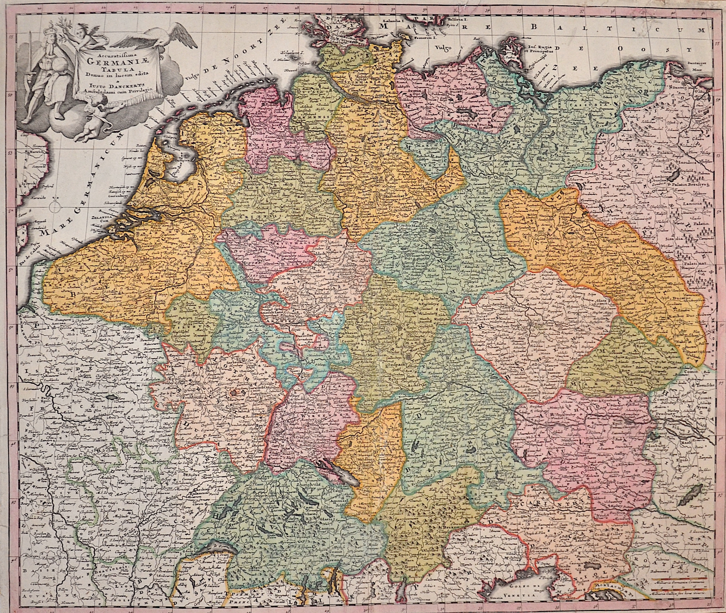
Accuratissima Germaniae Tabula Denuo in lucem e dita ..

| Article ID | EUD4654 |
Title | Accuratissima Germaniae Tabula Denuo in lucem e dita .. |
Description | Map shows all of Germany with Silesia, Bohemia, Netherlands, Belgium, Alsace, Switzerland, Tyrol, Austria and a title cartouche. |
| Year | ca. 1690 |
Artist | Danckerts (1635-1701) |
The Danckerts family sold and published maps during the 17th Century in Amsterdam. Justus Danckerts, the son of the business founder Cornelius Danckerts (c. 1603- c. 1656), was born 1635. He has published several Atlases together with his son Theodorus between 1680 and 1700. The plates finally have been sold to R. & J. Ottens who published them under their own name. Danckerts died in 1701. | |
Historical Description | The concept of Germany as a distinct region in central Europe can be traced to Roman commander Julius Caesar, who referred to the unconquered area east of the Rhine as Germania, thus distinguishing it from Gaul (France), which he had conquered. In the High Middle Ages, the regional dukes, princes and bishops gained power at the expense of the emperors. Martin Luther led the Protestant Reformationagainst the Catholic Church after 1517, as the northern states became Protestant, while the southern states remained Catholic. The two parts of the Holy Roman Empire clashed in the Thirty Years' War (1618–1648). 1648 marked the effective end of the Holy Roman Empire and the beginning of the modern nation-state system, with Germany divided into numerous independent states, such as Prussia, Bavaria and Saxony. |
| Place of Publication | Amsterdam |
| Dimensions (cm) | 49 x 57,5 cm |
| Condition | Missing part at upper margin replaced, centerfold perfectly restored |
| Coloring | original colored |
| Technique | Copper print |