

Adina Sommer
Antique and Contemporary Art
Winzerer Str. 154
80797 München
telephone
+49 89 304714
business hours:
by appointment
Email
![]()


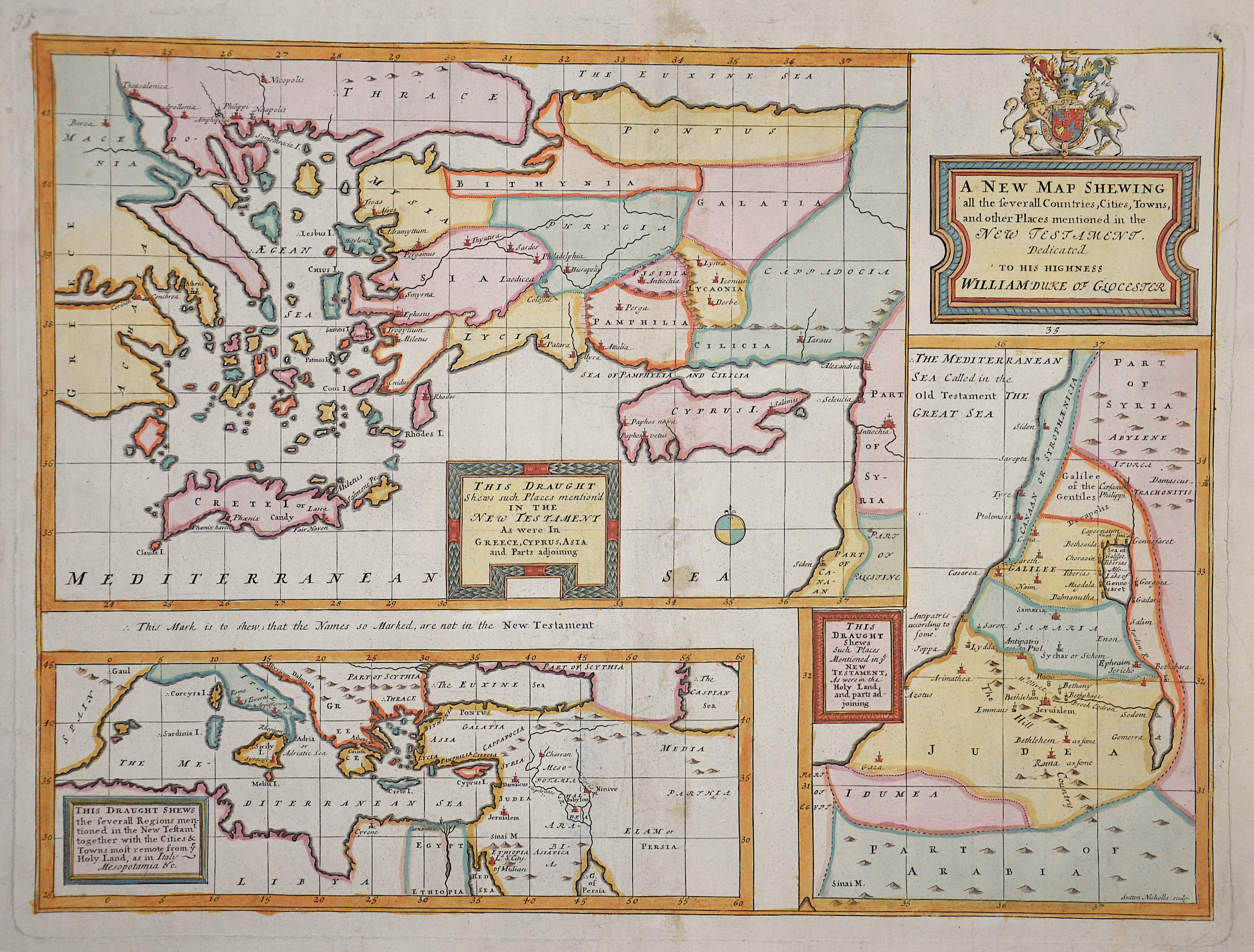
A new map shewing all the several countries, cities, towns, and other places mentioned in the new testament

| Article ID | EUZ1348 |
Title | A new map shewing all the several countries, cities, towns, and other places mentioned in the new testament |
Description | Map shows the total mediterranian sea with ist countries, the holy land and the aegean sea, Creta and Cyprus |
| Year | ca. 1720 |
Artist | Wells (1667-1727) |
Edward Wells (1667–1727) was an English mathematician, geographer, and controversial theologian. | |
Historical Description | Since the Bronze Age, Cyprus has supplied the eastern Mediterranean with copper. In the late Bronze Age, trading cities such as Enkomi arose on Cyprus, which were in close contact with the Levant. To the Hittites and Ugarites, Cyprus (or part of the island) was known as Alašija. In 332 BC the kings of Cyprus passed to Alexander the Great and Cyprus was incorporated into his empire. In 1191, the English King Richard the Lionheart, who helped lead the Third Crusade, conquered the island. Ottoman rule lasted from 1571 to 1878. In 1878, the Ottoman Empire leased the island to Britain in return for support against an advance by the Russians in the Russo-Ottoman War (1877-1878). Efforts by Greek Cypriots to unify Cyprus with Greece led to an uprising in 1931. In 1960 Cyprus became independent as a result of the Zurich and London Agreements between Britain, Greece, and Turkey. |
| Dimensions (cm) | 35 x 48 |
| Condition | Very good |
| Coloring | colored |
| Technique | Copper print |