

Adina Sommer
Antique and Contemporary Art
Winzerer Str. 154
80797 München
telephone
+49 89 304714
business hours:
by appointment
Email
![]()


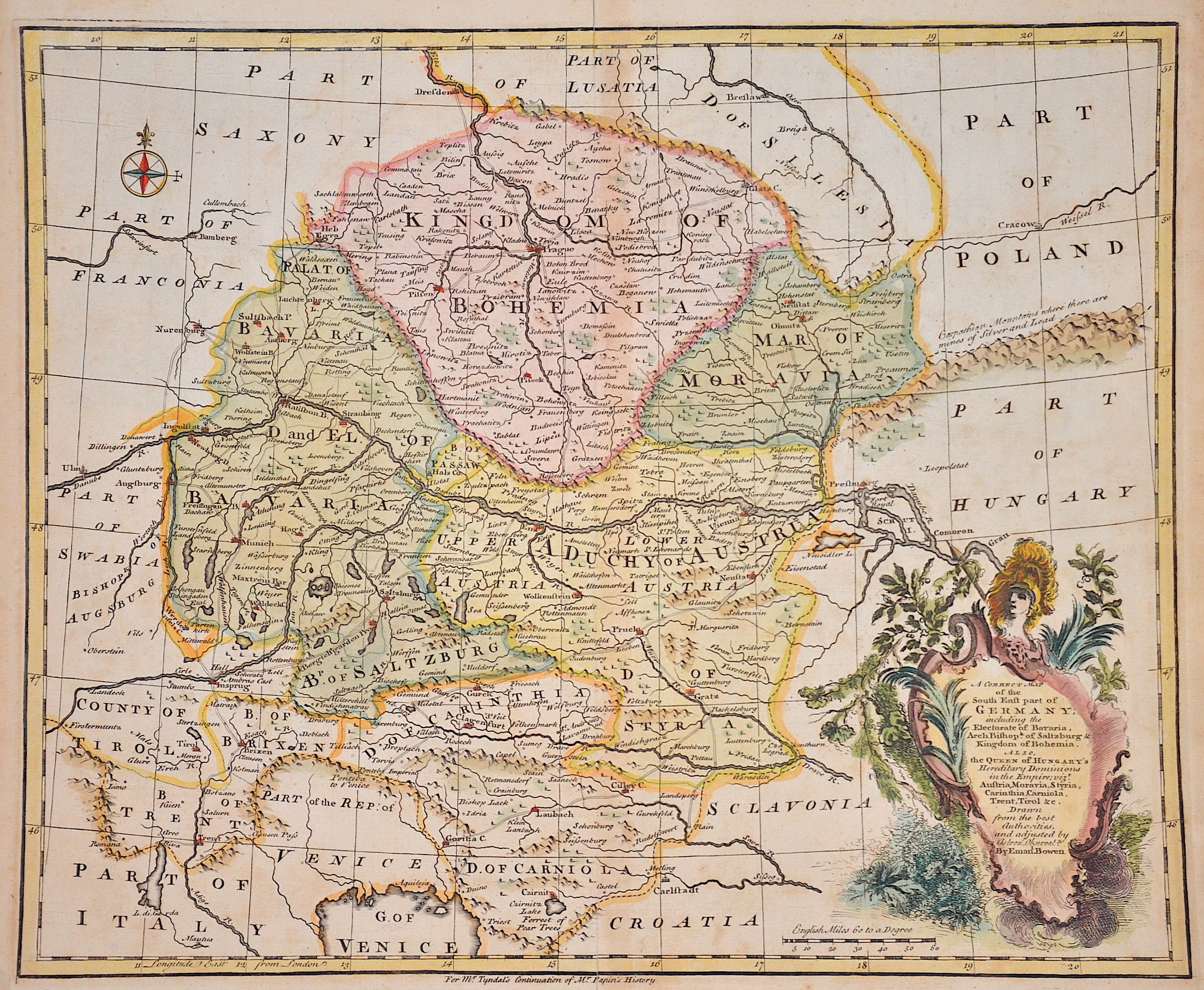
A correct map of the South East part of Germany, including the Elextorate of Bavaria, Arch Bishop of Saltzburg und Kingdom of Bohemia.

| Article ID | EUT5202 |
Title | A correct map of the South East part of Germany, including the Elextorate of Bavaria, Arch Bishop of Saltzburg und Kingdom of Bohemia. |
Description | Map shows the south-eastern part of Germany, including the Electorate of Bavaria, the Archbishopric of Salzburg and the Kingdom of Bohemia. From Rapin's History. |
| Year | ca. 1745 |
Artist | Bowen (1720-1767) |
Emanuel Bowen (1714- 1767 in London) was an English map engraver, who worked for George II of England and Louis XV of France as a geographer. In spite of his royal appointments and apparent prosperity he died in poverty and his son, who carried on the business was no more fortunate and died in a Clerkenwell workhouse in 1790. | |
Historical Description | Bohemia is the westernmost and largest historical region of the Czech lands in the present-day Czech Republic. In a broader meaning, Bohemia sometimes refers to the entire Czech territory, including Moravia and Czech Silesia, especially in a historical context, such as the Lands of the Bohemian Crown ruled by Bohemian kings. Bohemia was a duchy of Great Moravia, later an independent principality, a kingdom in the Holy Roman Empire, and subsequently a part of the Habsburg Monarchy and the Austrian Empire. After World War I and the establishment of an independent Czechoslovak state, Bohemia became a part of Czechoslovakia. Between 1938 and 1945, border regions with sizeable German-speaking minorities of all three Czech lands were joined to Nazi Germany as the Sudetenland. |
| Place of Publication | London |
| Dimensions (cm) | 34,5 x 42 cm |
| Condition | Some minor restoration at upper centerfold |
| Coloring | original colored |
| Technique | Copper print |