

Adina Sommer
Antique and Contemporary Art
Winzerer Str. 154
80797 München
telephone
+49 89 304714
business hours:
by appointment
Email
![]()


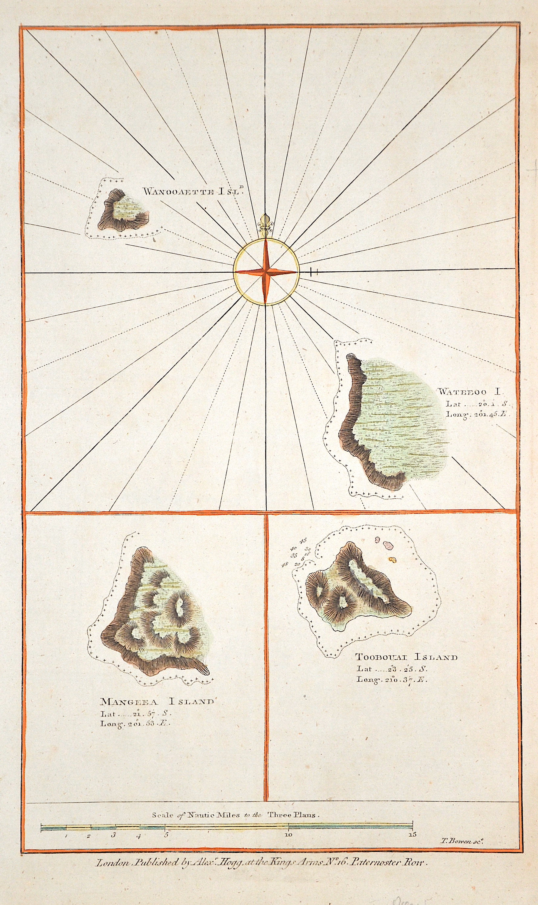
Wanooaette Isld. Mangeea Island. Toobouai Island

| Article ID | OZ0472 |
Title | Wanooaette Isld. Mangeea Island. Toobouai Island |
Description | Three maps on one sheet with the Cook Islands such as Mangaia (Mangeea Island), Wannooaette Island, Toobouai Island and a compass rose. |
| Year | ca. 1784 |
Artist | Bowen (1714-1767) |
Emanuel Bowen (1714- 1767 in London) was an English map engraver, who worked for George II of England and Louis XV of France as a geographer. In spite of his royal appointments and apparent prosperity he died in poverty and his son Thomas, who carried on the business was no more fortunate and died in a Clerkenwell workhouse in 1790. | |
Historical Description | The actual settlement began around 1500–1300 BC. BC presumably from the Philippines and Taiwan. In the course of many centuries the immigrants reached one island after the other and expanded the settlement area further and further east. Above all, the Polynesians embarked on impressive voyages of discovery from their core area, the island triangle Tonga-Fiji-Samoa. With their outrigger canoes they reached Hawaii, New Zealand and in the east of the Pacific to Easter Island. The history of this pre-European colonization is difficult to research because the peoples of Oceania had no writing. Only a few oral traditions have survived into modern times, such as B. the settlement of New Zealand by Tama Te Kapua. Written records only existed with the European voyages of discovery from the 16th century. The European spirit of discovery of the 16th century is decisive for numerous expeditions. The first focus is on exploring a western route across the Pacific to the wealthy trading centers of Asia. Later, mainly Spanish and Portuguese adventurers search for the hypothetical southern continent Terra Australis Incognita or hope to find legendary riches like the mines of King Solomon. Due to inadequate navigation techniques, some of the island groups discovered, e.g. B. the Solomon Islands, can no longer be found and fell into oblivion. At the end of the 16th century, the Dutch also began exploring Oceania. In the 17th century the Europeans still did not know a lot about the Pacific and especially the stories of those returning home about paradise attract more and more sailors. The motivation to travel to new worlds is great, but goes hand in hand with the greed for the pristine natural resources of the new world. Meanwhile, the church worries about the "mixing" with the heathen peoples, but is nevertheless interested in the salvation of the "savages". She reacts by publicly discrediting the fornication with the inhabitants and delegating missionaries to assist with the journeys. In the 18th century only a few islands are still undiscovered, but circumnavigators such as Louis Antoine de Bougainville, James Cook and others still find some unexplored areas. In addition, some of the discoveries of the 16th century were forgotten again. Some now set about mapping the islands using modern means. |
| Place of Publication | London |
| Dimensions (cm) | 33,5 x 20 cm |
| Condition | Perfect condition |
| Coloring | original colored |
| Technique | Copper print |