

Adina Sommer
Antique and Contemporary Art
Winzerer Str. 154
80797 München
telephone
+49 89 304714
business hours:
by appointment
Email
![]()


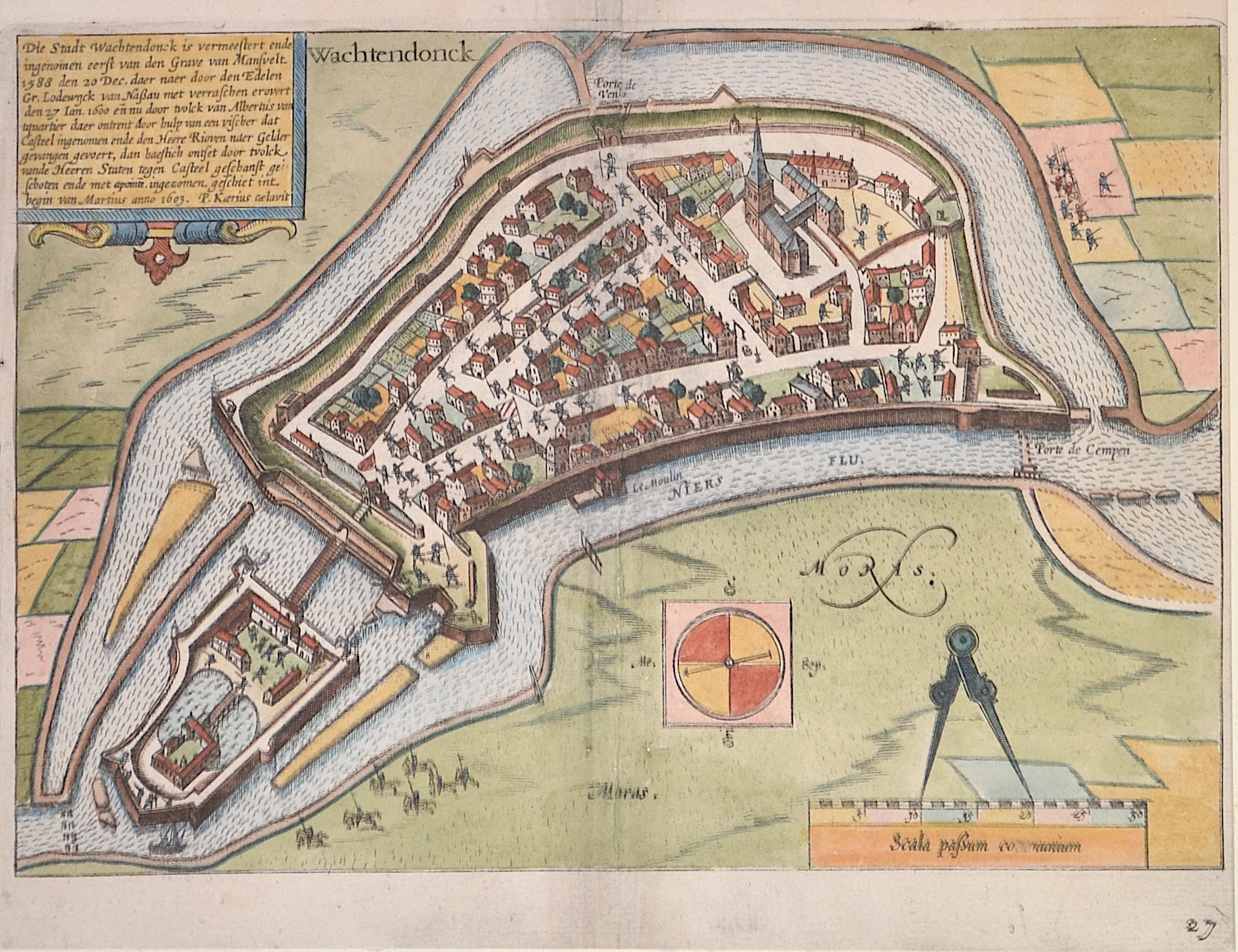
Wachtendonck / Die Stadt Wachtendonck is vermeestert ende..

| Article ID | EUD5128 |
Title | Wachtendonck / Die Stadt Wachtendonck is vermeestert ende.. |
Description | Plan of the town of Wachtendonk in North Rhine-Westphalia. With interior development, castle and fortifications, a compass rose, a mileage indicator and the history of the conquest between 1588 and 1603. Published by Janssonius. |
| Year | ca. 1648 |
Artist | Kaerius (1570-1630) |
Pieter van den Keere, or Petrus Kaerius (1570-1630). He was born in Ghent, and in 1584 moved with his family for religious reasons to London. From his time in England there is a map of Ireland from 1592, Hyberniae novissima descriptio. It was published by Hondius and served as a model for later editions of the Theatrum of Abraham Ortelius. Keere also contributed to John Norden's Speculum Britanniae of 1593. He also worked with Petrus Bertius, Cornelis Claesz, Petrus Plancius, the House of Visscher, and Lucas Janszoon Waghenaer. In 1595, there appeared a large wall map of Europe in 10 sheets, Nova totius Europae descriptio. From 1603, Keere began creating large urban panoramas, including Utrecht, Cologne, Amsterdam, and Paris. Around 1604, he was preparing the publication of the atlas Germania Inferior id est Provincuarum XVII. This first appeared in 1617, with a foreword by Petrus Montanus. | |
Historical Description | The municipality of Wachtendonk is a district municipality of the Kleve district in the Düsseldorf administrative district of the state of North Rhine-Westphalia. After the Romans, of whom few finds report, the Franks conquered the land in the 3rd and 4th centuries. The area of today's Wachtendonk - called Land Geißern - belonged to the Mühlgau according to Germanic division. In the 12th century the archbishops of Cologne took possession of the land of Geißern. The name Wachtendonk is derived from their Vogtendonk. Since 1326 Wachtendonk belonged to the upper quarter of the Duchy of Guelders and received town rights in 1343. During the Eighty Years' War, the Dutch struggle for freedom against Spanish rule, Wachtendonk was conquered several times by the Dutch and reconquered by the Spanish. After the end of the War of Spanish Succession in 1713, the French revolutionary armies occupied the left bank of the Rhine in 1794 and stayed for 20 years. For a time belonged to the Département de la Roer established in 1798 - and thus to France, After the abdication of Napoleon, it returned to Prussia in the Congress of Vienna in 1815. |
| Place of Publication | Amsterdam |
| Dimensions (cm) | 19,5 x 27 cm |
| Condition | Outer margin missing part restored |
| Coloring | original colored |
| Technique | Copper print |