

Adina Sommer
Antique and Contemporary Art
Winzerer Str. 154
80797 München
telephone
+49 89 304714
business hours:
by appointment
Email
![]()


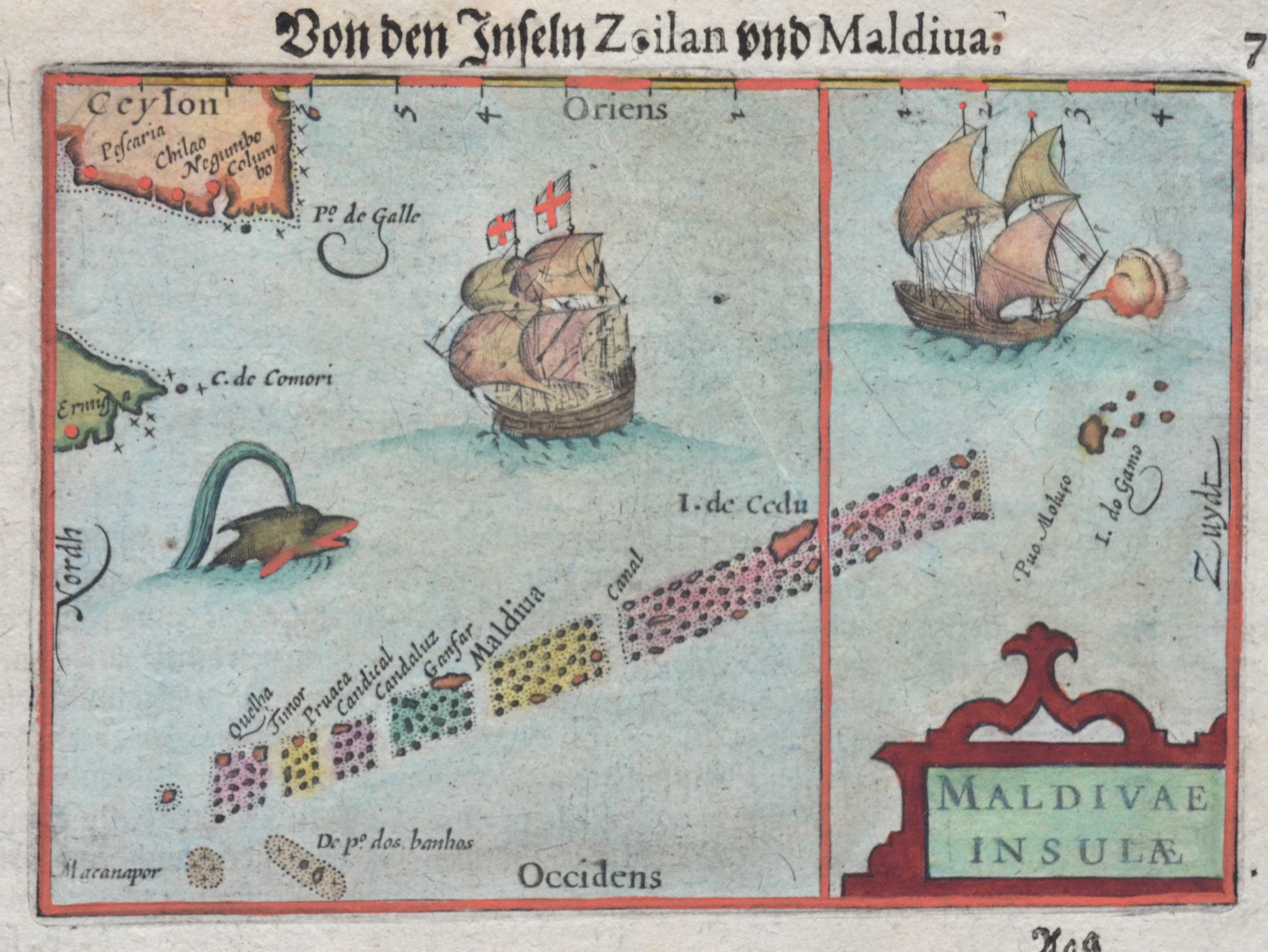
Von den Inseln Zeilan und Maldiva. / Maldivae Insulae

| Article ID | ASI1205 |
Title | Von den Inseln Zeilan und Maldiva. / Maldivae Insulae |
Description | Map depicts the islands of the Maledives, partly Ceylon( now Sri Lanka) and the south part of India. With decorative ships and sea monsters in the foreground. |
| Year | ca. 1620 |
Artist | Bertius (1565-1629) |
Petrus Bertius (1565 -1629) was a Flemish theologian, historian, geographer and cartographer, He grew up in Beveren (Flanders). In 1593 he was appointed mathematics professor and librarian of the University of Leyden. His main cartographic work includes a miniature world atlas of 1600, a pocket atlas of the German Empire of 1616 with 26 engraved maps and 101 city views, a version of the Geographia of Ptolemy with 28 maps by Mercator and 14 maps from the Parergon of Ortelius of 1618, but he is known today as a cartographer with his edition of the Geographia of Ptolemy (based on Mercator's edition of 1578) and for his atlas. | |
| Place of Publication | Amsterdam |
| Dimensions (cm) | 9 x 12 |
| Condition | Perfect condition |
| Coloring | colored |
| Technique | Copper print |