

Adina Sommer
Antique and Contemporary Art
Winzerer Str. 154
80797 München
telephone
+49 89 304714
business hours:
by appointment
Email
![]()


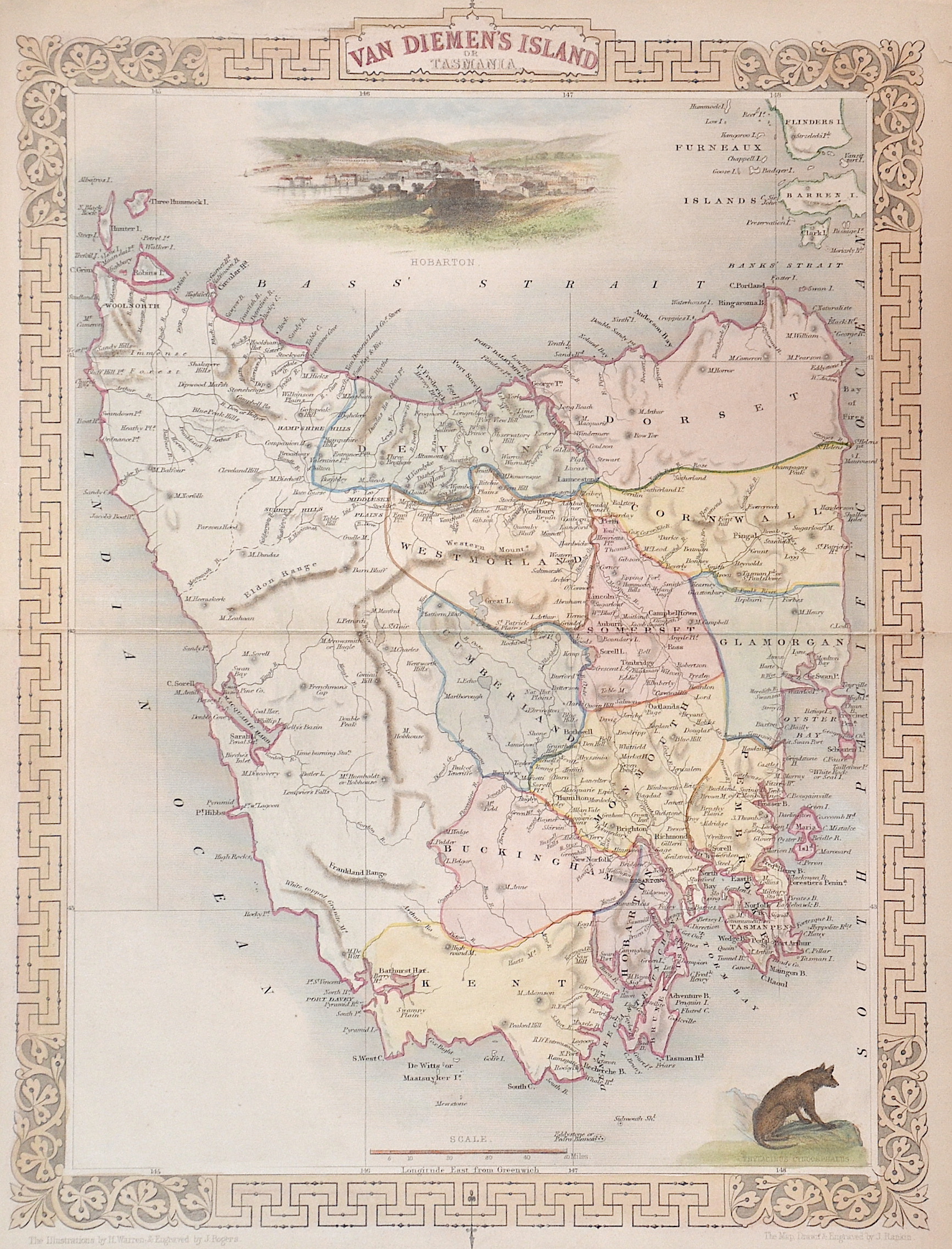
Van Diemen´s island or Tasmania

| Article ID | OZ0275 |
Title | Van Diemen´s island or Tasmania |
Description | Map shows total Tasmania and 2 views, showing Hobarton and a n animal representation. |
| Year | ca. 1850 |
Artist | Tallis (1817-1876) |
John Tallis was an English cartographic publisher. His company, John Tallis and Company, published views, maps and atlases in London from roughly 1838 to 1851. | |
Historical Description | In 1642, the Dutchman Abel Tasman sailed along the south coast of Australia with the ship Heemskerck and the Fleute Zeehaen and discovered this area as well as New Zealand. The voyage was commissioned by the Governor General of the Dutch Indies, Anton van Diemen, after whom he named the newly discovered land (Van Diemens Land). However, Tasman assumed that it was a peninsula of the Australian continent. In 1772, the British explorer Tobias Furneaux went ashore in the southeast of the island. A year later it was also visited by the French explorer Marc-Joseph Marion du Fresne. In 1798, British Captain Matthew Flinders established that it was an island by discovering Bass Strait. Shortly after the establishment of the British colony of New South Wales on the Australian mainland, a French expedition landed on Tasmania in 1792 to explore the country. In 1803, the British established Risdon Cove on the Derwent River, the first permanent European settlement in what is now Tasmania. A year later, they abandoned it and founded Hobart Town (Hobart) in the south and Port Dalrymple (today George Town) in the north of the island. In 1825, Van Diemens Land became an independent colony from New South Wales. |
| Place of Publication | London |
| Dimensions (cm) | 34 x 25 |
| Condition | Very good |
| Coloring | original colored |
| Technique | Steel engraving |