

Adina Sommer
Antique and Contemporary Art
Winzerer Str. 154
80797 München
telephone
+49 89 304714
business hours:
by appointment
Email
![]()


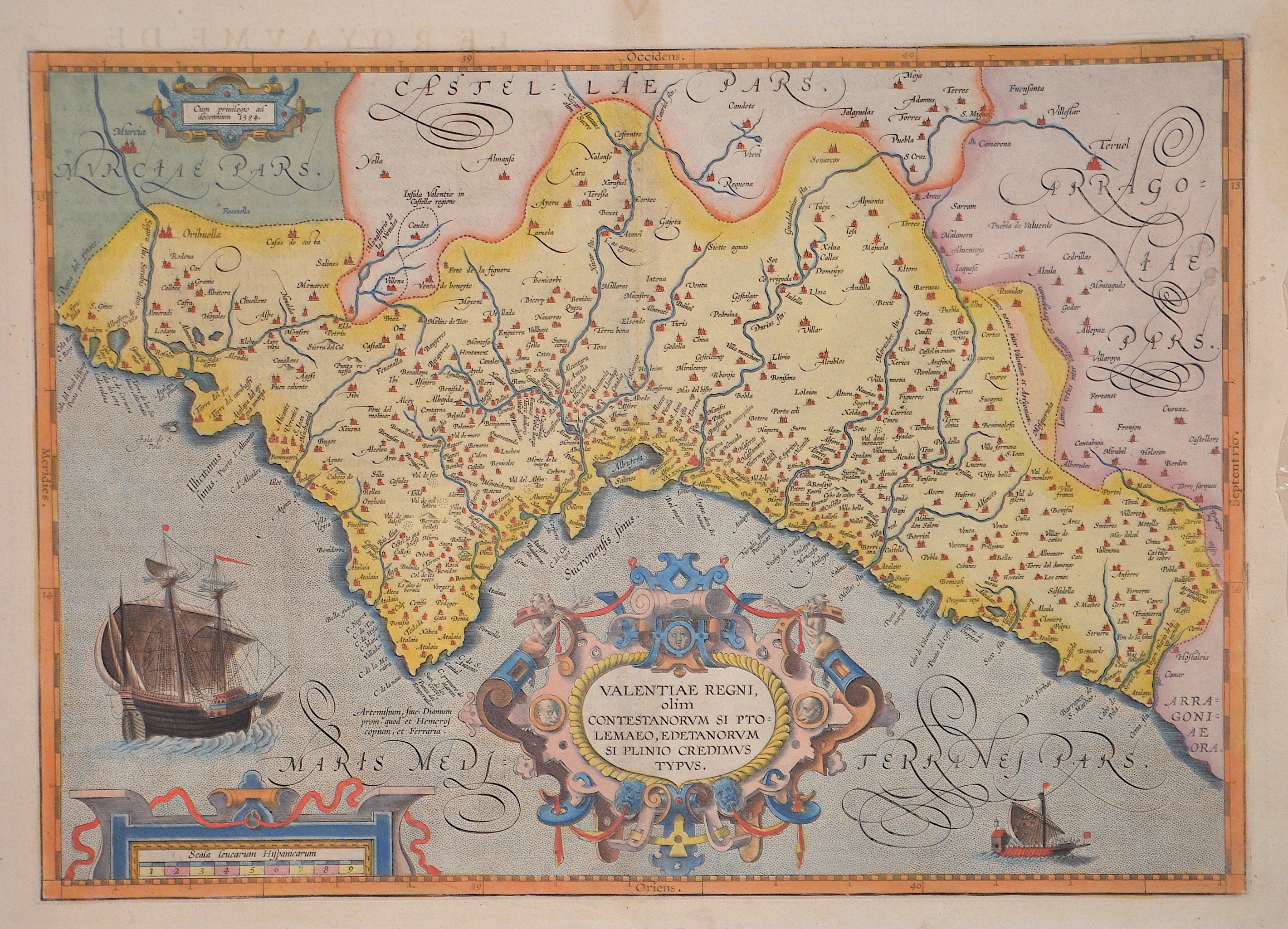
Valantiae regni, olim contestanorum si Ptolemaeo, edetanorum si plinio credimus typus.

| Article ID | EUE1067 |
Title | Valantiae regni, olim contestanorum si Ptolemaeo, edetanorum si plinio credimus typus. |
Description | Map shows total Valencia, two sailing ships, a mileage indicator and a magnificent title cartouche. |
| Year | ca. 1595 |
Artist | Ortelius (1527-1598) |
Abraham Ortelius (1527–1598) was a Flemish cartographer and publisher from Antwerp. Originally a map colorist, he became a major figure in cartography through his Theatrum Orbis Terrarum (1570), considered the first modern atlas—a uniform collection of reliable maps in book form. Influenced by Gerardus Mercator, Ortelius published several maps before compiling the Theatrum, which clearly showed America as a separate continent. The work was published in 42 editions and 7 languages by 1612. Unlike many of his peers, Ortelius cited his sources, and his atlas became a milestone in mapmaking and geographic knowledge. | |
Historical Description | The Valencian Community, also Valencian Land is an autonomous community of Spain located on the Mediterranean coast. It borders Catalonia to the north, Aragon and Castile-La Mancha to the west, and Murcia to the south, and includes the three provinces of Valencia, Alicante and Castellón de la Plana. The capital of the autonomous community is the city of Valencia. The territory of the Autonomous Community, formed in 1982, is largely identical to that of the former Kingdom of Valencia, which belonged to the Crown of Aragon. Most of the region belongs to the linguistic area of Valencian, a variety of Catalan. Valencian is an official language alongside Spanish. |
| Place of Publication | Antwerp |
| Dimensions (cm) | 35 x 49 cm |
| Condition | Minor restorations along the orig. outline colours |
| Coloring | original colored |
| Technique | Copper print |