

Adina Sommer
Antique and Contemporary Art
Winzerer Str. 154
80797 München
telephone
+49 89 304714
business hours:
by appointment
Email
![]()


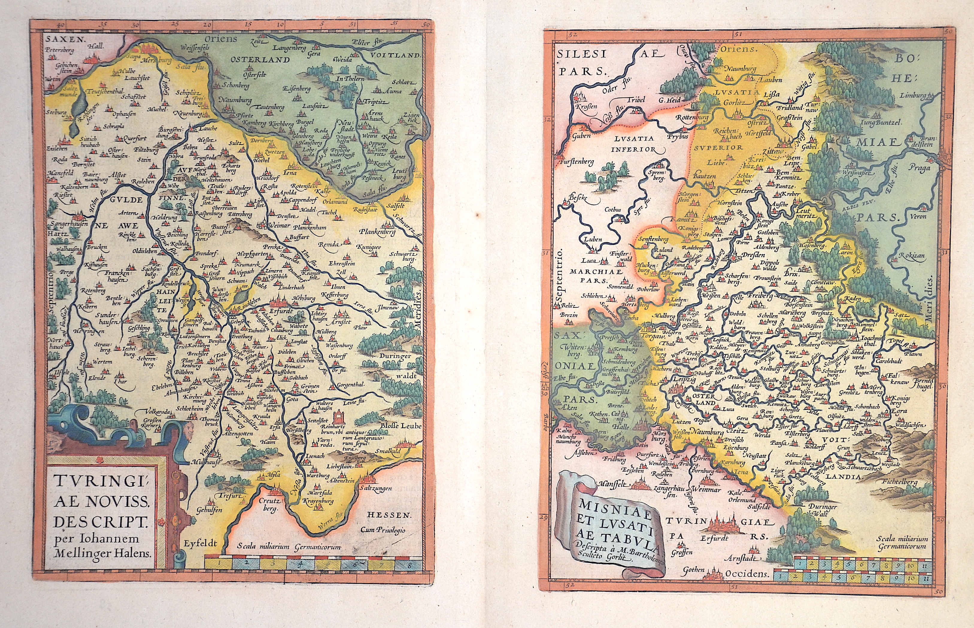
Turingiae Novis Descript.” und “Misinae et Lusatiae Tabula

| Article ID | EUD0058 |
Title | Turingiae Novis Descript.” und “Misinae et Lusatiae Tabula |
Description | Thuringia and Meissen, two maps on one sheet, each with a title cartouche and a mileage indicator. |
| Year | ca. 1570 |
Artist | Ortelius (1527-1598) |
Abraham Ortelius (1527–1598) was a Flemish cartographer and publisher from Antwerp. Originally a map colorist, he became a major figure in cartography through his Theatrum Orbis Terrarum (1570), considered the first modern atlas—a uniform collection of reliable maps in book form. Influenced by Gerardus Mercator, Ortelius published several maps before compiling the Theatrum, which clearly showed America as a separate continent. The work was published in 42 editions and 7 languages by 1612. Unlike many of his peers, Ortelius cited his sources, and his atlas became a milestone in mapmaking and geographic knowledge. | |
Historical Description | Named after the Thuringii tribe who occupied it around AD 300, Thuringia came under Frankish domination in the 6th century. The Thuringian tribe formed during the Migration Period. The Saxon Otonen and the Sangerhausen became a center of the Holy Roman Empire in the 10th century. A separate Duchy of Thuringia cannot develop in this way. Greatest power in the Thuringian war at that time was the county of Weimar. It was only the Ludowinger rights that brought parts of Thuringia under their control. In the 12th century, the process of expanding the state in Thuringia was secured. It is called the first climbed cities such as Mühlhausen. The important noble families of medieval Thuringia were next to the dominant Wettin and the Ludowingern. In 1485, with the division of Leipzig, the wet lands were sold to the Albertiner rights in the east and the Ernestiner administration in the west. With the Reformation at the beginning of the 16th century, Thuringia became the center of German politics. Martin Luther made announcements of responsibility at the University of Erfurt and in the Augustinian monastery before he went to Wittenberg and the Reformation began. In 1640, two main Ernestine lines emerged: the House of Saxony-Weimar and the House of Saxony-Gotha. Subsequently, the phase of humanism began in Thuringia, in which the University of Erfurt also had a heyday. A center of German humanism was formed around Ulrich von Hutten and the reformers. It was only around 1780 that the ruling Duchess Anna Amalia and her son Karl August left the region again. They called poets such as Johann Wolfgang von Goethe or Friedrich Schiller and their court, where they established Weimar Classicism as a German version of the classic literary movement. In 1833, the Customs and Trade Association of the Thuringian States was founded, which spurred industrial revolution in the country. As a result of industrialization, Thuringia became the cradle of social democracy. 1869 Greater August Bebel and Wilhelm Liebknecht in Eisenach the Social Democratic Workers 'Party, in 1875 merged with the General German Workers' Association in Gotha to form the SPD. The Gotha program and the Erfurt program subsequently defined the goals of social democratic politics in Germany. |
| Place of Publication | Antwerpen |
| Dimensions (cm) | 47 x 58 cm |
| Condition | Perfect condition |
| Coloring | original colored |
| Technique | Copper print |