

Adina Sommer
Antique and Contemporary Art
Winzerer Str. 154
80797 München
telephone
+49 89 304714
business hours:
by appointment
Email
![]()


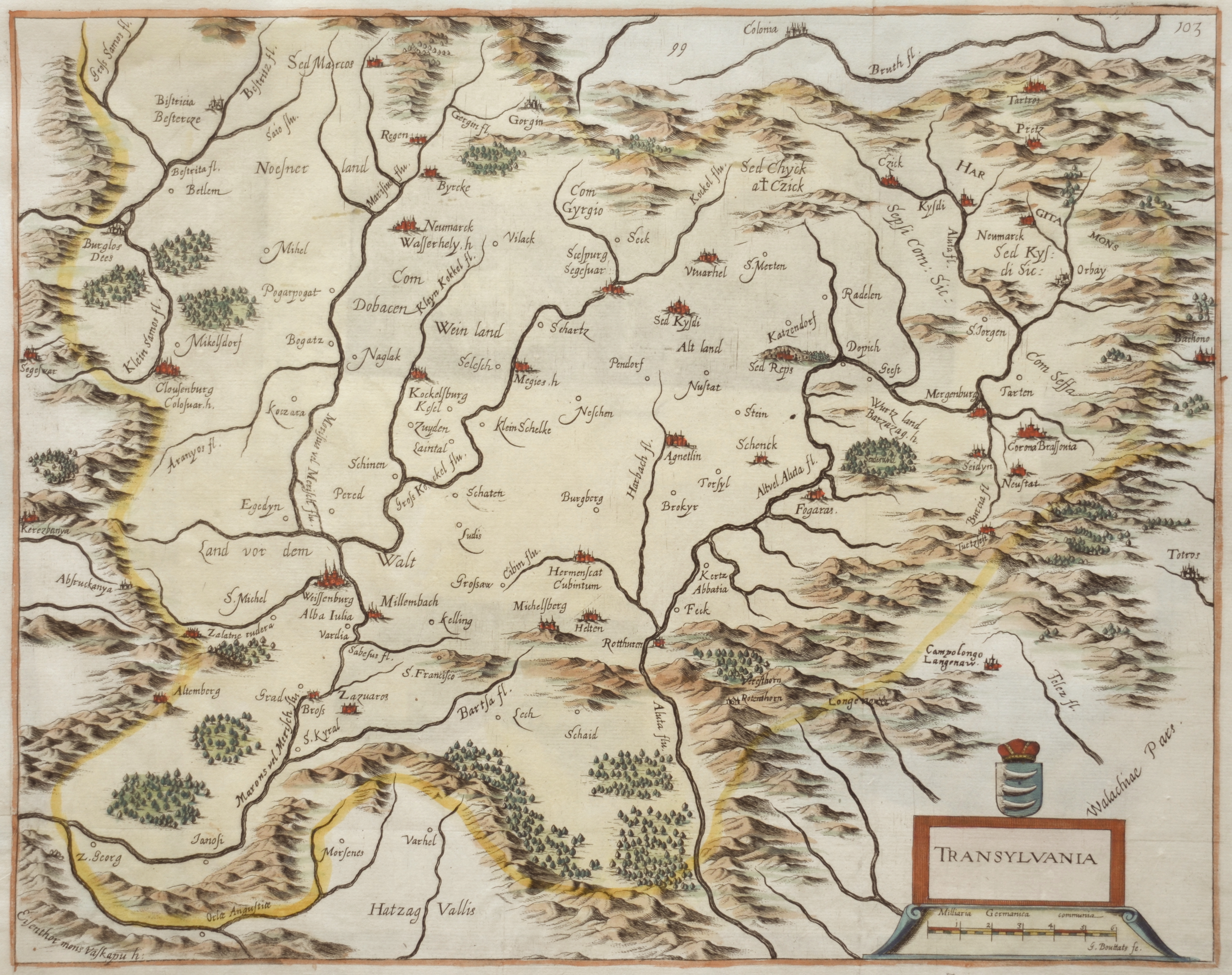
Transylvania

| Article ID | EUR4109 |
Title | Transylvania |
Description | Map shows the entire Transylvania (Siebenbürgen) with a detailed representation of cities, forests, mountains, and a title cartouche. |
| Year | ca. 1680 |
Artist | Bouttats (1640-1695-96) |
Gaspar Bouttats (c. 1650–1696), Antwerp, was a Flemish engraver and etcher. He specialized in: Book engravings (title pages, illustrations), City views (e.g. Amsterdam, Bergen op Zoom, Deventer, Leiden), Topographical scenes (cities, fortifications, landscapes), Historical scenes (e.g. the assassination of Henry IV), Portraits, and Maps (e.g. Polonia Regnum). Many of his engravings were based on drawings by Jan Peeters I, a well-known draughtsman of topographical views. At the time, Antwerp was a major European center for book printing, map production, and copper engraving. There was a high demand for printed city views, war reports, fortification plans, and maps—driven by wars, trade, and growing scientific interest. His works are now held in museums such as the Rijksmuseum in Amsterdam. | |
Historical Description | Transilvania is a historical region located in what is today the central part of Romania. Bound on the east and south by its natural borders, the Carpathian mountain range, historical Transylvania extended westward to the Apuseni Mountains. The region of Transylvania is known for the scenic beauty of its Carpathian landscape and its rich history. It also contains major cities such as Cluj-Napoca, Brașov, Sibiu and Târgu Mureș. The Habsburgs acquired the territory shortly after the Battle of Vienna in 1683. In 1687, the rulers of Transylvania recognized the suzerainty of the Habsburg emperor Leopold I, and the region was officially attached to the Habsburg Empire. |
| Place of Publication | Antwerp |
| Dimensions (cm) | 31,5 x 40 cm |
| Condition | Perfect condition |
| Coloring | colored |
| Technique | Copper print |