

Adina Sommer
Antique and Contemporary Art
Winzerer Str. 154
80797 München
telephone
+49 89 304714
business hours:
by appointment
Email
![]()


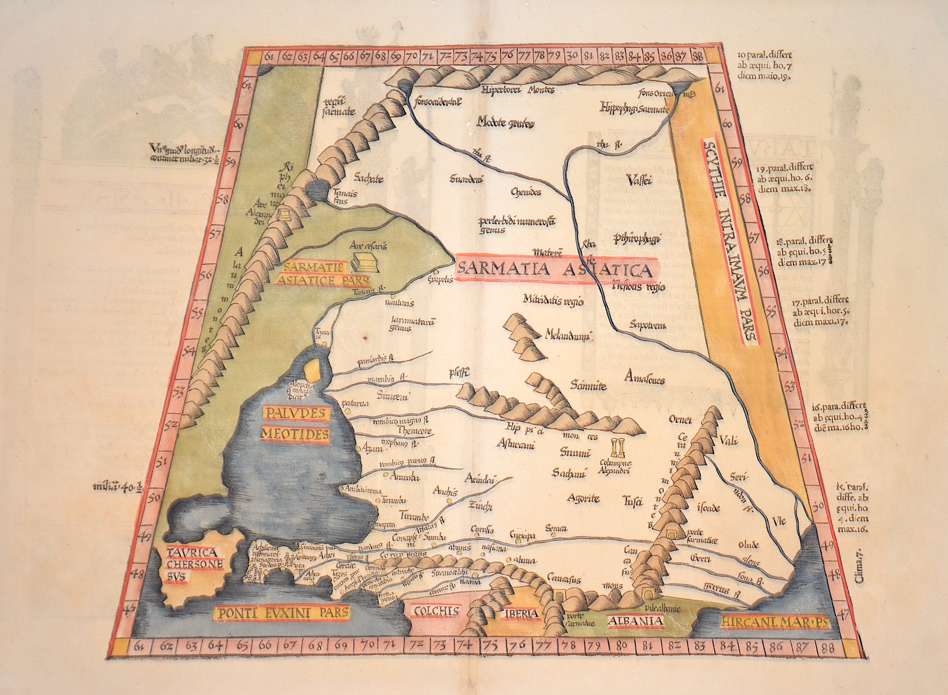
Tabula II Asiae

| Article ID | EUO3638 |
Title | Tabula II Asiae |
Description | Interesting map shows in Trapeziod shape former Sarmatia, now partly Russia with the Black Sea, the Ukraine and the peninsula Krim with the Asow sea. On reverse a dexcription with ornamental decoration. |
| Year | ca. 1535 |
Artist | Ptolemy/ Fries (1490-1531) |
Lorenz (Laurent) Fries was born in Alsace in 1490 or thereabouts, describing himself on one occasion as from Colmar, one of the towns of the region. He studied medicine at university, or rather at universities, as he seems to have had a peripatetic education, apparently spending time at the universities of Pavia, Piacenza, Montpellier and Vienna. Having successfully completed his education, Fries established himself as a physician, at a succession of places in the Alsace region, with a short spell in Switzerland, before settling in Strasbourg, in about 1519. By this time, he had established a reputation as a writer on medical topics, with several publications already to his credit. Indeed, it was thus that Fries met the Strasbourg printer and publisher Johann Grüninger, an associate of the St. Die group of scholars formed by, among others, Walter Lud, Martin Ringmann and Martin Waldseemuller. Gruninger was responsible for printing several of the maps prepared by Waldseemuller, and for supervising the cutting of the maps for the 1513 edition of Ptolemy, edited by the group. This meeting was to introduce a important digression into Fries' life, and for the next five years, from about 1520 to about 1525, he worked in some capacity as a cartographic editor with Gruninger, exploiting the corpus of material that Waldseemuller had created. The first edition of Ptolemy's Geographia editet by Fries was published in Strasbourg in 1522, with maps that were copied and re-engraved from those of Martin Waldseemüller of the 1520 edition of Ptolemy and text edited by Pirckheimer. In 1525 a second edition was printed in Strasbourg. At the death of Fries and Gruninger, the plates were purchased by the brother Melchior and Gaspar Treschel, who printed a thord edition in Lyon in 1535. For the text, the two editors used the supervision of Michael Servetus, who editet Pirckheimer's text. Finally, in 1541, Gaspare Treechsel published in Vienne, in the Dauphine, this fourth edition, again with Servetus' text. in this edition, compared to the first edition of Strasbourg in 1522, the text underwent numerous changes, corrections and additions, but the wood-Blocks were not changed. Claudius Ptolemy ( arround 100- 160 a.C.) Geographia, gives a list of geographic coordinates of spherical longitude and latitude of almost ten thousand point locations on the earth surface, as they were known at his times. The list is organized in Tabulae which cor- respond to specific regions of the three known continents at that time, Africa, Asia and Europe. Research on Ptolemy’s Geographia has started at the University of Thessaloniki, Greece, in the eighties, focused mainly, but not exclusively, on data re- lated to territories which are now under the sovereignty of the modern Greek state. The World of Ptolemy is classified in Regions, since each Chapter is referred to one of them, giving by this way the concept of Atlas as it is understood today. | |
Historical Description | Neanderthal settlement in Ukraine is seen in the Molodova archaeological sites, which include a mammoth bone dwelling. The territory is also considered to be the likely location for the human domestication of the horse. In the mid-14th century, upon the death of Bolesław Jerzy II of Mazovia, king Casimir III of Poland initiated campaigns (1340–1366) to take Galicia-Volhynia. Meanwhile, the heartland of Rus', including Kiev, became the territory of the Grand Duchy of Lithuania, ruled by Gediminas and his successors, after the Battle on the Irpen' River. In 1648, Bohdan Khmelnytsky and Petro Doroshenko led the largest of the Cossack uprisings against the Commonwealth and the Polish king John II Casimir. After Khmelnytsky made an entry into Kiev in 1648, where he was hailed liberator of the people from Polish captivity, he founded the Cossack Hetmanate which existed until 1764. In 1657–1686 came "The Ruin", a devastating 30-year war amongst Russia, Poland, Turks and Cossacks for control of Ukraine. In 1709, Cossack Hetman Ivan Mazepa (1639–1709) defected to Sweden against Russia in the Great Northern War (1700–1721). Lithuanians and Poles controlled vast estates in Ukraine, and were a law unto themselves. After the Annexation of Crimea by the Russian Empire in 1783, New Russia was settled by Ukrainians and Russians. |
| Place of Publication | Strassburg |
| Dimensions (cm) | 30,5 x 38 cm |
| Condition | Perfect condition |
| Coloring | original colored |
| Technique | Woodcut |