

Adina Sommer
Antique and Contemporary Art
Winzerer Str. 154
80797 München
telephone
+49 89 304714
business hours:
by appointment
Email
![]()


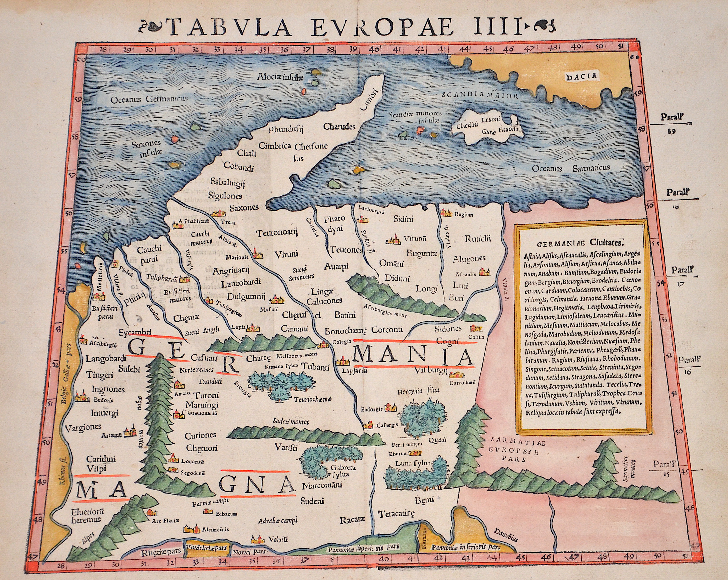
Tabula Europae IIII ( Germaniam maganm)

| Article ID | EUD555 |
Title | Tabula Europae IIII ( Germaniam maganm) |
Description | Map shows detailed Germany, the Baltic and part of the Balkans, extending to the Carpathian Mountains and the Danube. Shwon as it has been understood in the Ptolomaic time and trapezoid. |
| Year | ca. 1540 |
Artist | Ptolemy/Münster Sebastian (1489-1552) |
Sebastian Münster (1489–1552) was a prominent Renaissance cosmographer. His Cosmographia, published in 1544 with 24 double-page maps based on research from around 1528, was continuously expanded. It was the first widely accessible scientific description of the world in German, combining knowledge from history, geography, astronomy, and natural sciences. The work remained popular for a long time and was published in many editions and languages until 1650. Claudius Ptolemy (c. 100–160 AD) was a Greek mathematician, geographer, and astronomer. His works on astronomy, geography, and astrology were long considered standard references. He described the Earth as the center of the universe (Centrum Mundi) and established the basis for latitude measurement. His Geographia included the known world and the hypothesis of Terra Australis. Ptolemy provided written instructions for mapmaking but made only rough sketches himself; later maps were created under his name. | |
Historical Description | The concept of Germany as a distinct region in central Europe can be traced to Roman commander Julius Caesar, who referred to the unconquered area east of the Rhine as Germania, thus distinguishing it from Gaul (France), which he had conquered. In the High Middle Ages, the regional dukes, princes and bishops gained power at the expense of the emperors. Martin Luther led the Protestant Reformationagainst the Catholic Church after 1517, as the northern states became Protestant, while the southern states remained Catholic. The two parts of the Holy Roman Empire clashed in the Thirty Years' War (1618–1648). 1648 marked the effective end of the Holy Roman Empire and the beginning of the modern nation-state system, with Germany divided into numerous independent states, such as Prussia, Bavaria and Saxony. |
| Place of Publication | Basle |
| Dimensions (cm) | 27 x 34 cm |
| Condition | Very good |
| Coloring | original colored |
| Technique | Woodcut |