

Adina Sommer
Antique and Contemporary Art
Winzerer Str. 154
80797 München
telephone
+49 89 304714
business hours:
by appointment
Email
![]()


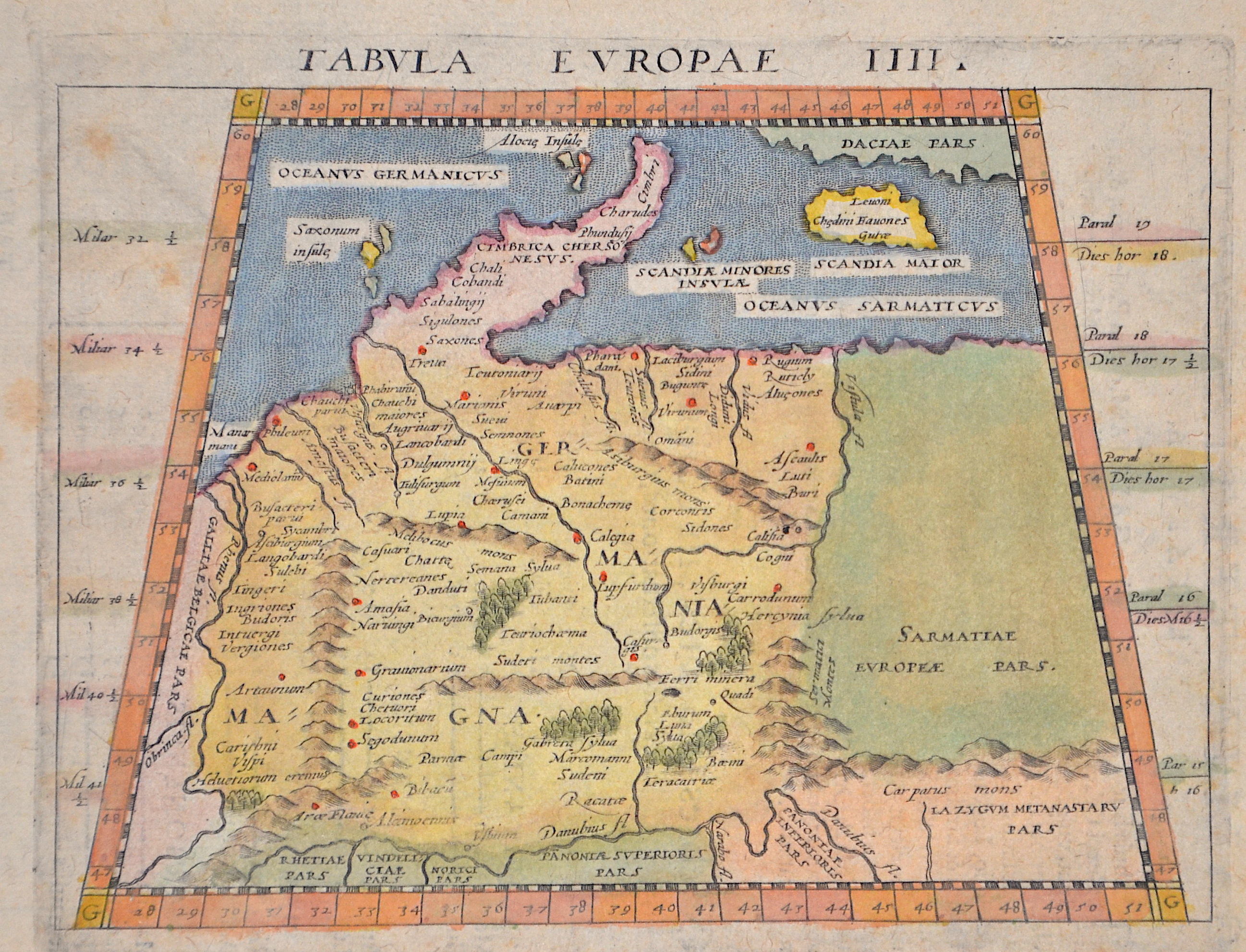
Tabula Europae IIII. / Galliae, Tertia Europae Tabula. 5

| Article ID | EUD5201 |
Title | Tabula Europae IIII. / Galliae, Tertia Europae Tabula. 5 |
Description | Map shows the whole of Germany with the Baltic States, partly the Balkans, the Carpathians and the Danube. Depicted as it was understood in Ptolemaic times and in trapezoidal form. |
| Year | ca. 1600 |
Artist | Magini (1555-1617) |
Giovanni Antonio Magini was an Italian astronomer and mathematician. In 1592 he published De Planis Triangulis, where he described the use of the quadrants. In 1607 he published the astrological work De astrologica ratione. Magini also created an atlas of Italy (Atlante geografico d'Italia), which, however, was not published by his son until 1620. In 1935 the lunar crater Maginus was named after him. | |
Historical Description | The concept of Germany as a distinct region in central Europe can be traced to Roman commander Julius Caesar, who referred to the unconquered area east of the Rhine as Germania, thus distinguishing it from Gaul (France), which he had conquered. In the High Middle Ages, the regional dukes, princes and bishops gained power at the expense of the emperors. Martin Luther led the Protestant Reformationagainst the Catholic Church after 1517, as the northern states became Protestant, while the southern states remained Catholic. The two parts of the Holy Roman Empire clashed in the Thirty Years' War (1618–1648). 1648 marked the effective end of the Holy Roman Empire and the beginning of the modern nation-state system, with Germany divided into numerous independent states, such as Prussia, Bavaria and Saxony. |
| Place of Publication | Venice |
| Dimensions (cm) | 13 x 17 cm |
| Condition | Perfect condition |
| Coloring | original colored |
| Technique | Copper print |