

Adina Sommer
Antique and Contemporary Art
Winzerer Str. 154
80797 München
telephone
+49 89 304714
business hours:
by appointment
Email
![]()


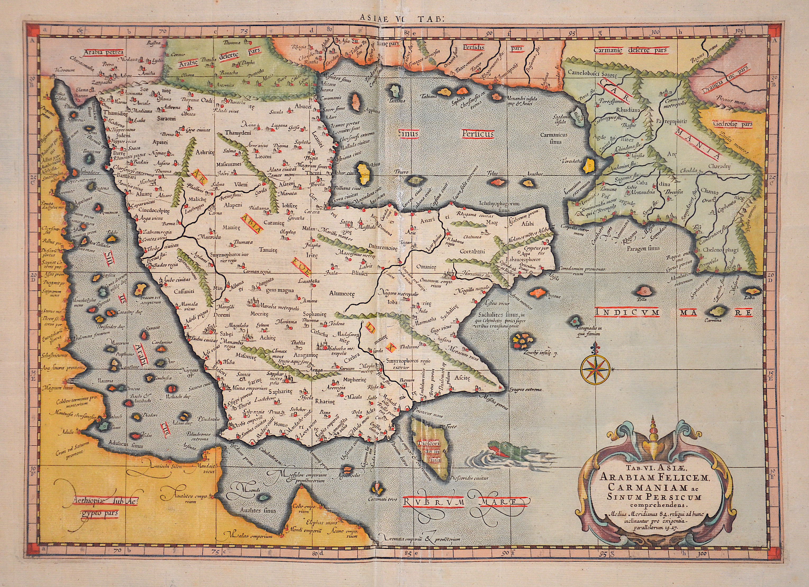
Tab. VI. Asiae Arabiam Felicem. Carmaniam ac. Sinum Persicum comprehendens”

| Article ID | ASA059 |
Title | Tab. VI. Asiae Arabiam Felicem. Carmaniam ac. Sinum Persicum comprehendens” |
Description | Map of the Arabic Peninsula, the Red Sea and the Persian Gulf. |
| Year | ca. 1690 |
Artist | Ptolemy/ Gerhard Mercator (1512-1594) |
Gerardus Mercator (1512 - 1594) He was a cartographer, philosopher and mathematician. He is best known for his work in cartography, in particular the world map of 1569 based on a new projection which represented sailing courses of constant bearing as straight lines. He is renowned to the present day as the cartographer who created a world map based on a new projection which represented sailing courses of constant bearing as straight lines. In his own day he was the world's most famous geographer but in addition he had interests in theology, philosophy, history, mathematics and magnetism as well as being an accomplished engraver, calligrapher and maker of globes and scientific instruments. He wrote few books but much of his knowledge is to be found in the copious legends on his wall maps and the prefaces that he composed for his atlas ,the first in which the term ""atlas"" appears and the sections within it." Claudius Ptolemy ( arround 100- 160 a.C.) Geographia, gives a list of geographic coordinates of spherical longitude and latitude of almost ten thousand point locations on the earth surface, as they were known at his times. The list is organized in Tabulae which cor- respond to specific regions of the three known continents at that time, Africa, Asia and Europe. Research on Ptolemy’s Geographia has started at the University of Thessaloniki, Greece, in the eighties, focused mainly, but not exclusively, on data re- lated to territories which are now under the sovereignty of the modern Greek state. The World of Ptolemy is classified in Regions, since each Chapter is referred to one of them, giving by this way the concept of Atlas as it is understood today. | |
Historical Description | Arabia, an early empire on the largely uninhabitable Arabian Peninsula, was the legendary Saba in the south, which at times ruled all of southwest Arabia and had colonies in Eritrea and Tanzania. In the seventh century, Islam became the dominant religion on the peninsula. The Islamic prophet Muhammad was born in Mecca around 570 and began preaching in the city in 610, but immigrated to Medina in 622. Mohammed founded a new unified polity on the Arabian Peninsula which, under the subsequent caliphates of Rashidun and Umayyads, experienced a century of rapid expansion of Arab power far beyond the Arabian Peninsula in the form of a vast Muslim Arab Empire with an expanding sphere of influence from the northwest Indian subcontinent across Central Asia, the Middle East, North Africa, South Italy and the Iberian Peninsula to the Pyrenees. Despite its spiritual significance, Arabia soon became politically a fringe region of the Islamic world, with the main medieval Islamic states located at different times in cities as distant as Damascus, Baghdad and Cairo. However, from the 10th century (and indeed until the 20th century) the Hashemite Sharifs of Mecca retained a state in the most developed part of the region, the Hejaz. Their domain originally included only the holy cities of Mecca and Medina, but was extended to the rest of the Hejaz in the 13th century. Although the Sharifs in the Hejaz exercised largely independent authority, they were usually subject to the suzerainty of one of the great Islamic empires of the time. In the Middle Ages, this included the Abbasids of Baghdad and the Fatimids, Ayyubids and Mamluks of Egypt. |
| Place of Publication | Amsterdam |
| Dimensions (cm) | 34 x 48 cm |
| Condition | Restoration at centerfold |
| Coloring | colored |
| Technique | Copper print |