

Adina Sommer
Antique and Contemporary Art
Winzerer Str. 154
80797 München
telephone
+49 89 304714
business hours:
by appointment
Email
![]()


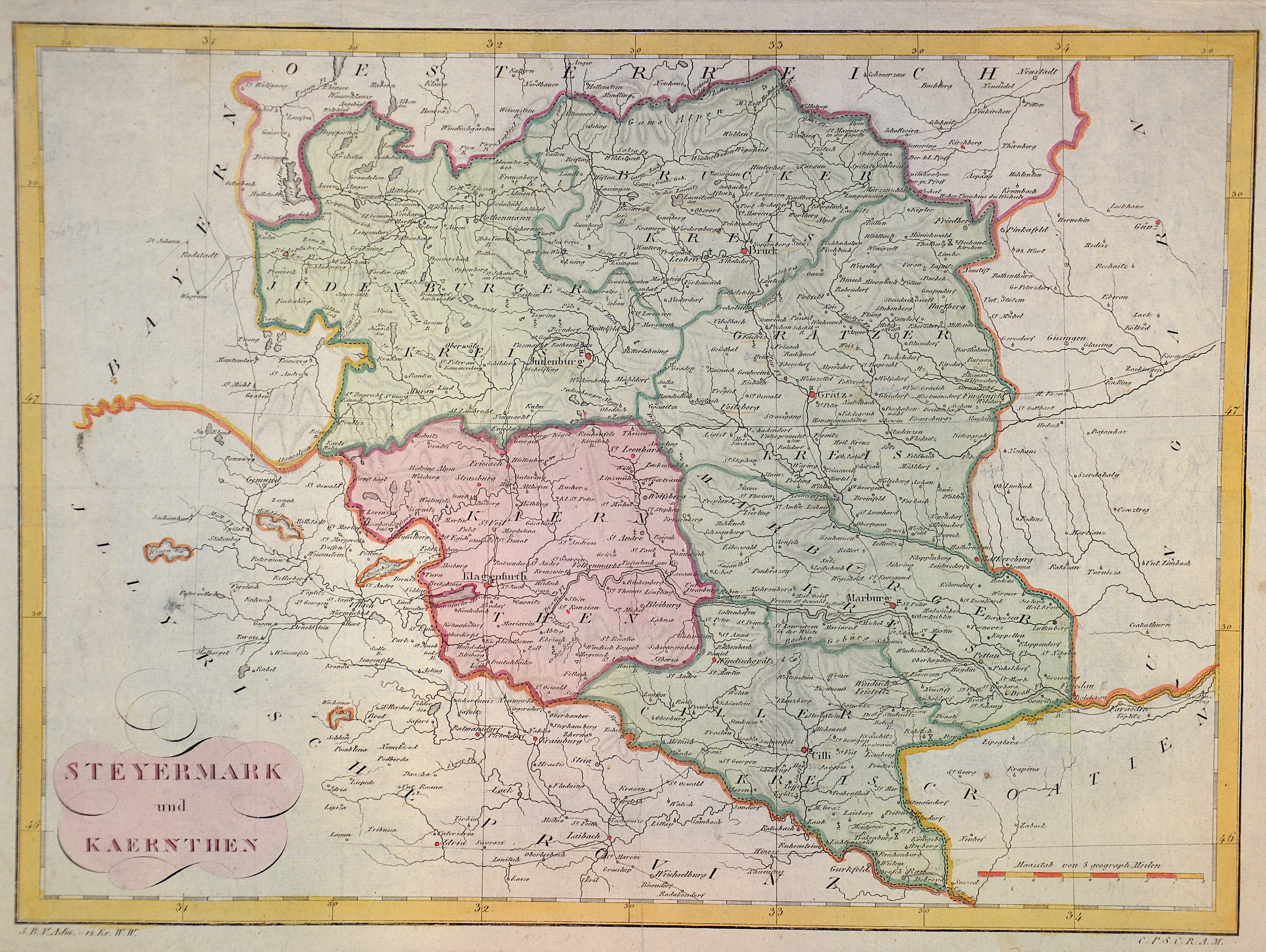
Steyermark und Kaernthen

| Article ID | EUA3404 |
Title | Steyermark und Kaernthen |
Description | Map depicts the entire Steiermark and its administrative units (Judenburger Kreis, Brucker Kreis, Gratzer Kreis, Marburger Kreis und Ciller Kreis) with the cities of Judenburg, Bruck at the Mur, Graz. Partly Slovenia with Marburg at the river Donau, Cilli and the eastern part of Kaerten with Klagenfurt at the Wörth lake. |
| Year | ca. 1740 |
Artist | Anonymus |
Historical Description | The name Austria is first handed down in its Old High German form Ostarrichi from the year 996. The Latin form Austria was also used. In 1156 Austria became an independent duchy in the Holy Roman Empire. After the Babenbergs died out in 1246, the House of Habsburg prevailed in the struggle for rule in Austria. The area designated as Austria later included the entire Habsburg Monarchy and later the Austrian Empire, which was constituted in 1804, and the Austrian half of the Austro-Hungarian Dual Monarchy established in 1867. The present republic came into being in 1918. |
| Dimensions (cm) | 29,5 x 40 |
| Condition | Some folds |
| Coloring | original colored |
| Technique | Copper print |