

Adina Sommer
Antique and Contemporary Art
Winzerer Str. 154
80797 München
telephone
+49 89 304714
business hours:
by appointment
Email
![]()


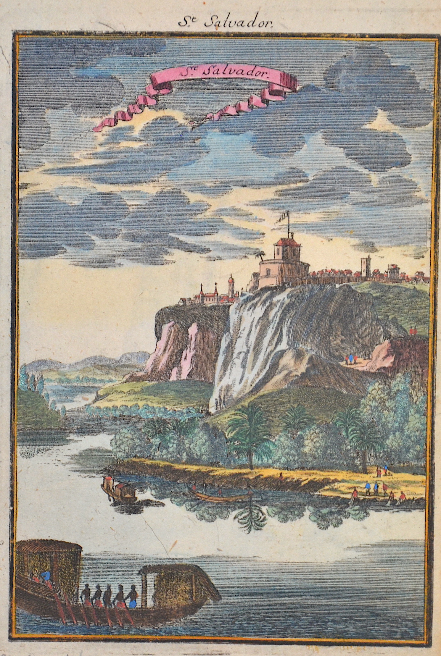
St. Salvador.

| Article ID | AF0413 |
Title | St. Salvador. |
Description | View of M´banza in Kongo, Africa. |
| Year | ca. 1686 |
Artist | Mallet (1630-1706) |
Alain Manesson Mallet (1630- 1706 ) was a French cartographer and engineer. He started his career as a soldier in the army of Louis XIV, became a Sergeant-Major in the artillery and an Inspector of Fortifications. He also served under the King of Portugal, before returning to France, and his appointment to the court of Louis XIV. His military engineering and mathematical background led to his position teaching mathematics at court. His major publications were Description de L'Univers (1683) in 5 volumes, and Les Travaux de Mars ou l'Art de la Guerre (1684) in 3 volumes. His Description de L'Universe contains a wide variety of information, including star maps, maps of the ancient and modern world, and a synopsis of the customs, religion and government of the many nations included in his text. It has been suggested that his background as a teacher led to his being concerned with entertaining his readers. This concern manifested itself in the charming harbor scenes and rural landscapes that he included beneath his description of astronomical concepts and diagrams. Mallet himself drew most of the figures that were engraved for this book. | |
Historical Description | Angola is a country on the west coast of south-central Africa. It is the seventh largest country in Africa. Although inhabited since the Palaeolithic Age, today's Angola was shaped by Portuguese colonization. It began with coastal settlements and trading posts, which were established from the 16th century onwards, and was limited to these for centuries. In 1483, Portuguese trading posts began to be established on the coast, mainly in Luanda and inland a century later also in Benguela. In the 19th century, European settlers slowly and hesitantly began to settle in the interior. The Portuguese colony that became Angola did not have its current borders until the early 20th century due to resistance from groups such as the Cuamato, the Kwanyama and the Mbunda. The Portuguese explorer Diogo Cão reached the area in 1484. The year before, the Portuguese had established relations with the Congo, which at that time stretched from present-day Gabon in the north to the Kwanza River in the south. The Portuguese established their first trading post in Soyo, which today is the northernmost city in Angola, with the exception of the exclave of Cabinda. Paulo Dias de Novais founded São Paulo de Loanda (Luanda) in 1575 with one hundred settler families and four hundred soldiers. Benguela was fortified in 1587 and became a city in 1617. |
| Place of Publication | Frankfurt on Main |
| Dimensions (cm) | 15 x 10 |
| Condition | Perfect condition |
| Coloring | original colored |
| Technique | Copper print |