

Adina Sommer
Antique and Contemporary Art
Winzerer Str. 154
80797 München
telephone
+49 89 304714
business hours:
by appointment
Email
![]()


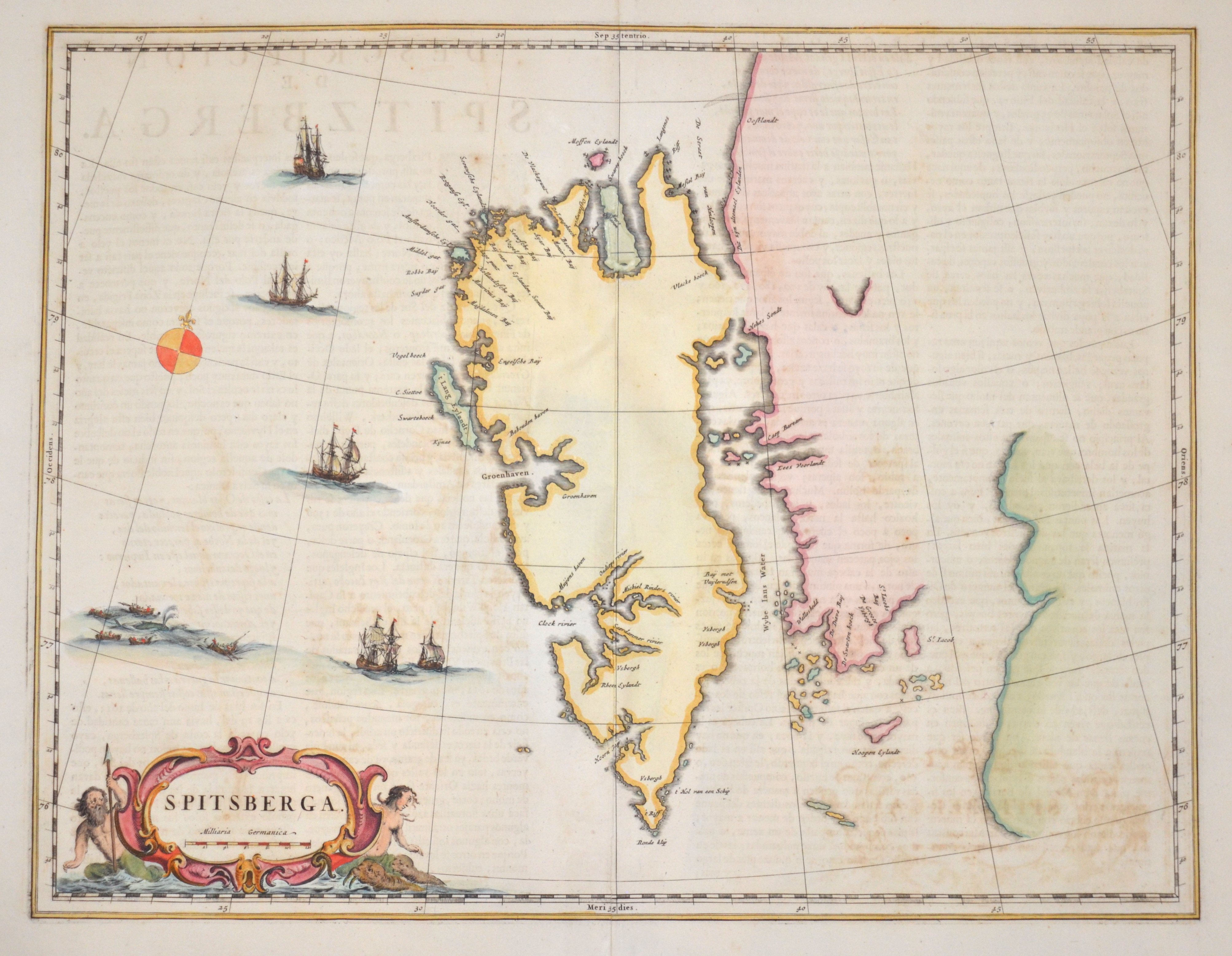
Spitsberga.

| Article ID | EUS4058 |
Title | Spitsberga. |
Description | Map shows the island group Spitzbergen (Svalbard) in the North Atlantic ( Arctic ocean), belonging to Norway. With title cartouche, shipstaffage and wind rose. |
| Year | ca. 1665 |
Artist | Blaeu (1571-1638) |
Joan Guilliemus Blaeu was the eldest son of Willem Janszoon Blaeu (1571-1638), and was probably born in Alkmaar in the province of Noord-Holland in the final years of the 16th century. He was brought up in Amsterdam, and studied law at the University of Leiden before going into partnership with his father in the 1630s. Although his father Willem had cartographic interests, having studied under the Danish astronomer Tycho Brahe and having manufactured globes and instruments, his primary business was as a printer. It was under the control of Joan that the Blaeu printing press achieved lasting fame by moving towards the printing of maps and expanding to become the largest printing press in Europe in the 17th century. By the 1660s the Theatrum Orbis Terrarum (or Atlas Maior as it had became known by this time) had expanded to between 9 and 12 volumes, depending on the language. With over 3,000 text pages and approximately 600 maps, it was the most expensive book money could buy in the later 17th century. The translation of the text from Latin into Dutch, English, German, French, and Spanish for several volumes created enormous work for those involved in typography and letterpress activities. It is estimated that over 80 men must have been employed full-time in the Blaeu printing house in Bloemgracht, not including engravers who worked elsewhere, with over 15 printing presses running simultaneously, and in 1667 a second press was acquired at Gravenstraat. At the same time as producing the Atlas Maior, Blaeu was also publishing town plans of Italy, maps for globes, and other volumes. At its peak the Blaeu press managed to produce over 1 million impressions from 1,000 copper plates within four years. | |
Historical Description | Norsemen possibly discovered Svalbard as early as the 12th century. The Dutchman Willem Barentsz made the first discovery of the archipelago in 1596, when he sighted its coast while searching for the Northern Sea Route. The name Spitsbergen originated with Barentsz, who described the "pointed mountains" he saw on the west coast of the main island, Spitsbergen although his 1599 map of the Arctic labels the island as Het Nieuwe Land ("The New Land"). Barentsz did not recognize that he had discovered an archipelago, and consequently the name Spitsbergen long remained in use both for the main island and for the archipelago as a whole. |
| Place of Publication | Amsterdam |
| Dimensions (cm) | 38 x 49 |
| Condition | Upper and lower centerfold perfectly restored |
| Coloring | original colored |
| Technique | Copper print |