

Adina Sommer
Antique and Contemporary Art
Winzerer Str. 154
80797 München
telephone
+49 89 304714
business hours:
by appointment
Email
![]()


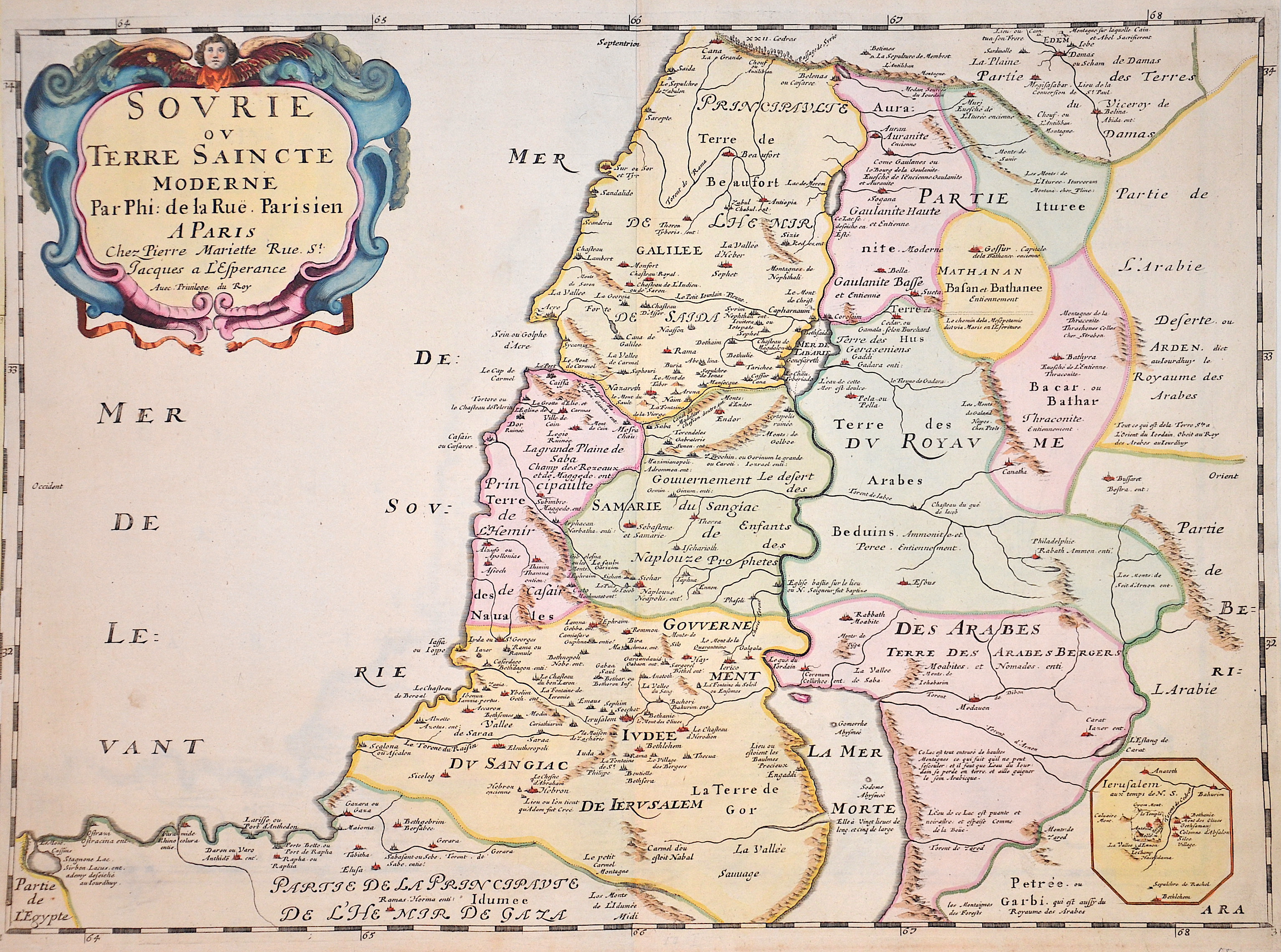
Sovrie ou Terre Saincte moderene Par Phi. De la Rue. Parisien
| Article ID | ASP066 |
Title | Sovrie ou Terre Saincte moderene Par Phi. De la Rue. Parisien |
Map shows the Holy Land (Terra Sancta) with a splendid title cartouche and a partial map with the surroundings of Antonia Castle, an ancient fortress in Jerusalem. | |
| Year | ca. 1650 |
Artist | Mariette |
| Place of Publication | Paris |
| Dimensions (cm) | 40 x 54 cm |
| Condition | Perfect condition |
| Coloring | colored |
| Technique | Copper print |
:
70.50 €
( A reproduction can be ordered individually on request. )