

Adina Sommer
Antique and Contemporary Art
Winzerer Str. 154
80797 München
telephone
+49 89 304714
business hours:
by appointment
Email
![]()


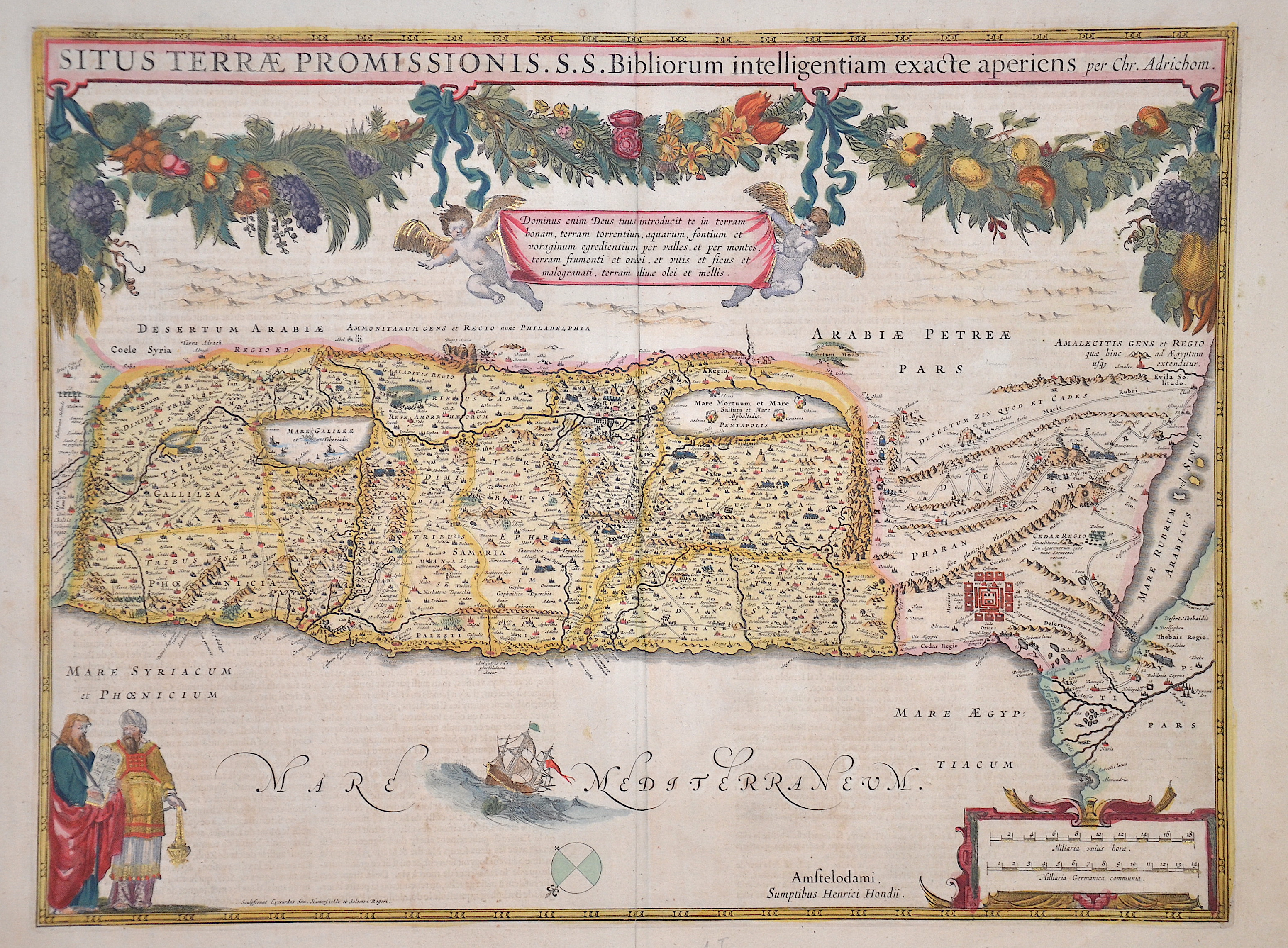
Situs Terrae Promissionis S.S. Bibliorum intelligentiam exacte aperiens per Chr. Adrichom.
| Article ID | ASP065 |
Title | Situs Terrae Promissionis S.S. Bibliorum intelligentiam exacte aperiens per Chr. Adrichom. |
Map facing east showing the Holy Land (Terra Sancta) and a magnificent title cartouche with a plant border and two putti. There is also a ship's staffage with the scene of Jonah being thrown to the whale and a compass rose. At the bottom right a mileage cartouche and on the left Moses with the tablets of the law. | |
| Year | ca. 1630 |
Artist | Hondius |
| Place of Publication | Amsterdam |
| Dimensions (cm) | 37 x 50 cm |
| Condition | Some restoration at centerfold |
| Coloring | original colored |
| Technique | Copper print |
:
174.00 €
( A reproduction can be ordered individually on request. )