

Adina Sommer
Antique and Contemporary Art
Winzerer Str. 154
80797 München
telephone
+49 89 304714
business hours:
by appointment
Email
![]()


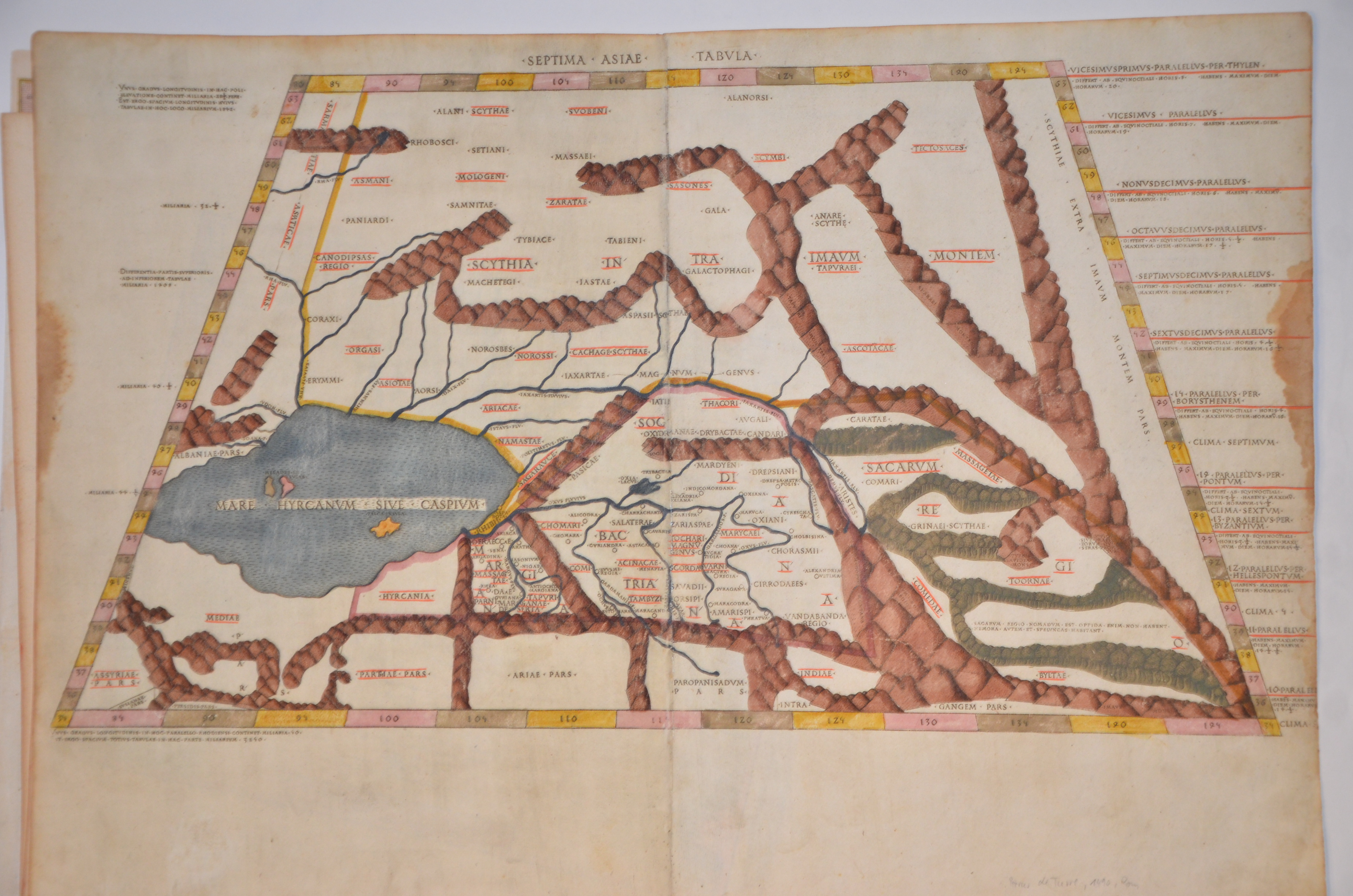
Septima Asiae Tabula

| Article ID | EUO2600 |
Title | Septima Asiae Tabula |
Description | Rare trapezoind projection map of the Caspian Sean with the bordering countries. |
| Year | ca. 1490 |
Artist | Ptolemy/ Petrus de Turre |
Petrus de Turre puchased Conrad Sweynheyms plates in 1490 to reissue the maps based on Claudius Ptolemy notes. Claudius Ptolemy ( arround 100- 160 a.C.) Geographia, gives a list of geographic coordinates of spherical longitude and latitude of almost ten thousand point locations on the earth surface, as they were known at his times. The list is organized in Tabulae which cor- respond to specific regions of the three known continents at that time, Africa, Asia and Europe. Research on Ptolemy’s Geographia has started at the University of Thessaloniki, Greece, in the eighties, focused mainly, but not exclusively, on data re- lated to territories which are now under the sovereignty of the modern Greek state. The World of Ptolemy is classified in Regions, since each Chapter is referred to one of them, giving by this way the concept of Atlas as it is understood today. | |
Historical Description | Since the Caspian Sea is not a sea in the legal sense, it is not subject to the 1994 Convention on the Law of the Sea. The oldest cultural evidence can be found on inscriptions on Assyrian pottery and call it a "Southern Sea". the first popular name refers to the tribe of the Caspians who lived on the southwestern bank of the Caspian Caucasus, in today's Azerbaijan, the second refers to the bank near Hyrkania, a landscape on today's Iranian and southern Turkmen coast. The changing history of settlement led to numerous other names such as B. the Tatar name "Ag Deniz", White Sea. |
| Place of Publication | Rome |
| Dimensions (cm) | 30 x 55 cm |
| Condition | Perfect condition |
| Coloring | original colored |
| Technique | Woodcut |