

Adina Sommer
Antique and Contemporary Art
Winzerer Str. 154
80797 München
telephone
+49 89 304714
business hours:
by appointment
Email
![]()


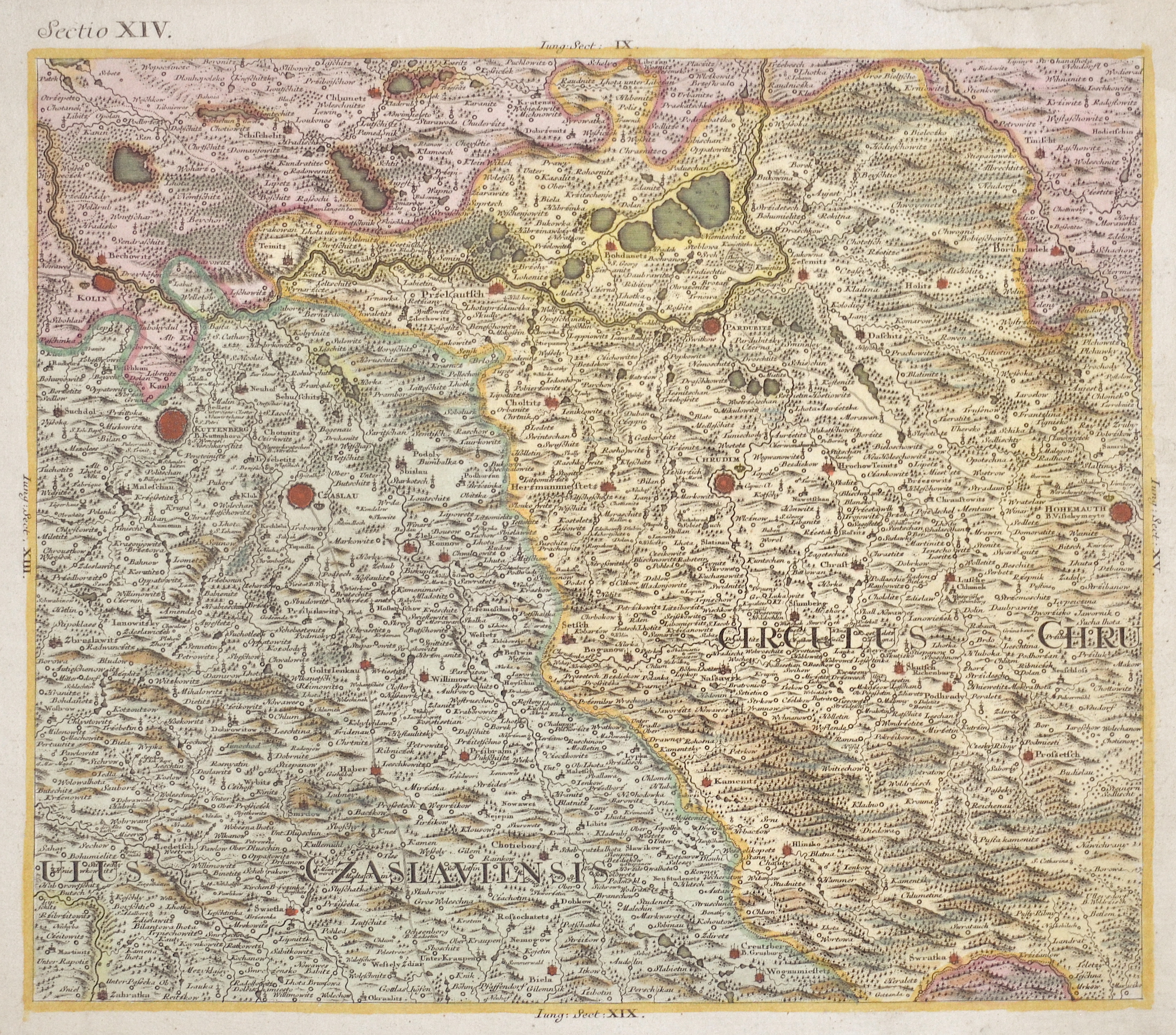
Sectio XIV.

| Article ID | EUT4299 |
Title | Sectio XIV. |
Description | Map shows the area around Kuttenberg (Kutná Hora), Czaslau (Cáslav), Pardubice, Chrudim, Hohenmauth (Vysoké Mýto), and many more. |
| Year | ca. 1730 |
Artist | Anonymus |
Historical Description | Bohemia is the westernmost and largest historical region of the Czech lands in the present-day Czech Republic. In a broader meaning, Bohemia sometimes refers to the entire Czech territory, including Moravia and Czech Silesia, especially in a historical context, such as the Lands of the Bohemian Crown ruled by Bohemian kings. Bohemia was a duchy of Great Moravia, later an independent principality, a kingdom in the Holy Roman Empire, and subsequently a part of the Habsburg Monarchy and the Austrian Empire. After World War I and the establishment of an independent Czechoslovak state, Bohemia became a part of Czechoslovakia. Between 1938 and 1945, border regions with sizeable German-speaking minorities of all three Czech lands were joined to Nazi Germany as the Sudetenland. |
| Dimensions (cm) | 29,5 x 34 cm |
| Condition | Upper external right corner perfectly restored |
| Coloring | original colored |
| Technique | Copper print |