

Adina Sommer
Antique and Contemporary Art
Winzerer Str. 154
80797 München
telephone
+49 89 304714
business hours:
by appointment
Email
![]()


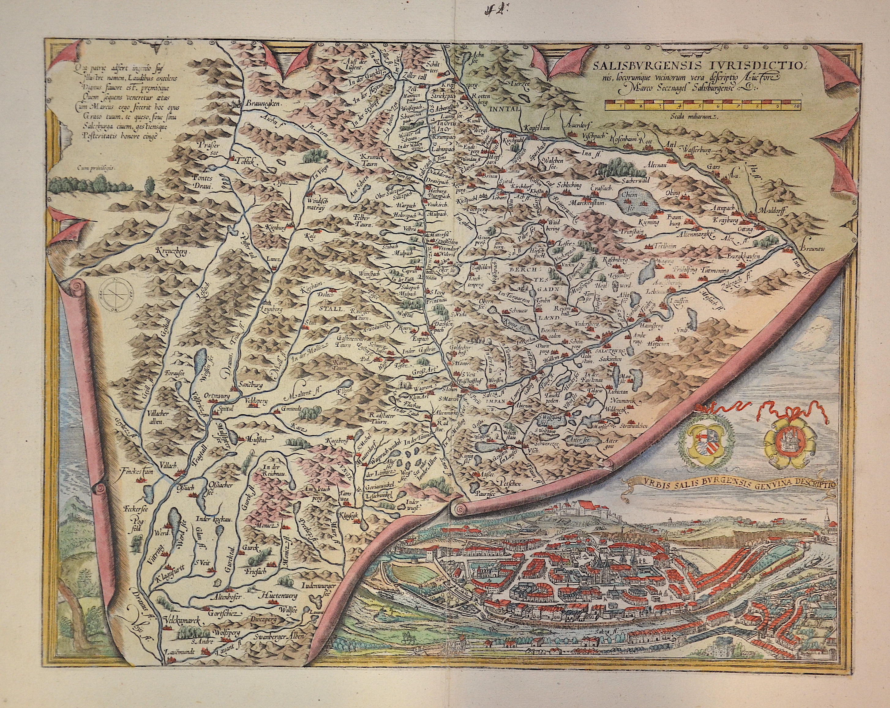
Salisburgensis Ivrisdictionis, …

| Article ID | EUA1500 |
Title | Salisburgensis Ivrisdictionis, … |
Description | Print shows a map of the environs around the city Salzburg, the Chiemsee, the Zillertal, and a total view of Salzburg. |
| Year | ca. 1595 |
Artist | Ortelius (1527-1598) |
Abraham Ortelius (1527–1598) was a Flemish cartographer and publisher from Antwerp. Originally a map colorist, he became a major figure in cartography through his Theatrum Orbis Terrarum (1570), considered the first modern atlas—a uniform collection of reliable maps in book form. Influenced by Gerardus Mercator, Ortelius published several maps before compiling the Theatrum, which clearly showed America as a separate continent. The work was published in 42 editions and 7 languages by 1612. Unlike many of his peers, Ortelius cited his sources, and his atlas became a milestone in mapmaking and geographic knowledge. | |
Historical Description | The name Austria is first handed down in its Old High German form Ostarrichi from the year 996. The Latin form Austria was also used. In 1156 Austria became an independent duchy in the Holy Roman Empire. After the Babenbergs died out in 1246, the House of Habsburg prevailed in the struggle for rule in Austria. The area designated as Austria later included the entire Habsburg Monarchy and later the Austrian Empire, which was constituted in 1804, and the Austrian half of the Austro-Hungarian Dual Monarchy established in 1867. The present republic came into being in 1918. |
| Place of Publication | Antwerp |
| Dimensions (cm) | 33,50 x 43 |
| Condition | Very good |
| Coloring | original colored |
| Technique | Copper print |